Located about 20 km (12.4 mi) outside of Twizel, the Greta Track is one of the most underrated day walks in New Zealand. On a clear day, you’ll get 360° views over Lake Ohau, the surrounding Southern Alps, and the Mackenzie Country. Despite its relatively long length, the terrain and landscape changes keep the walk exciting the whole way through. Read on for a full hike guide to the Greta Track, including tips to make your walk a success!
General information
- Difficulty: Moderate
- Type of hike: Loop
- Total elevation change: 978 m / 3,211 ft
- Length: 17.9 km / 11.15 mi
- Time: 5-7 hours return
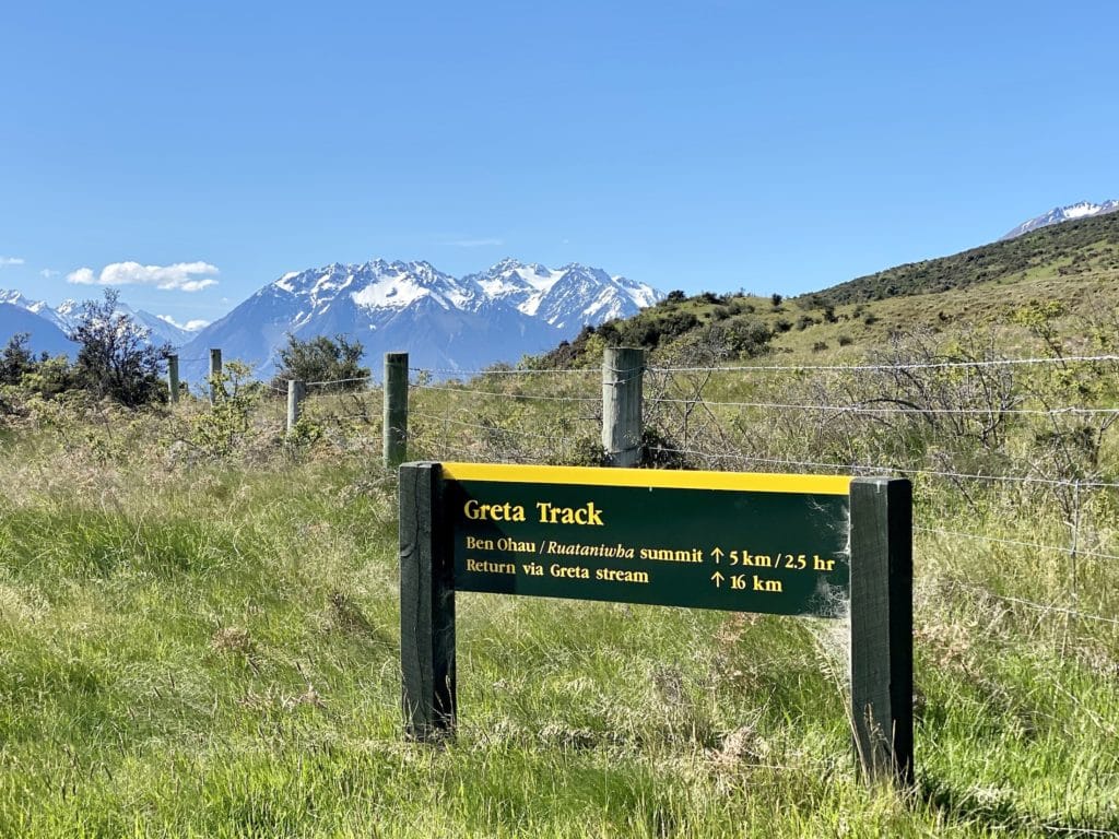
How to get to the Greta Track
From Twizel, follow the canals until you reach the eastern mouth of Lake Ōhau. From there, you’ll need to drive up Glen Lyon Road until you reach the trailhead (you’ll find it on Google Maps as Greta Track Trailhead And Car Park). The car park is grassy and has enough room for several cars.
Unfortunately, there are no public transportation options between Twizel and the Greta Track trailhead. You’ll need to have your own vehicle or get a ride with someone that does.
⇉ Welcome to Twizel: New Zealand’s Hidden Gem
Things to know before you go
- The road leading to the trailhead is narrow and often requires careful manoeuvring to pass someone heading in the opposite direction. Drive slowly, especially around blind turns.
- The track is also used for mountain biking and horseback riding.
- Dogs are allowed but must be on a leash at all times.
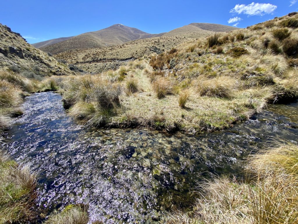
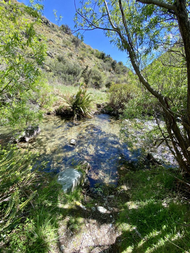
- The track crosses over Greta Stream several times — expect to get your feet wet! When I went, the water was at about shin height at its deepest point.
- After heavy rain, the track can be very muddy in places.
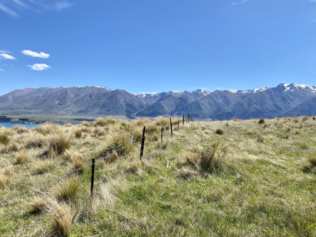
Greta Track part 1: Grassy ascent
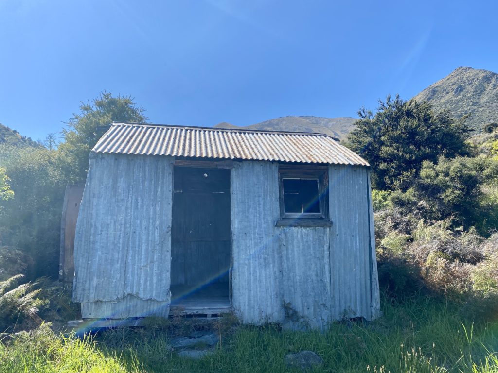
The first part of the track is a gentle, grassy ascent up Ben Ohau’s western face. After a few minutes you’ll pass Back Hut, an old musterer’s hut from the 1890s. The hut is empty inside and isn’t used anymore, but it’s cool to see nonetheless.
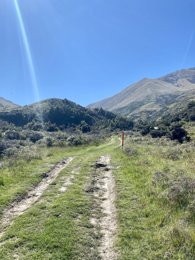
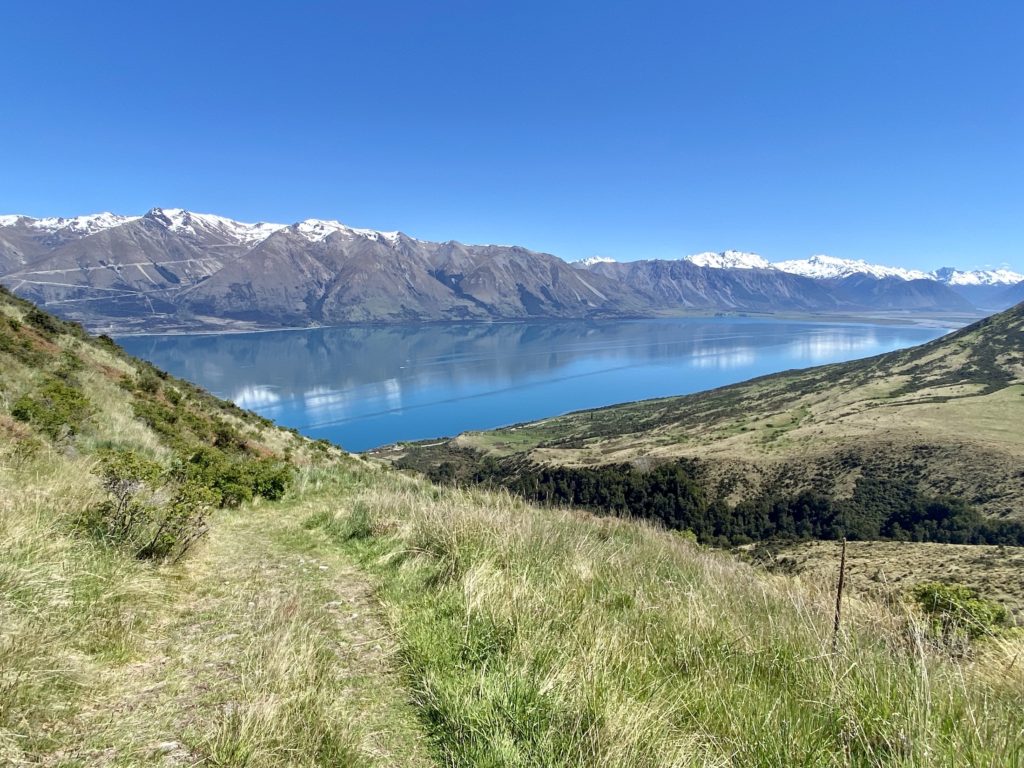
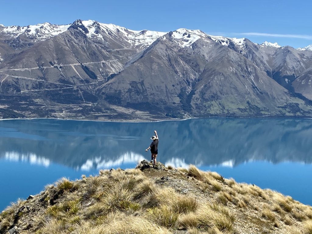
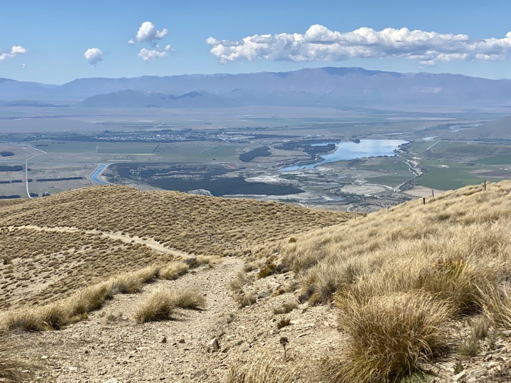
Already from this early on, the views from the track are unreal. As you ascend, they only get better and better, with more parts of Lake Ōhau and the Southern Alps coming into view.
Despite going on a sunny day, there were several parts of this section that seemed perpetually muddy. Thankfully, it was generally pretty easy to avoid stepping in any mud.
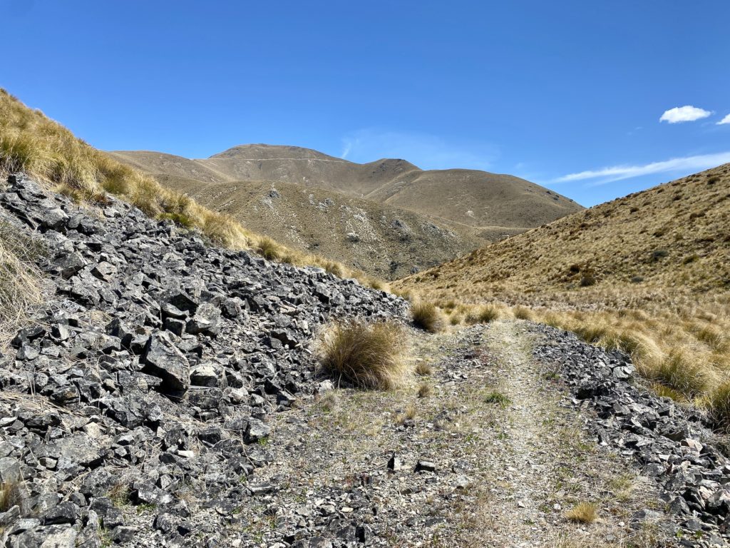
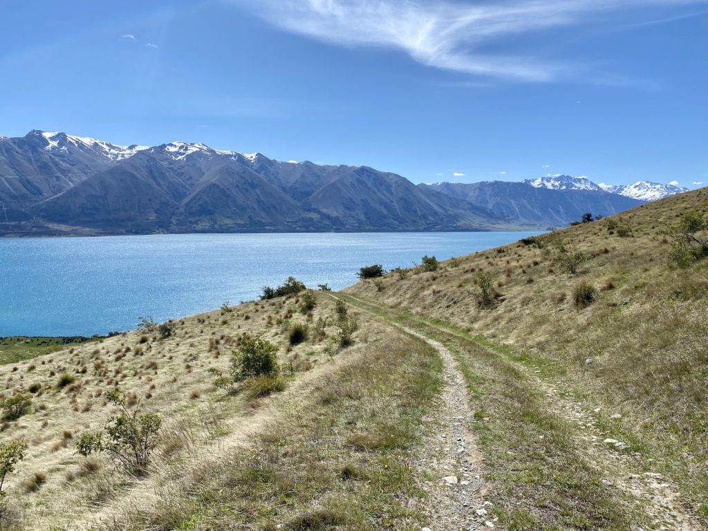
Greta Track part 2: Tussocks & switchbacks
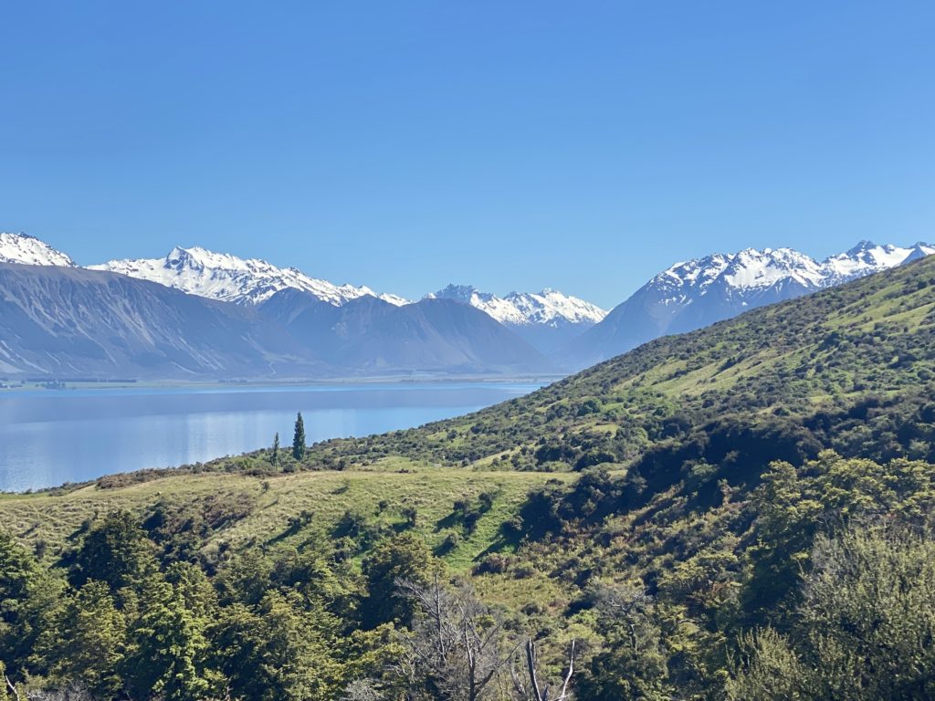
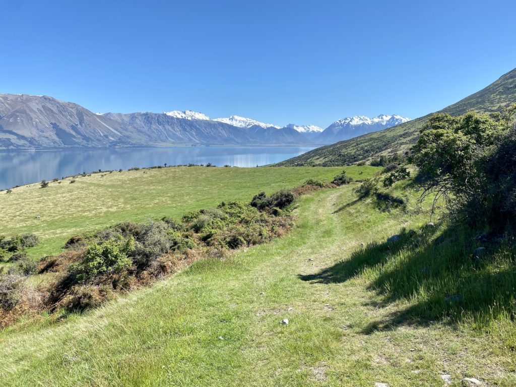
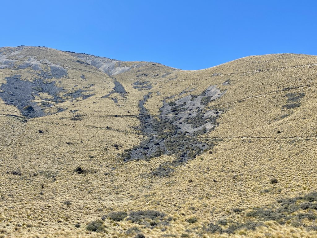
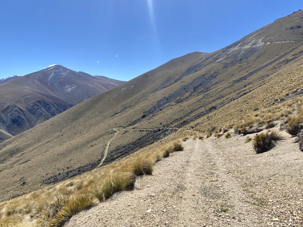
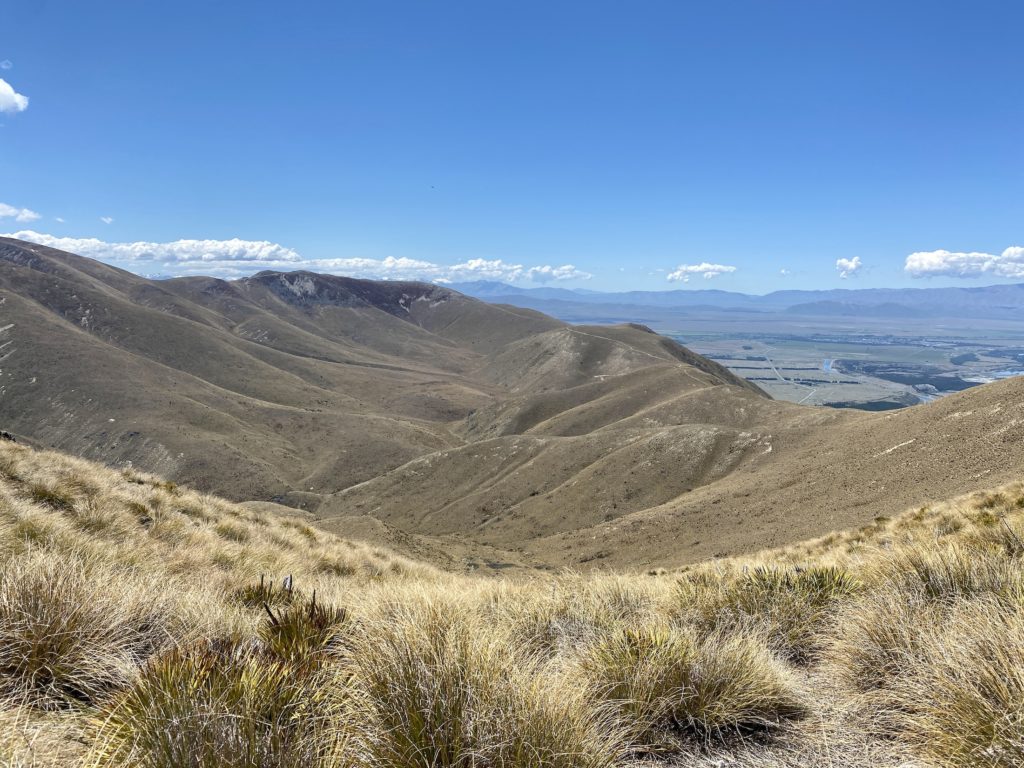
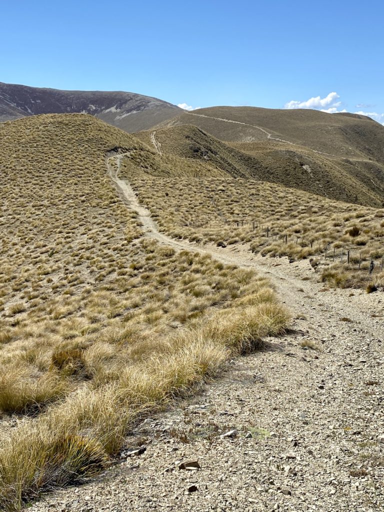
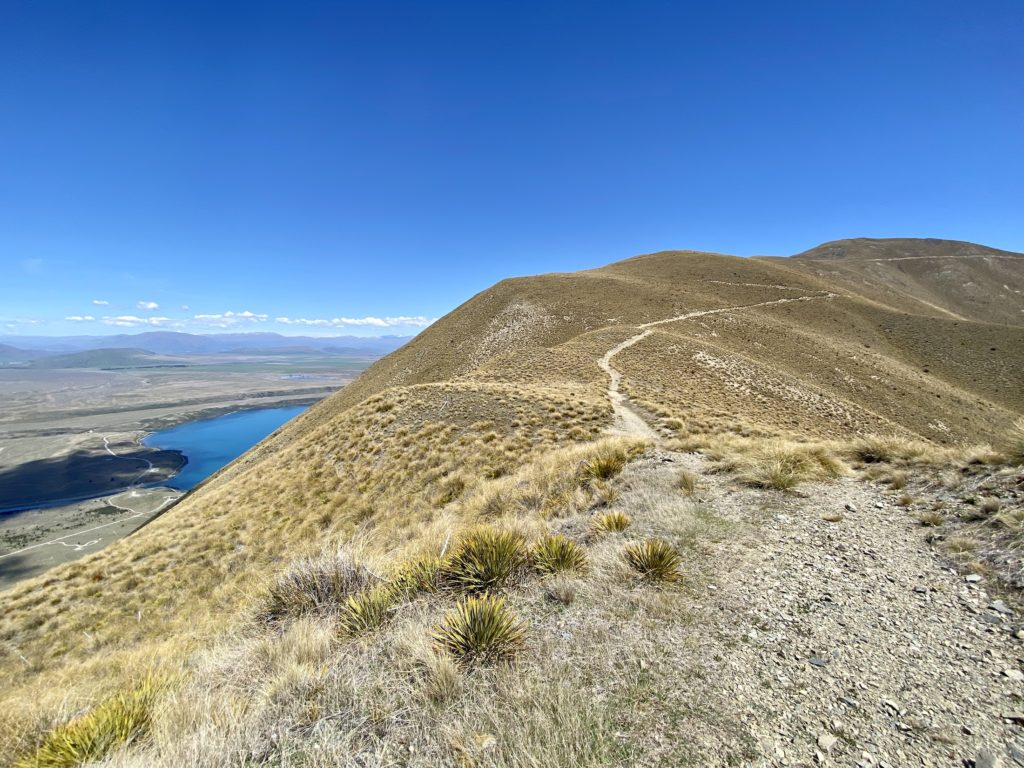
After reaching around 900 m (2,952 ft) of elevation, the track changes from grassy to gravelly. Instead of trees and shrubs, you begin to see the golden-hued tussocks that are common in the Mackenzie Country. The trail starts to zigzag across the western face of the mountain (seemingly forever). The barren landscape reminded me of something you’d find on an extraterrestrial planet more than anything I’d expect to see on Earth.
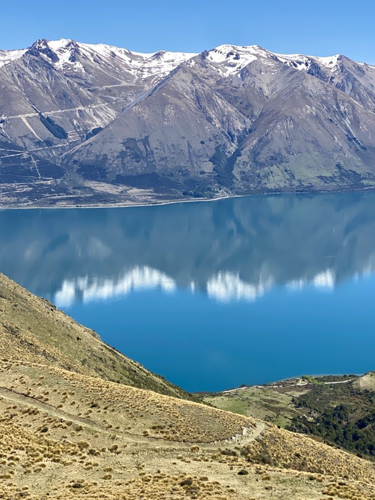
At a certain point, you can veer off trail a bit to walk the ridgeline of a little knob that juts out over the water. From here, the southern curve of Lake Ōhau finally comes into view, giving you a full view of the kidney bean-shaped lake. This spot reminded me of the iconic picture people always take on Roy’s Peak Track in Wanaka — except here, there is no need to queue up and wait!
If you want to make it to the true summit of Ben Ohau, you’ll need to veer off trail again and climb another 122 m (400 ft).

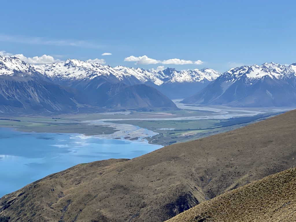
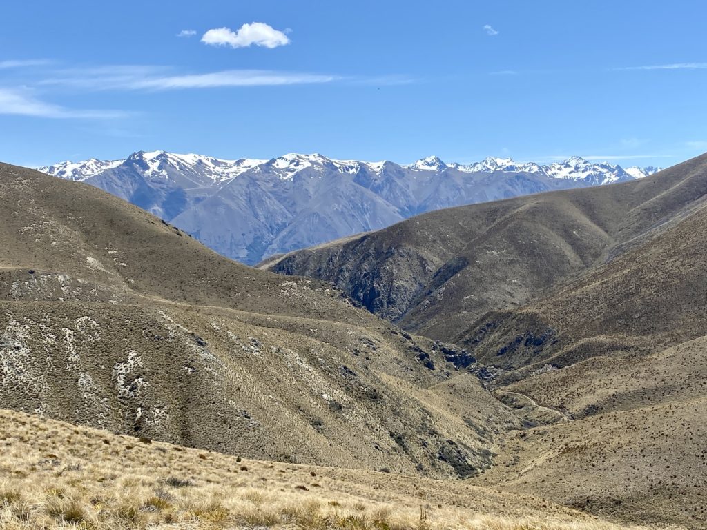
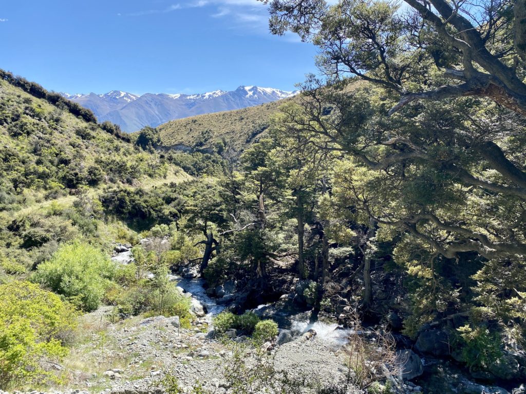
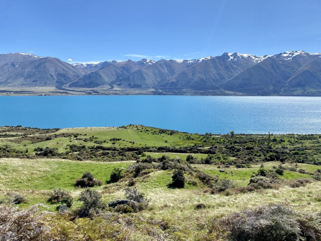
Once you make it past the summit and over the saddle, the eastern ridgeline comes into view. From here, you’ll also be able to see Twizel, Lake Ruataniwha, and Lake Pukaki in the distance.
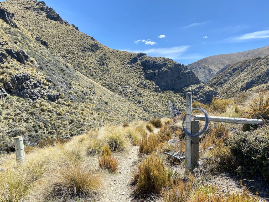
After following this section of trail for a bit, you’ll reach a fork — the left side heads down into the valley and the right side connects to the Dorcy Stream Track. Head left to close the Greta Track loop.
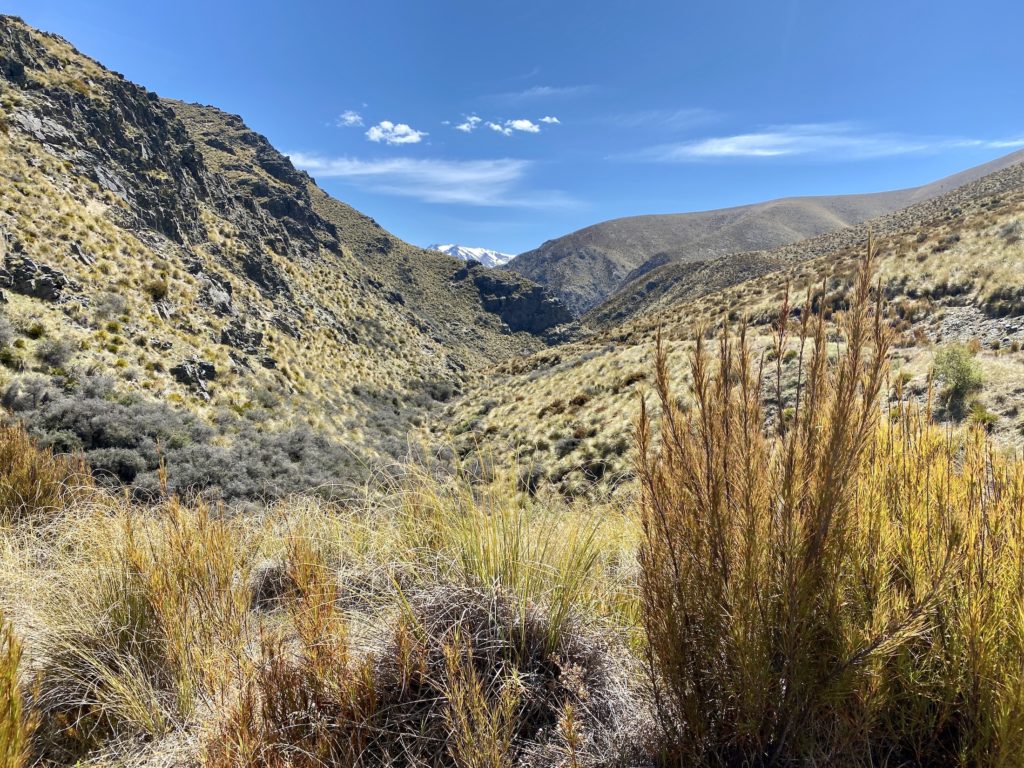
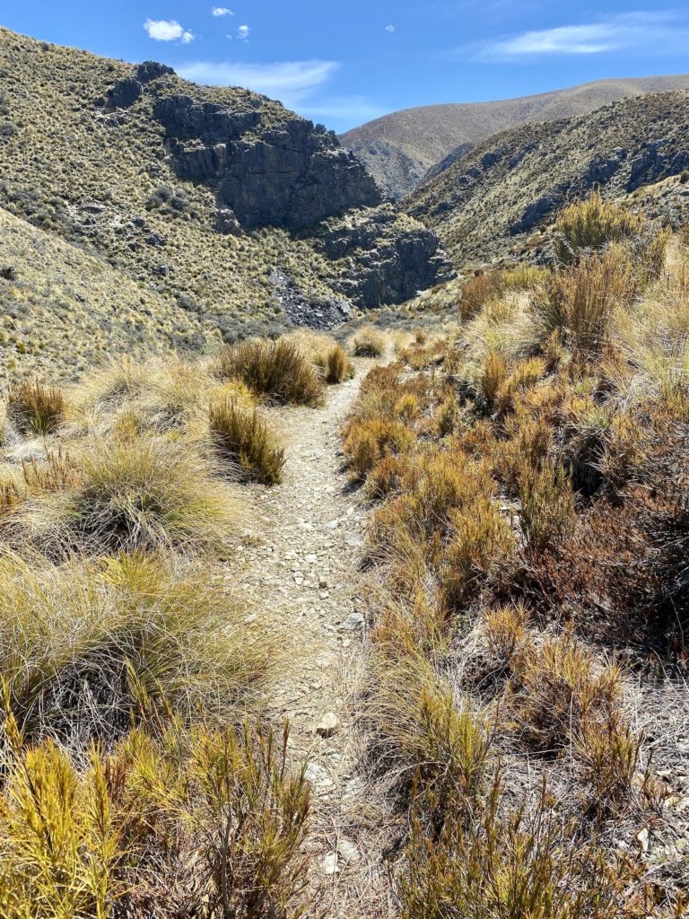
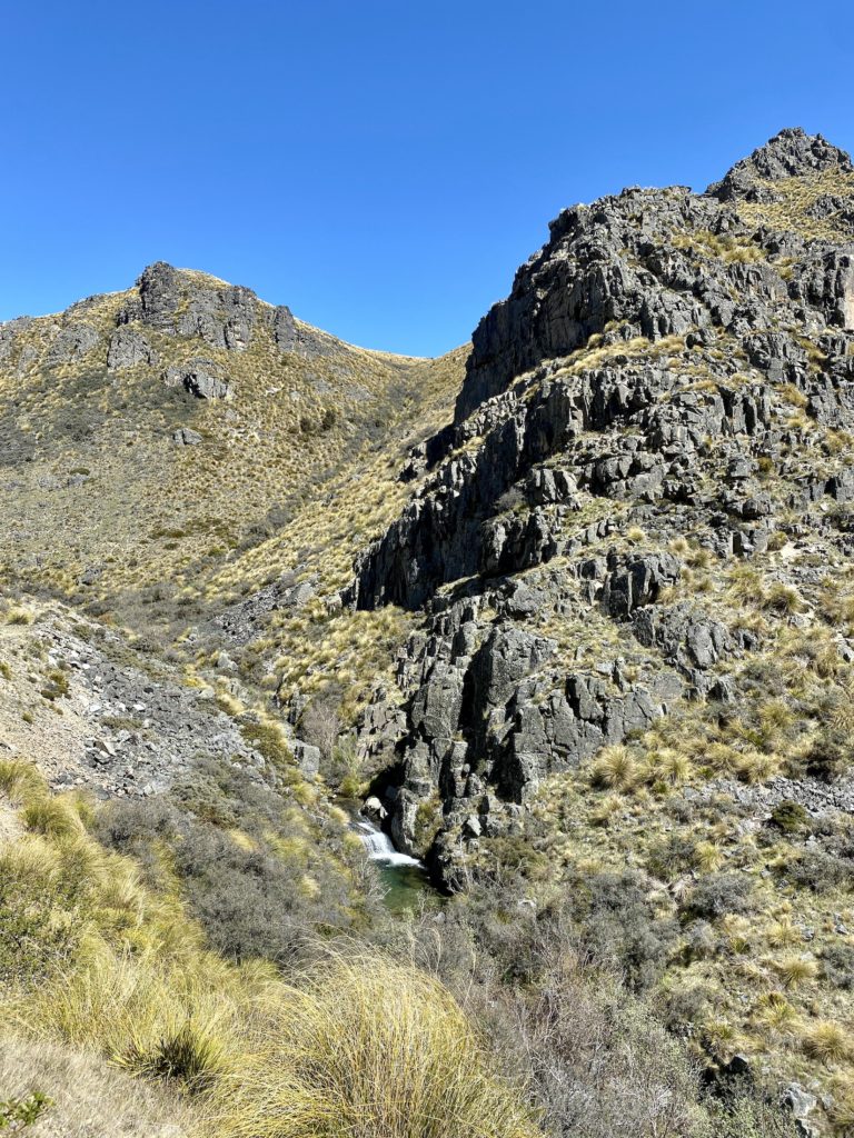
Greta Track part 3: Rocky valleys
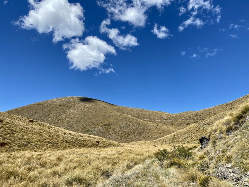
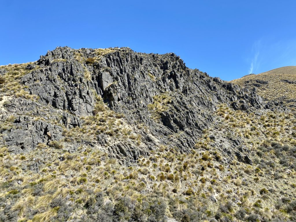
This part of the track starts to descend into the valley (which is a relief after all that uphill climbing!). The terrain becomes rockier, covering the surrounding areas with fellfields, scree, and rock bluffs.
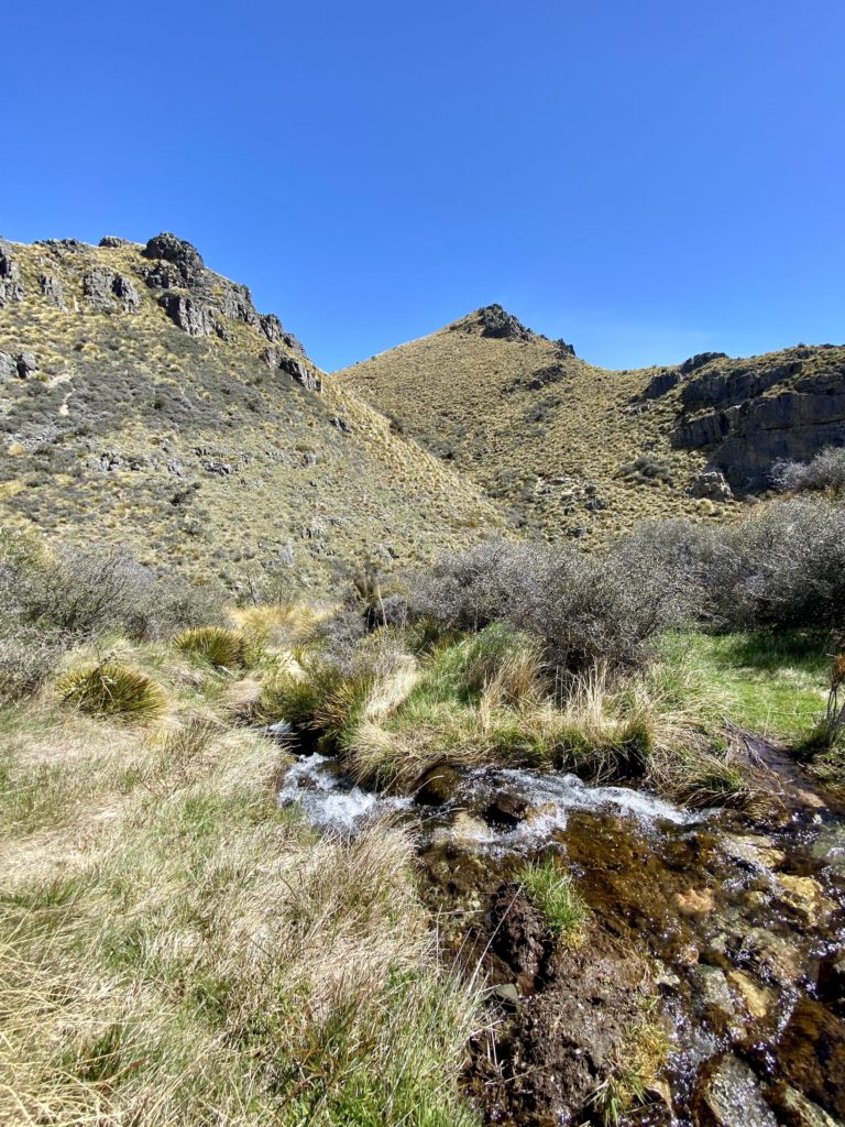
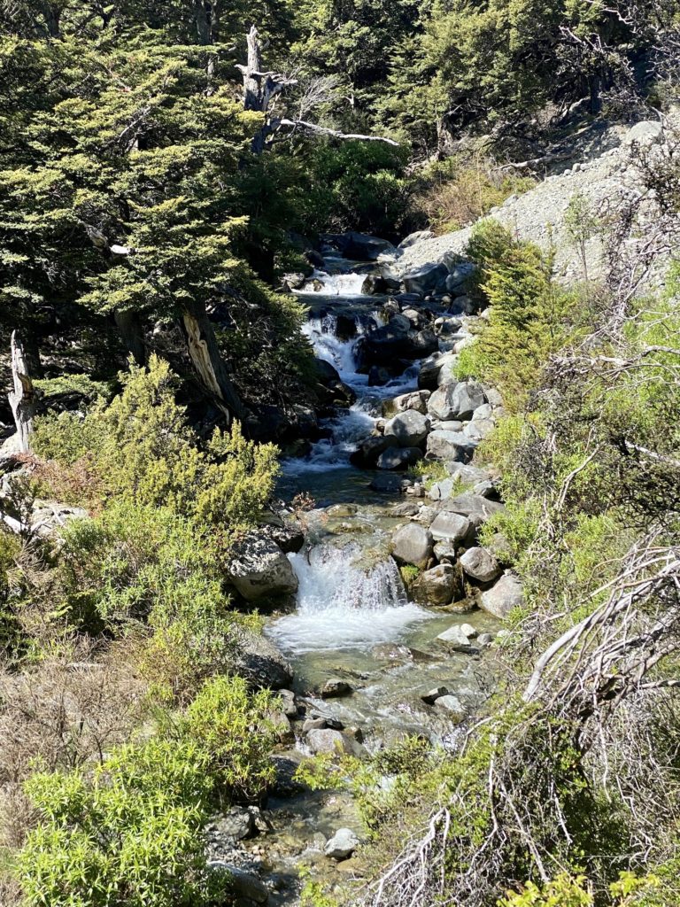
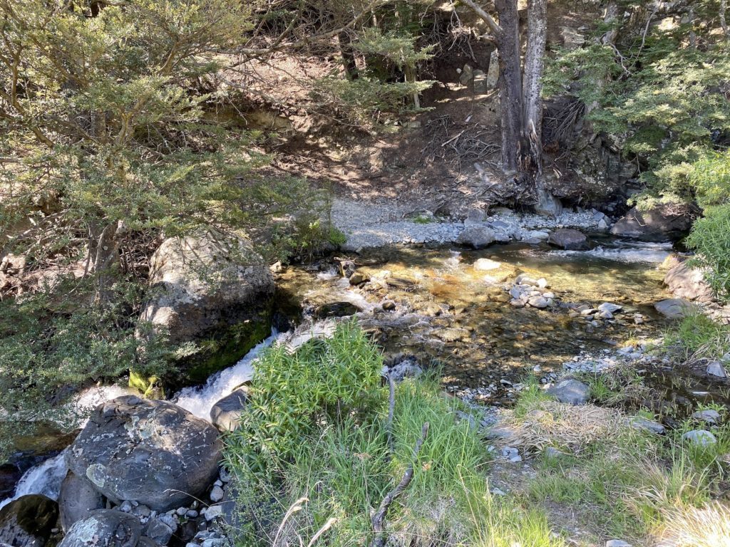
After a few minutes, the track meets up with and runs parallel to the Greta Stream. Eventually, the two cross over and you’ll need to ford your first river crossing. There’s really no way around getting your feet wet here (trust me, I tried).
This specific section of the track gave me strong American Wild West vibes for some reason. I almost expected a group of cowboys to come galloping down the trail at any minute.
Greta Track part 4: Forest & river crossings
Towards the far end of the valley, you’ll eventually reach a glorious section of shaded forest. Here, there are a few more river crossings and muddy patches near the water. The surrounding scenery is much more lush and green than before and the familiar snow-capped mountain range comes back into view.
The forest eventually opens up into a wide, flat paddock. The end of the track is finally near!
Greta Track part 5: The descent
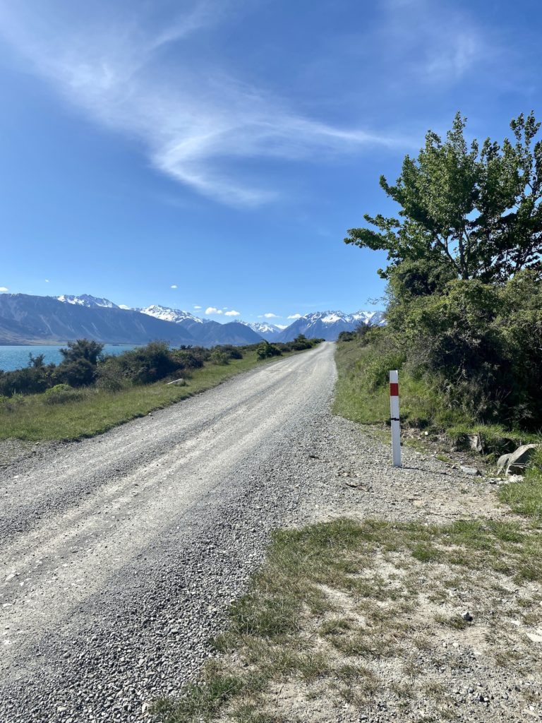
The descent down the western face of the mountain follows an old 4WD track. After making it across several switchbacks, the track ends at a different point than where it started. To close the Greta Track loop, you’ll have to walk a few minutes down Glen Lyon Road. Make sure to look out for cars (and grazing cattle!).
The entire loop took me 5 hours and 23 minutes to complete. I’m not the fastest hiker, so it’s safe to assume that most people will complete the walk in less time than DOC suggests.
Thanks for reading this Greta Track hike guide!
xoxo Niki