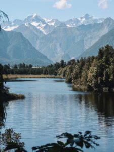
Only 15 minutes away from Queenstown, Bob’s Cove track and surrounding beaches are the perfect way to spend a summer afternoon. It’s an easy, well-managed trail that rewards you with stunning views of Lake Wakatipu and the neighboring mountains. Keep reading for a complete guide to hiking Bob’s Cove track!
General information
- Difficulty: Easy
- Total elevation gain: 136 m / 447 ft
- Length: 3.4 km / 2.1 mi return
- Time: 1 hour total
- Type of hike: Moderately steep dirt path, rocks
How to get to Bob’s Cove
From Queenstown, head west towards Glenorchy. Bob’s Cove track will be 15 minutes away on your left. The parking lot is a decent size but can fill up quickly at peak times. The trailhead begins immediately past the parking lot.
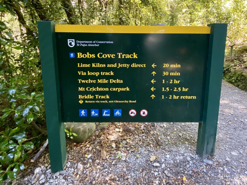
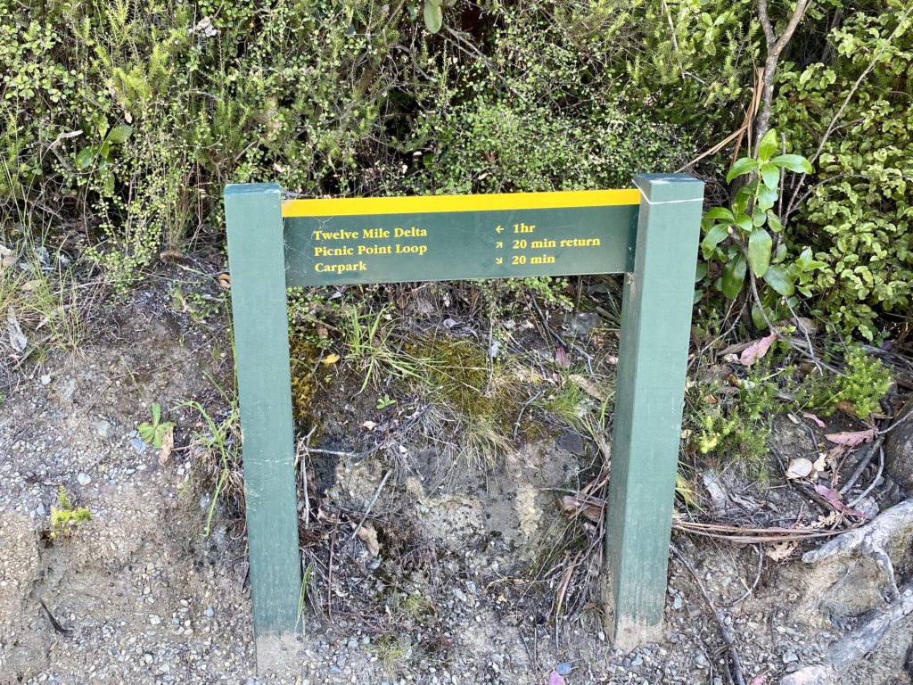
Bob’s Cove & jetty
Start by heading left towards the Lime Kilns and Jetty. You’ll walk mostly downhill on a well-maintained trail through native bush. About a minute into our walk, we could already see the bright blue water of Lake Wakatipu peeking through the trees. There is intermittent shade down this part of the trail, so don’t forget to apply sunscreen!
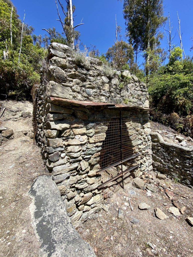
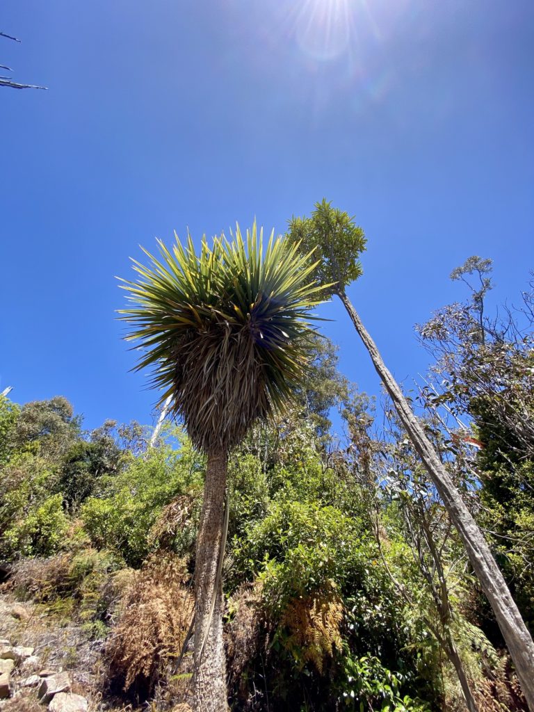
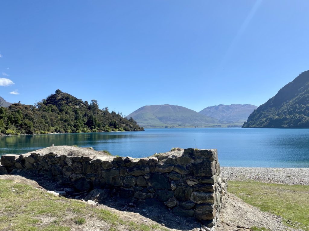
A few minutes in, you’ll see the large remains of an old kiln. It was built and used in the 1880s by Wakatipu Lime Company to quarry and process nearby limestone. To fuel the kiln, the company planted gum trees (you’ll see lots of them along the way, in addition to more tropical-looking ferns and trees).
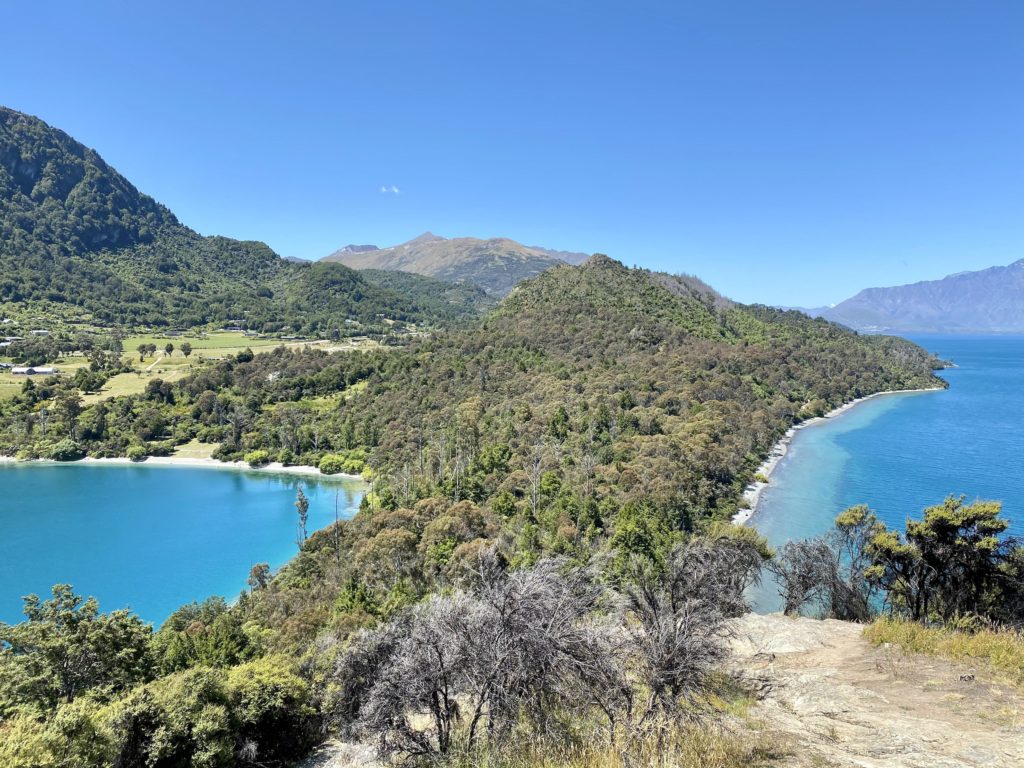
Past the limestone kiln, you’ll start to see lots of areas along the edge of the trail to stop and lay by the water. On the day we went, there were plenty of people spaced out along the beach and soaking up the sun (though it was easy enough to find a secluded spot). This is also a great place to relax with a few beers or have a picnic. At this point, we decided to continue up to the viewpoint and save the beaches for our way down.
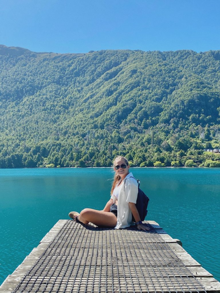
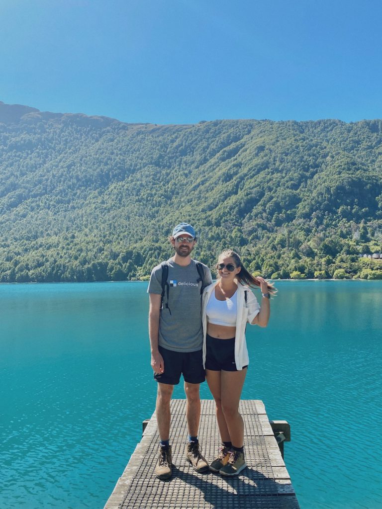
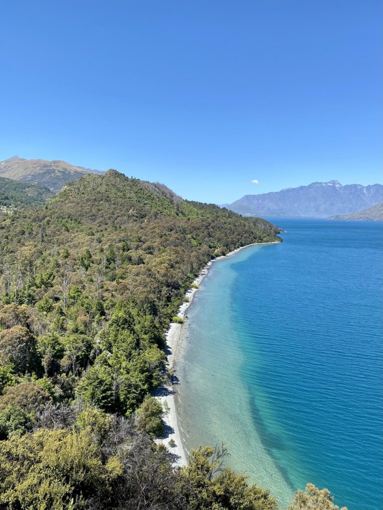
Twenty minutes after starting in the parking lot, you’ll make it to the (super Instagrammable) jetty. The water in the cove is a bright, turquoise blue. Looking down into it, you can see all of the rocks at the bottom quite clearly. Although the water is extremely cold, a few people were swimming around this area as well.
I highly recommend continuing on to the Picnic Point Loop if you want more stunning views. It’s a short way up to the top, so the effort-to-reward ratio is pretty high.
Picnic Point Loop
Keep walking a short way past the jetty and you’ll reach a fork in the road. Turn right towards the Picnic Point Loop and make your way uphill. Although some parts of the track are a bit steep, it only takes about 20 minutes to get up and down the loop.
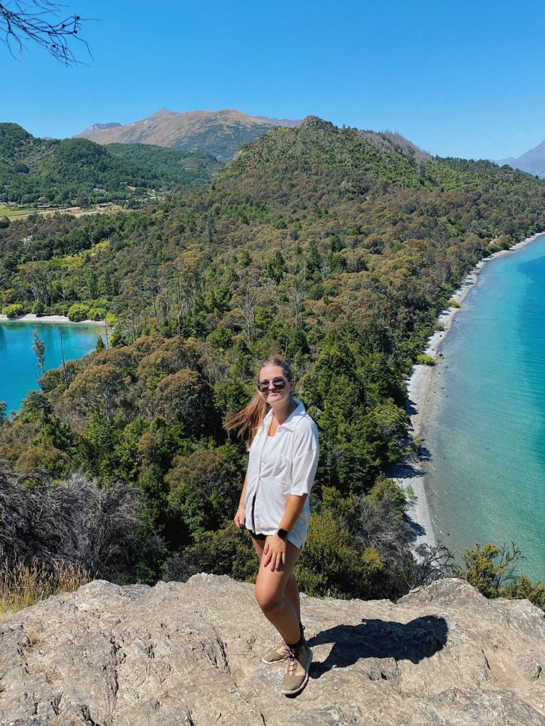
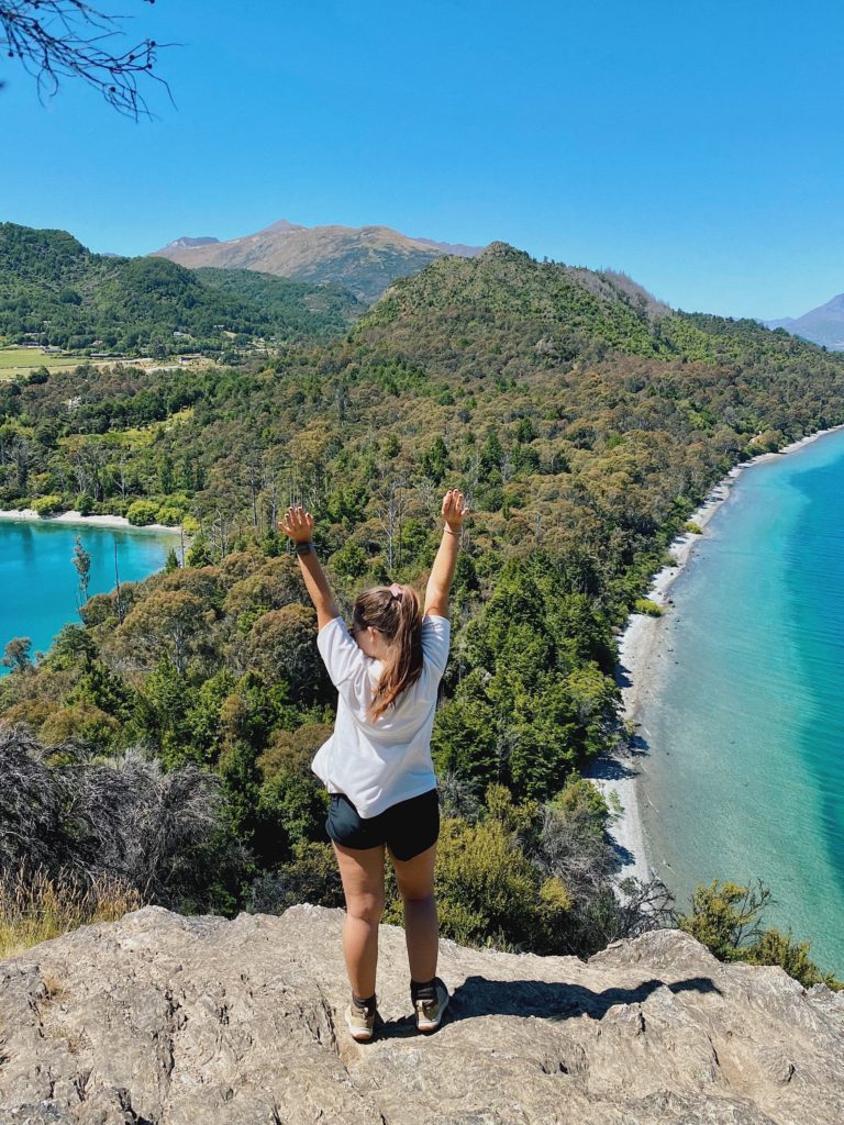
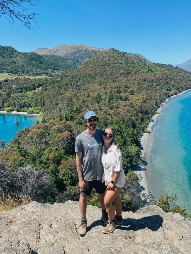
After making it to the top, you’ll be met with an incredible view of the peninsula and surrounding lake. Between the color of the water and the tree-covered hills dotting the landscape, I got major tropical island vibes from this viewpoint. Head down towards the edge of the cliff (past the bench) for a great photo spot.
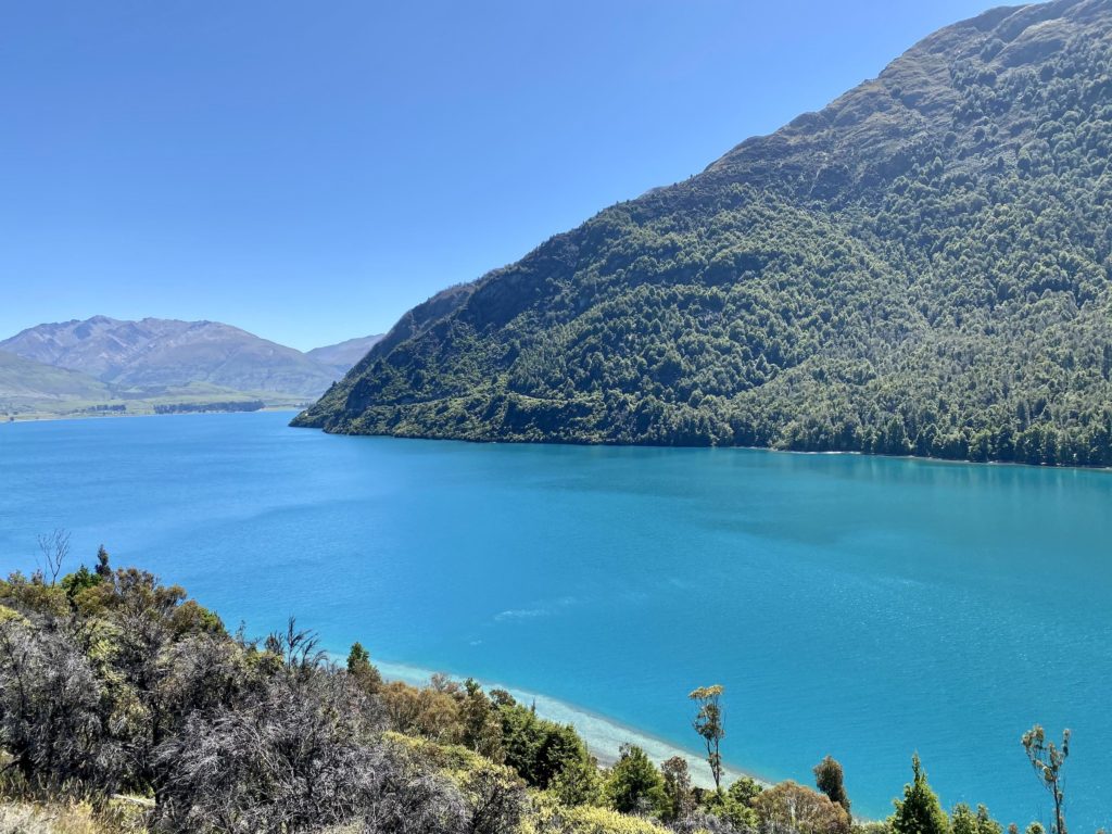
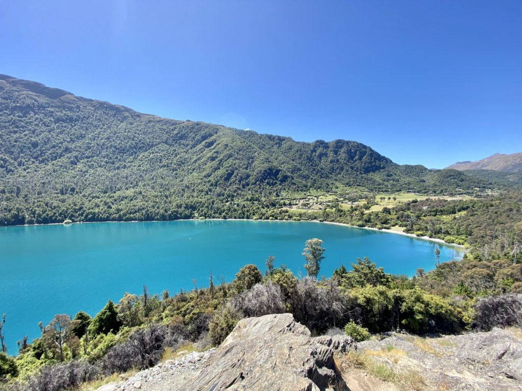
On our way back down, we took a path that led us around the other side of the cliff. Since this path comes down around the outer face of the hill, you get some more spectacular views of the peninsula neck. Once we were back down by the beach, we decided to stop and cool off with a swim (highly recommend!). All told, we spent about 2 hours at Bob’s Cove — 1 hour walking and 1 hour laying by the water.
Hiking Bob’s Cove track was a wonderful way to spend our afternoon. The ease of the hike and the easy accessibility of water to chill by makes it a five-star excursion in my book. If you’d like to see more posts on hiking, click here!
xoxo Niki
Pin this post to save it for later!