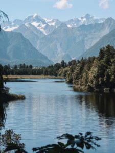
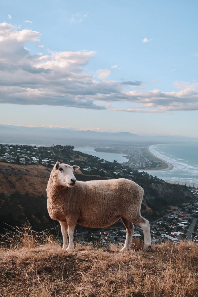
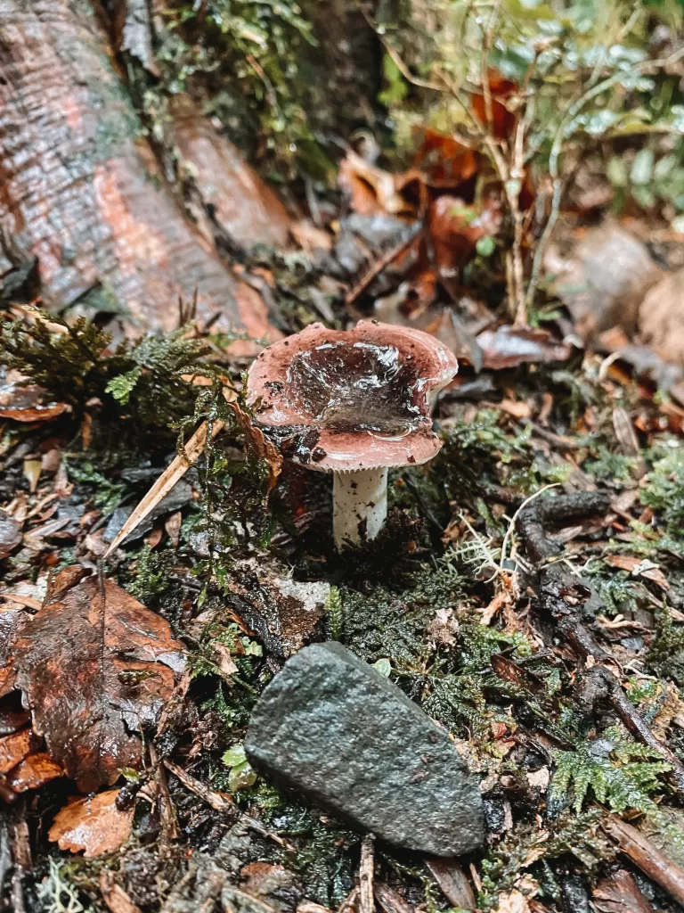
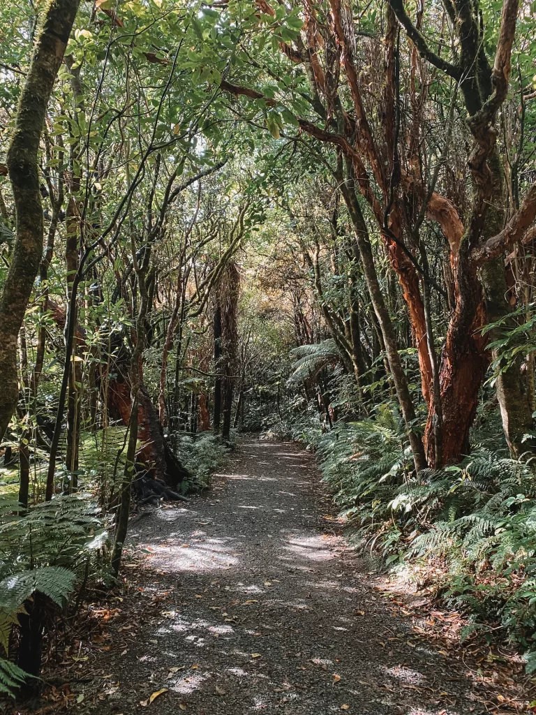
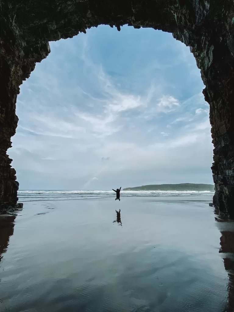
The South Island is home to some of the most breathtaking day hikes in the world. From majestic mountains to serene forests, there’s a trail for every type of hiker to enjoy. In this post, I’ll be sharing the best day hikes on the South Island of New Zealand that you won’t want to miss!
Whether you’re a seasoned pro looking for a new challenge or a beginner seeking a peaceful escape, these hikes are sure to take your breath away (both literally and figuratively!).
Disclosure: Some of the links below are affiliate links. When you purchase through links on my site, I may make a small commission (at no extra cost to you!).
- What to expect in this South Island New Zealand hiking guide
- South Island New Zealand day hikes map
- Best day hikes on New Zealand's South Island
- Best day hikes in Otago (Queenstown, Glenorchy, & Wanaka)
- Best day hikes in Fiordland National Park
- Best day hikes in Aoraki Mount Cook National Park
- Best day hikes in South Canterbury & the Mackenzie Region
- Best day hikes on the West Coast
- Best day hikes in North Canterbury (Christchurch & Arthur's Pass)
- Best day hikes in Coastal Otago (Dunedin & the Catlins)
- South Island New Zealand day hikes FAQ
What to expect in this South Island New Zealand hiking guide
- The distances and durations for each hike are based on a return/round-trip journey.
- The duration and difficulty ratings I’ve given are completely subjective and based on my own personal experience. A hike may take you more or less time based on your own experience and fitness levels!
- I’ve divided these hikes up by general location:
- Otago: Queenstown, Glenorchy, and Wanaka
- Fiordland National Park: Including Te Anau and the road to Milford Sound
- Mt Cook National Park
- South Canterbury and the Mackenzie Region: Twizel, Lake Pukaki, Tekapo
- The West Coast: Including Haast Pass and Mount Aspiring National Park
- North Canterbury: Christchurch and Arthur’s Pass
- Coastal Otago: Dunedin and the Catlins
- Some of these hiking trails have huts at the peak where you can sleep overnight. I’ve included them here as day hikes because they can be realistically completed in just one day. If you’re looking for some of the best multi-day hikes on the South Island, I added a few suggestions to the bottom of this post.
South Island New Zealand day hikes map
How to use this map: Click “View larger map” in the top right corner. From there, you can view each location and save your favorites to your own Google Maps lists!
Best day hikes on New Zealand’s South Island
Best day hikes in Otago (Queenstown, Glenorchy, & Wanaka)
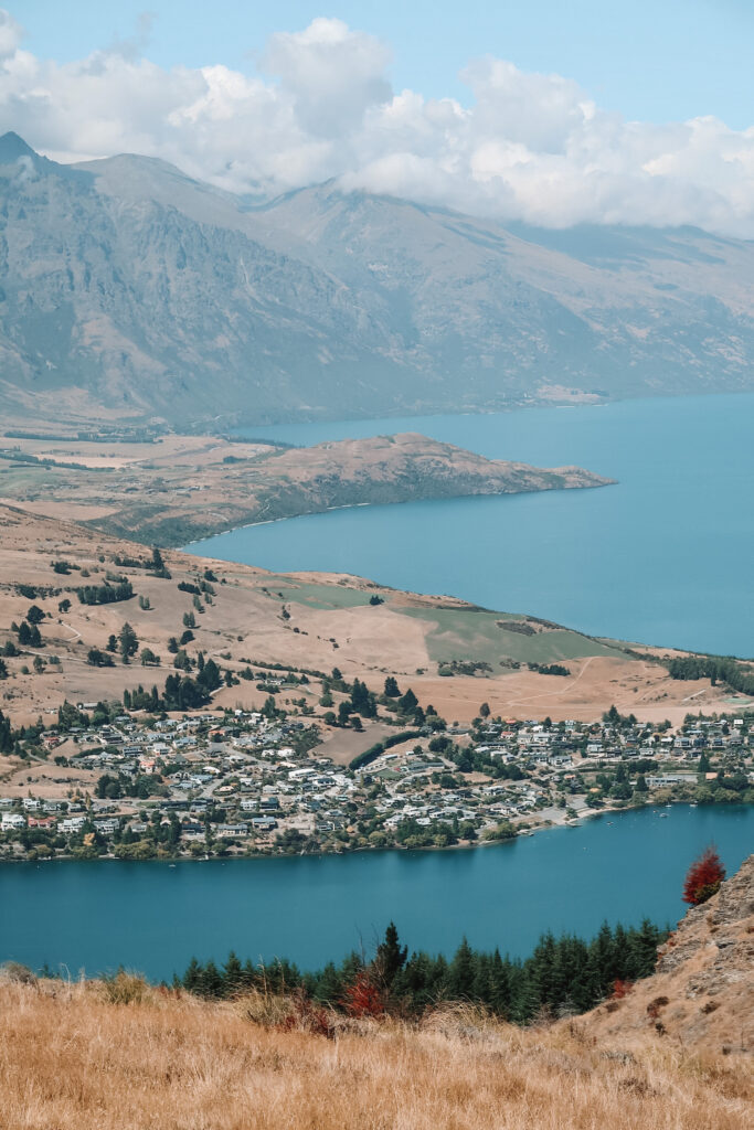
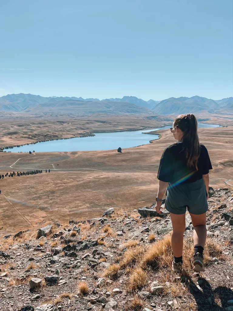
Queenstown Hill Walkway
- Distance: 4.8 km / 3 mi
- Duration: 2 hours
- Difficulty: Moderate
- Features: Uphill forest trail, views over Queenstown and Lake Wakatipu
Starting right near Queenstown’s town centre, the Queenstown Hill Walkway is a quick day walk with breathtaking views.
The start of the track is a gradual, steep climb through pine forest. Once you get above the tree line, you’re rewarded with panoramic views of Queenstown, Lake Wakatipu, and the Remarkables mountain range. This is one of the best hikes to do in the Queenstown area because it’s easily accessible from town and is a relatively quick 2-hour return trip.
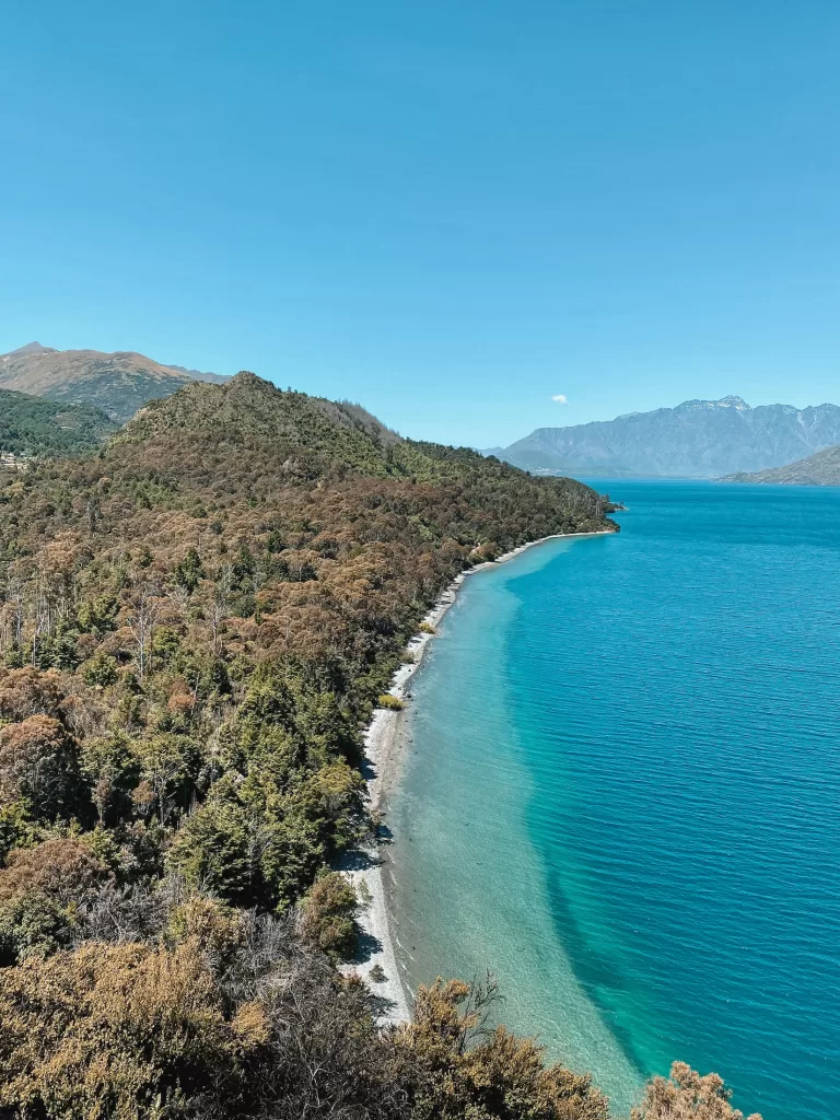
Bob’s Cove Track
- Distance: 3.4 km / 2.1 mi
- Duration: 1 hour
- Difficulty: Easy
- Features: Views of Lake Wakatipu, swimming holes
Bob’s Cove Track is an easy, scenic hike located 14 km (8.7 mi) away from Queenstown’s town centre.
The trail passes through lush manuka groves and beech forest, and features a historic lime kiln from the 1800s. The track also offers views of Lake Wakatipu and the surrounding mountains. Make sure to listen for the songs of bellbirds, tui, and kereru (wood pigeons) along the way.
I’d definitely recommend bringing a swimsuit for a dip in the lake after you finish your hike — the water is simply incredible!
⇉ Hiking Bob’s Cove Track Queenstown
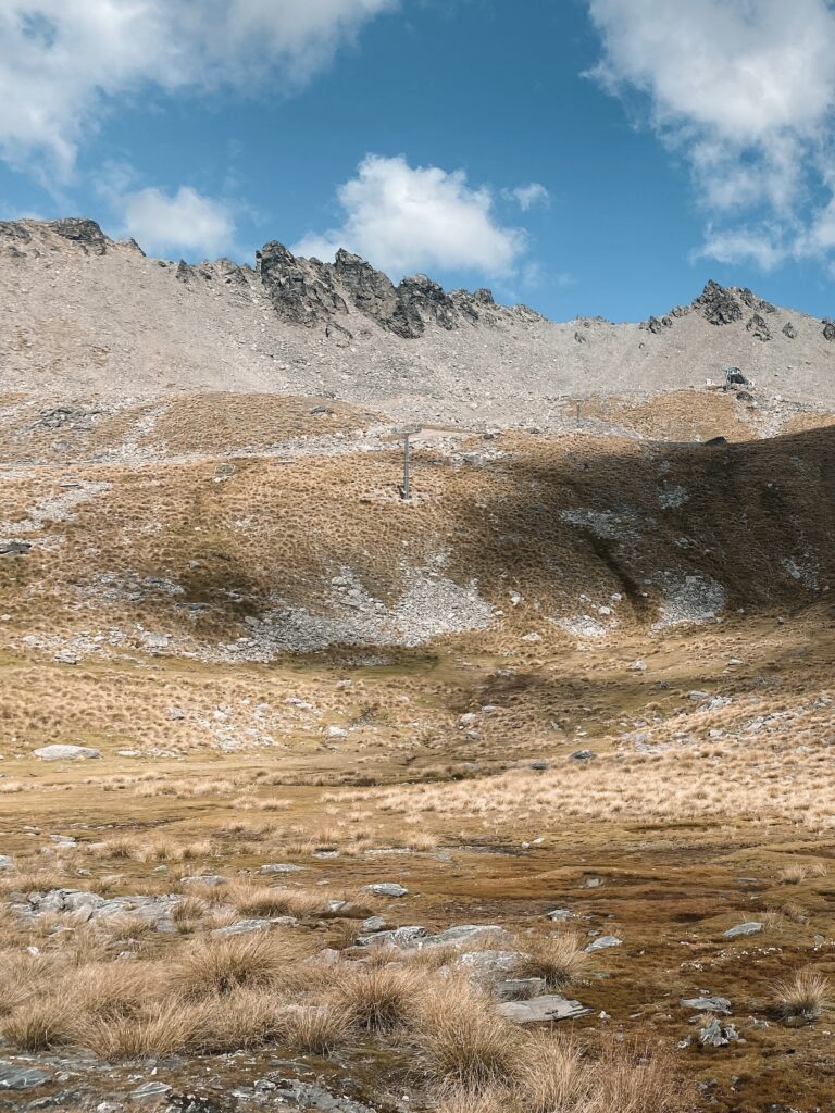
Lake Alta Track
- Distance: 2.4 km / 1.5 mi
- Duration: 1 hour 30 minutes
- Difficulty: Easy to moderate
- Features: Alpine vegetation, glacial lake
The Lake Alta Track begins at the Remarkables Ski Field just outside of Queenstown. You’ll need to drive the steep and winding track up the side of the mountain to reach the trailhead. Outside of the winter season, there is a road toll of $10 — you can pay with debit or credit card (no cash).
Once you’re at the start of the track, it’s a steady climb up to the lake, passing tussocks and unique alpine vegetation. There are a few informational signs along the way that describe the plants, insects, and birds you’ll see.
The best views of Lake Alta are found on a clear day, when the water perfectly reflects the mountains in the background. Check the weather forecasts before you head out for the best experience!
Ben Lomond Track
- Distance: 11 km / 6.8 mi
- Duration: 6-8 hours
- Difficulty: Hard
- Features: Douglas fir forest, tussock-covered valley, views of Queenstown and Lake Wakatipu
This one isn’t for the faint of heart — the Ben Lomond Track is a long day hike with little shade and a lot of elevation gain (1,438 m / 4,718 ft to be exact!). Those that persevere to the summit are rewarded with incredible views of Queenstown, Lake Wakatipu, and the surrounding mountain ranges.
There are several sections to this track: a steep, covered forest walk to the Skyline Gondola (called the Tiki Trail), the uphill slog to the Ben Lomond Saddle, and the final, unmarked climb to the summit.
If you want to cheat a little bit, you can buy tickets up the Skyline Gondola to avoid the first 800 m (2,625 ft) of elevation gain. Tickets start at $46 per person.
Make sure to take a look at the Department of Conservation website before you head out for some vital safety and planning tips!
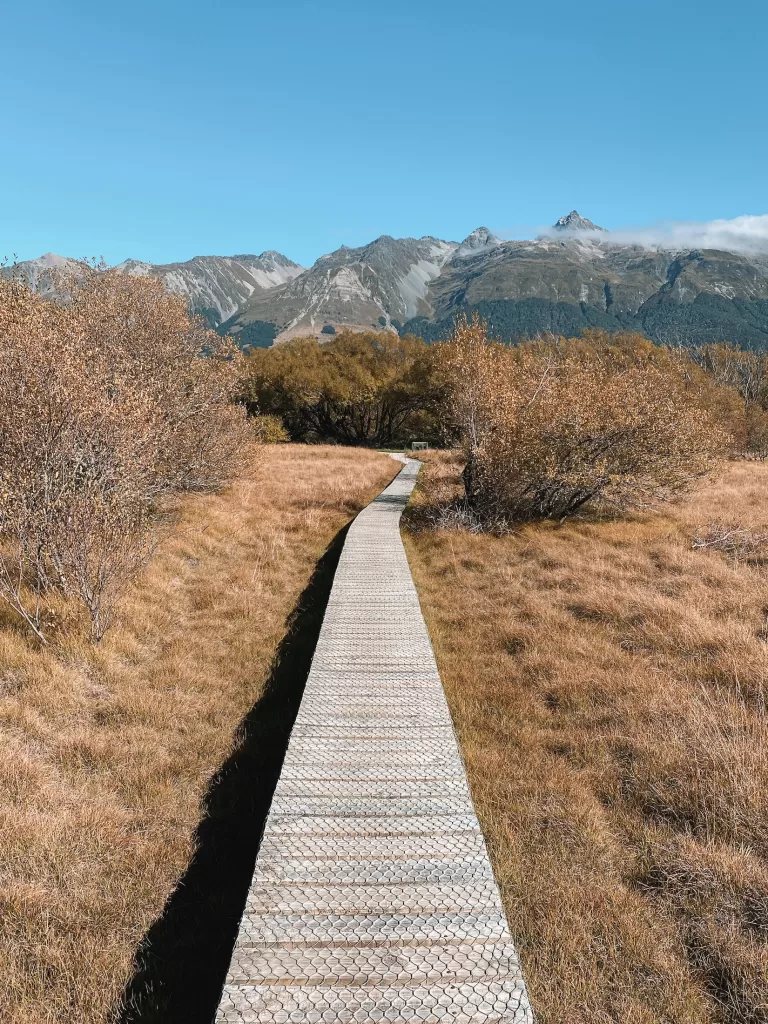
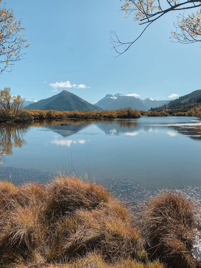
Glenorchy Walkway
- Distance: 3.2 km / 2 mi
- Duration: 1-2 hours
- Difficulty: Easy
- Features: Boardwalk over wetland, native birdlife
This short and scenic walk in Glenorchy is great for the entire family.
You’ll cross over the Glenorchy Lagoon, get amazing views of Mt Earnslaw and the surrounding mountain peaks, and hear the sounds of native birds such as pied stilts and New Zealand falcons.
After your walk, make sure to get a coffee and some sweet treats from the nearby Trading Post cafe!
⇉ 12 Awesome Things to Do in Glenorchy & Paradise
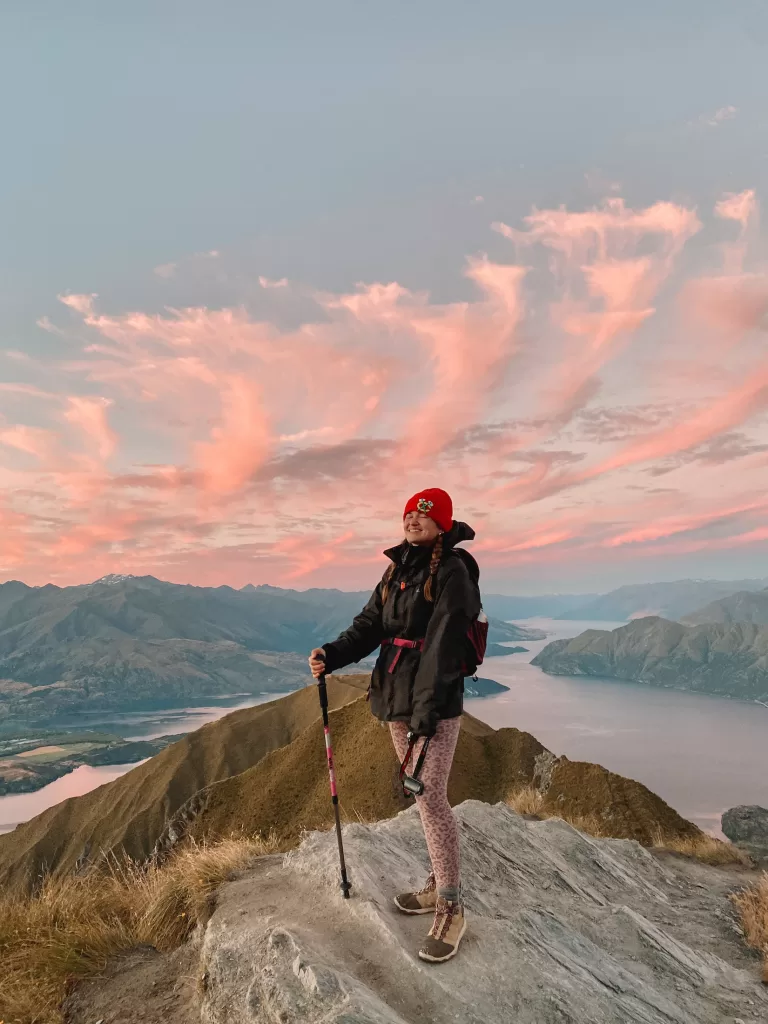
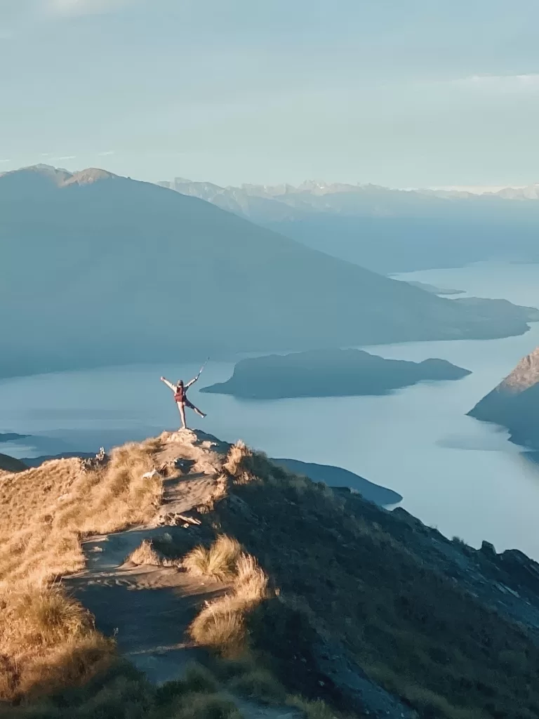
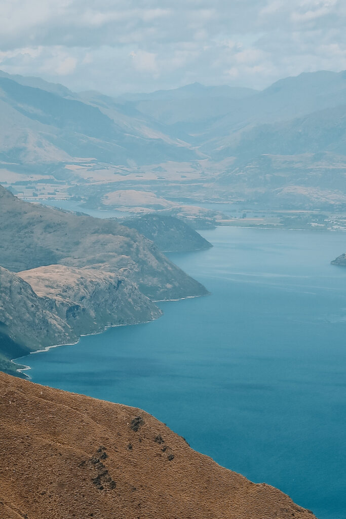
Roys Peak Track
- Distance: 16 km / 10 mi return
- Duration: 5-6 hours
- Difficulty: Moderate to hard
- Features: Alpine meadows, views over Lake Wanaka
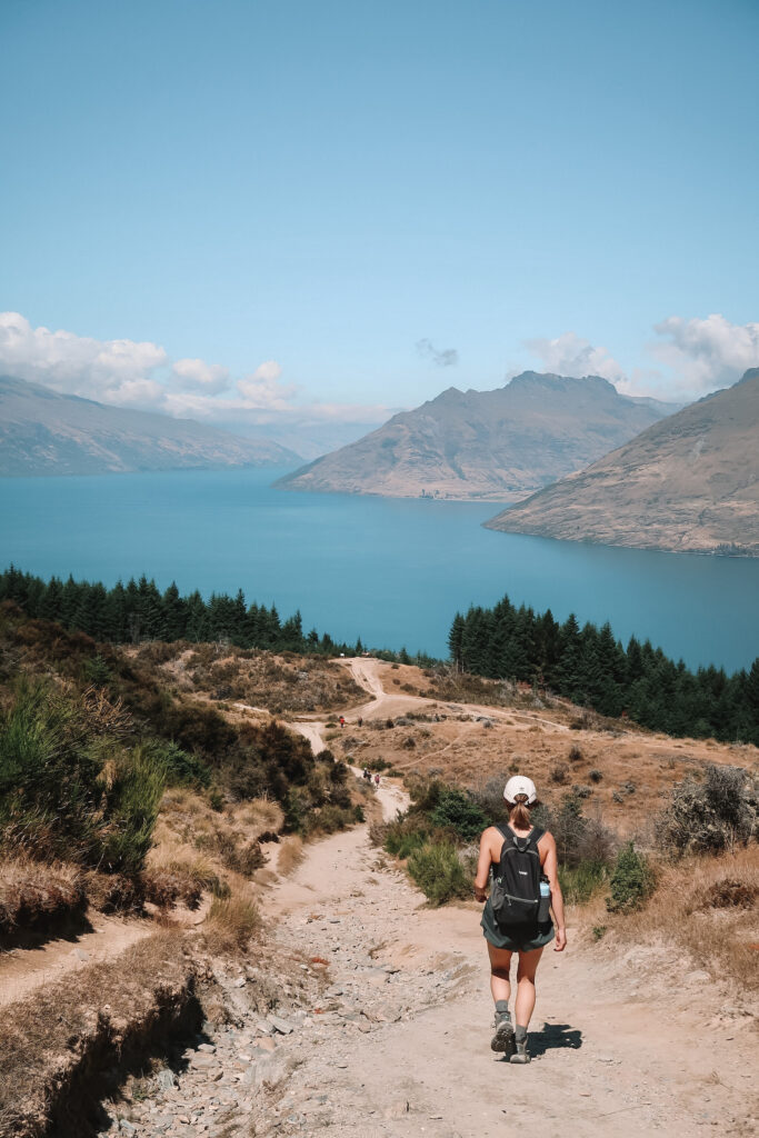
Roy’s Peak Track is a popular hike that’s only a short drive away from Wanaka’s town centre. With panoramic views over Lake Wanaka and Mount Aspiring, this track is a great option for those that want to feel a sense of accomplishment at the summit.
To avoid the midday crowds (and the harsh sun — the entire track is uncovered!), try hiking at sunrise or sunset. We encountered only a few other people on our way up and got the best lighting and cotton candy clouds at the summit.
Roys Peak is closed for lambing each year from 1 October through 10 November. There is also a $2 track fee that you can pay at the trailhead (cash only).
⇉ Roys Peak at Sunset: How to Conquer the Best Hike in Wanaka
Isthmus Peak Track
- Distance: 16 km / 10 mi
- Duration: 5-7 hours
- Difficulty: Hard
- Features: Views over Lake Wanaka and Lake Hawea
Isthmus Peak is very similar to Roys Peak — same same but different! With a nearly identical distance, duration, and difficulty level, this hike makes a good (and less crowded) alternative.
Just like Roys, Isthmus is a long and mostly unshaded uphill slog. Once you reach the top, though, the views over Lake Wanaka, Lake Hawea, and the Southern Alps are out of this world.
Because part of the track crosses over private farmland, Isthmus Peak is closed for fawning between 20 November and 20 December each year.
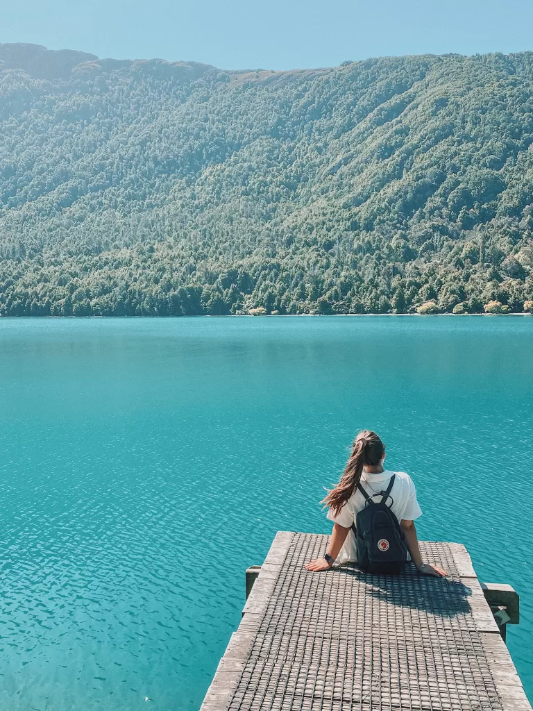
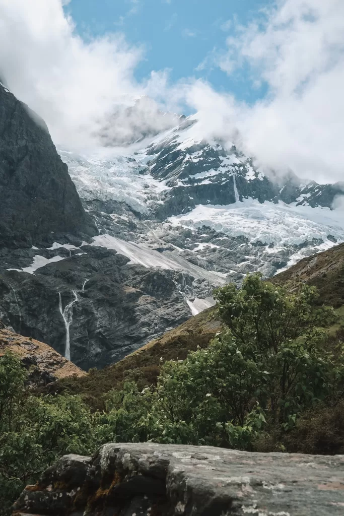
Rob Roy Glacier Track
- Distance: 10 km / 6.2 mi
- Duration: 3-4 hours
- Difficulty: Easy to moderate
- Features: Beech forest, suspension bridges, alpine valley with views of waterfalls and glaciers
Despite the 2-hour, 54 km (33.5 mi) unsealed drive from Wanaka, the Rob Roy Glacier Track is a definite must-do while in the area.
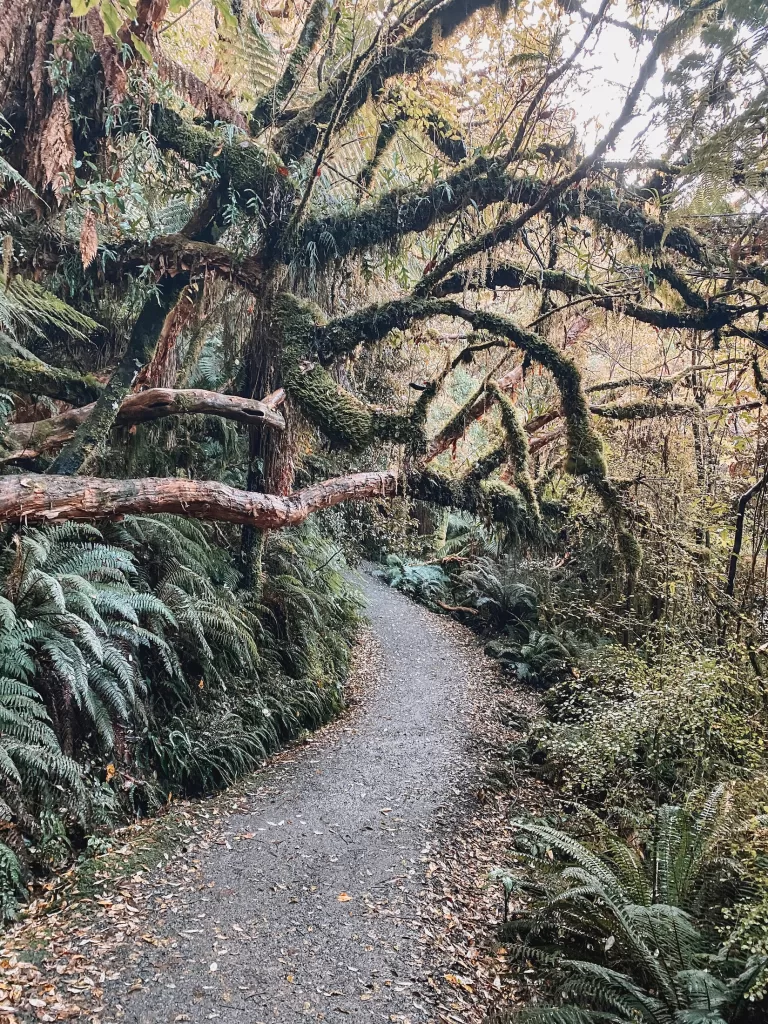
The start of the track crosses through rolling pastures filled with sheep. It then traverses a magical beech forest before entering the head of an alpine valley. Inside the valley, you’ll find countless waterfalls, tumbling glaciers, and plenty of large boulders to sit and eat your lunch.
The incredible views, multiple changes of scenery, and relatively easy walk make the Rob Roy Glacier Track one of my all-time favorite hikes on the South Island!
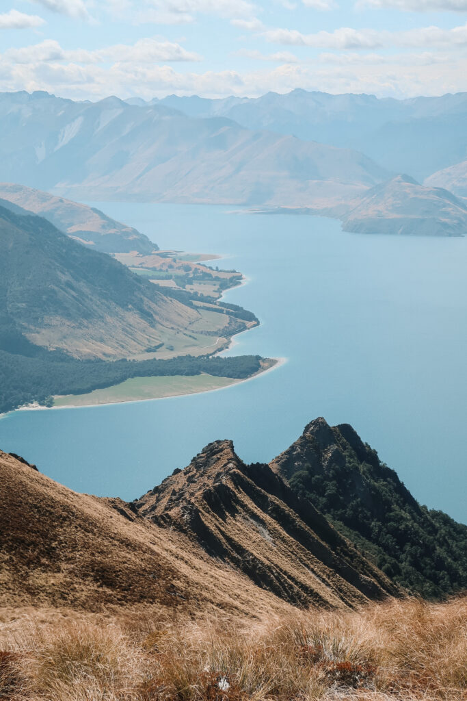
Diamond Lake and Rocky Mountain Summit Track
- Distance: 7 km / 4.3 mi
- Duration: 3 hours
- Difficulty: Moderate
- Features: Diamond Lake, views of Lake Wanaka and Glendhu Bay
From the parking lot, the track gradually climbs up and around Diamond Lake, a serene and reflective body of water. You can finish the loop around the lake and go back down from here, but the best views are found further up!
Rising up from the lake, you’ll reach the Lake Wanaka viewpoint, a viewing platform with sweeping views of Lake Wanaka, Glendhu Bay, and Roys Peak. Continue uphill from the viewpoint to reach the summit of Rocky Mountain at 775 m (2,543 ft).
Best day hikes in Fiordland National Park
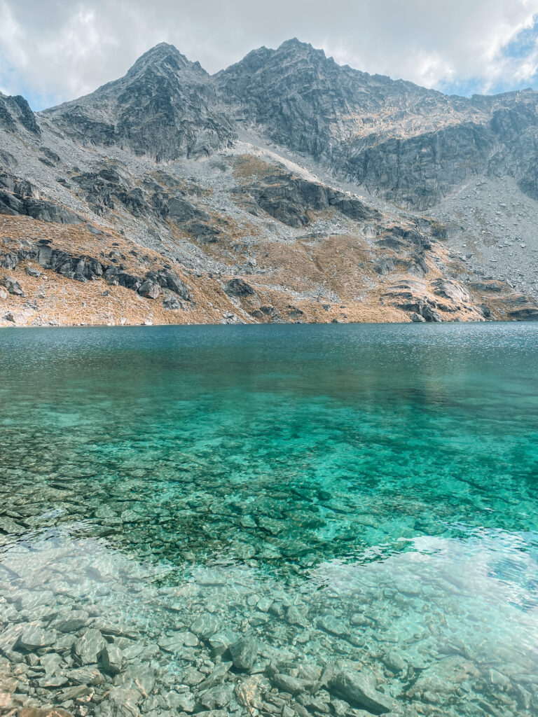
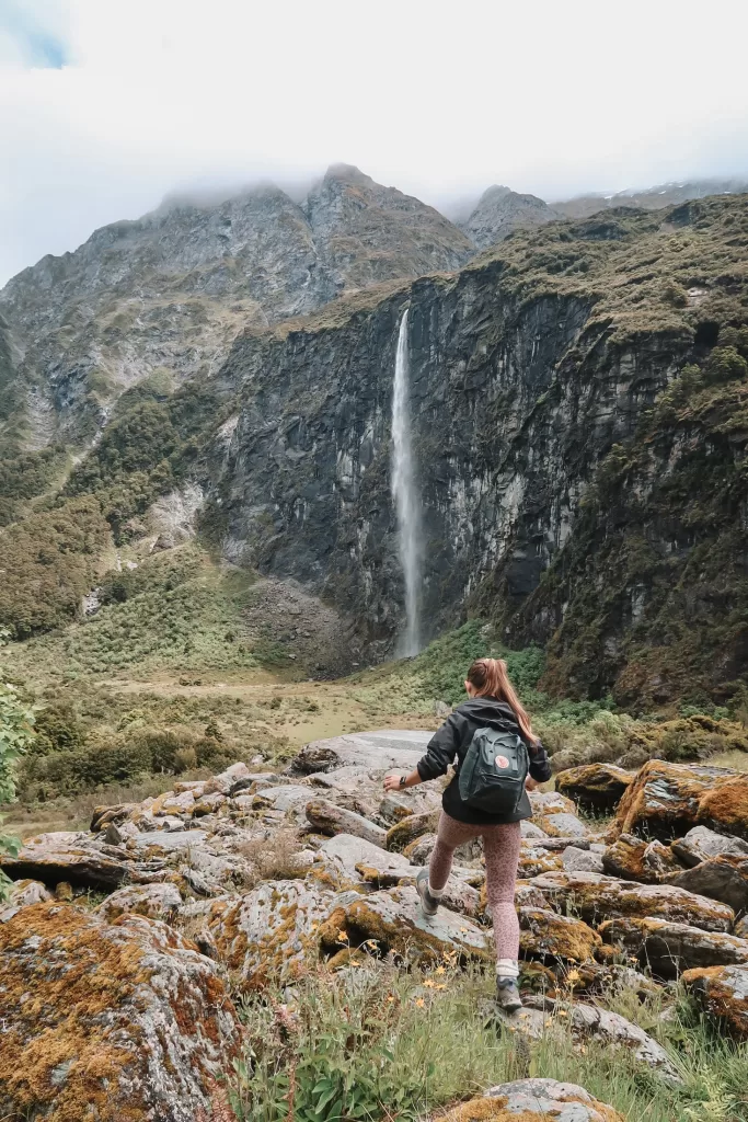
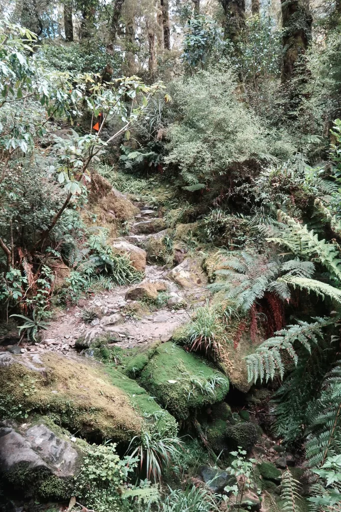
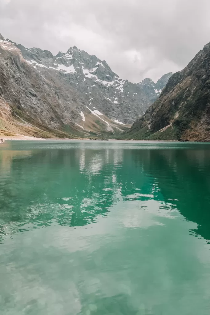
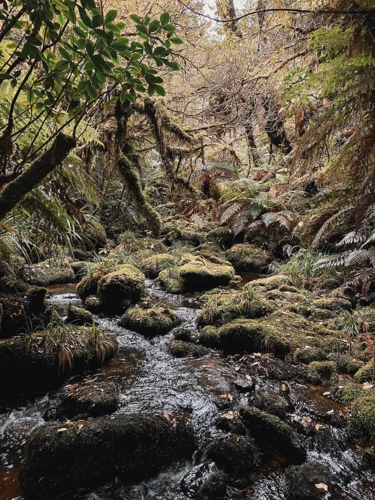
Lake Marian Track
- Distance: 6.2 km / 4 mi
- Duration: 2-3 hours
- Difficulty: Moderate
- Features: Lush forest, hanging valley, alpine lake
This rocky out-and-back track is a steady uphill climb that ends at the beautiful Lake Marian, a blue-green alpine lake with a snowy mountain background.
Throughout the hike, you can expect plenty of unsteady terrain, tree roots, and scrambling over rocks — you’ll definitely need to wear sturdy hiking boots! A few minutes past the trailhead, you’ll reach a series of lovely waterfalls. The views only get better, so make sure to continue down the rest of the track!
Routeburn Track to Key Summit
- Distance: 6.8 km / 4.2 mi
- Duration: 2-3 hours
- Difficulty: Moderate
- Features: Beech forest, alpine tarns, native birdlife
The Key Summit Track is actually a part of the Routeburn Track, one of New Zealand’s nine Great Walks. This half-day walk is an accessible option for those that don’t have the time (or desire!) to tackle a multi-day hike.
Starting at The Divide Shelter, 85 km (53 mi) from Te Anau, the track cruises through native forest and up several switchbacks before reaching the summit. From the top, you can see views of Lake Marian and other alpine tarns.
If you want to hike the rest of the Routeburn Track, you’ll need to organize your trip far in advance — spots in the huts book out pretty quickly.
Gertrude Saddle Route
- Distance: 7 km / 4.3 mi
- Duration: 4-6 hours
- Difficulty: Hard
- Features: Rocky alpine terrain with steel cables, stream crossings, views of Milford Sound
Starting in a lush alpine valley, the track ascends continuously towards the saddle. After reaching Black Lake, the Gertrude Saddle Route becomes incredibly steep, with steel cables bolted into the rocks to help you pull yourself up. This hike is not recommended for people with a fear of heights!
At the top of the saddle, you’ll get impressive views of the valley and Milford Sound in the distance.
Because of the alpine terrain and steep drop-offs, you should only attempt this hike in the summer when weather conditions are good. Snow, rain, and ice would make the climb incredibly dangerous!
Best day hikes in Aoraki Mount Cook National Park
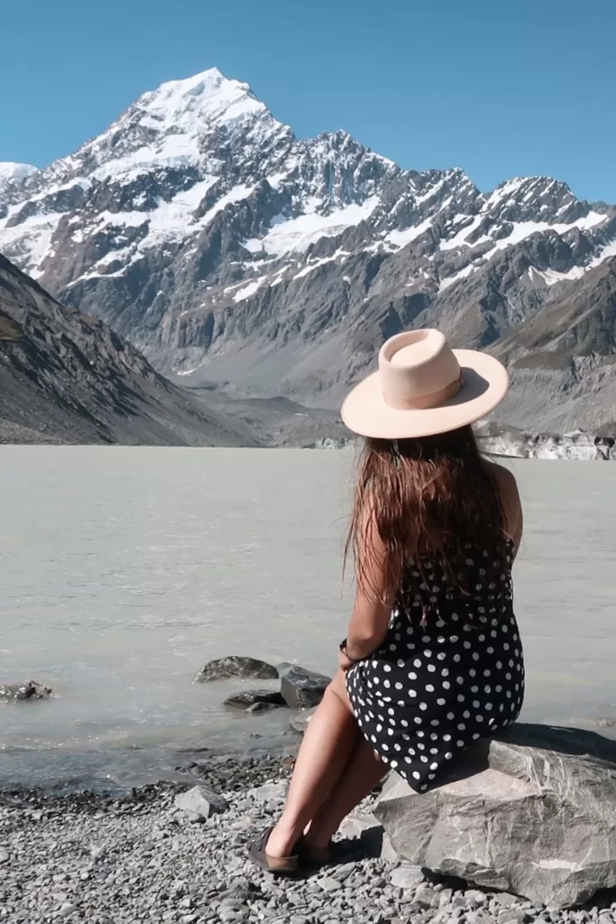
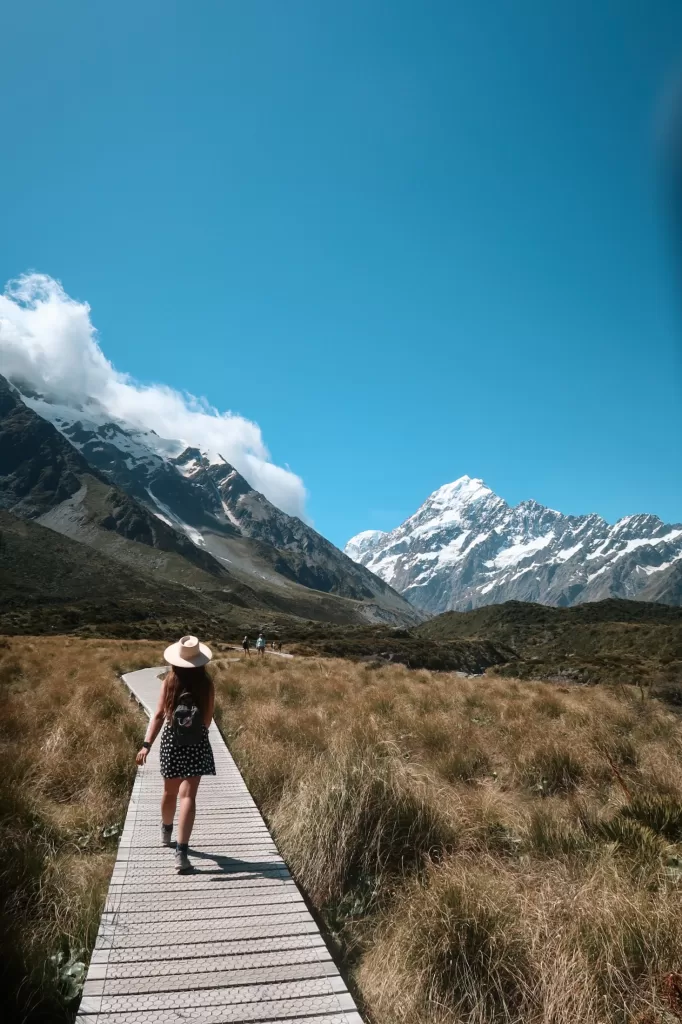
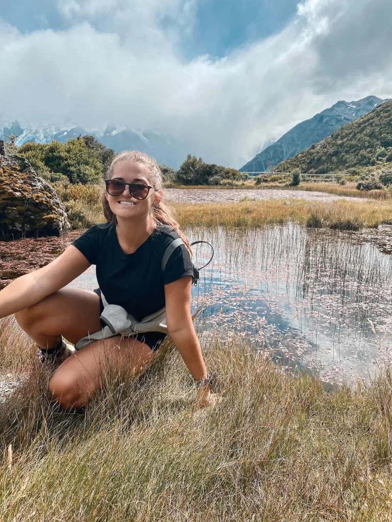
Hooker Valley Track
- Distance: 10 km / 6.2 mi
- Duration: 3 hours
- Difficulty: Easy
- Features: Swing bridges, alpine streams, glaciers, iceberg-speckled Hooker Lake
This is one of the best South Island New Zealand day hikes.
The Hooker Valley Track is a nice, meandering walk with very little elevation gain and unbelievable views. It includes several swing bridges, tons of native vegetation, and views of the surrounding snowy mountain peaks. If you’re feeling brave, make sure to take a dip in Hooker Lake once you reach the end — it’s icy and very invigorating!
In my opinion, this hike is only worth doing when skies are clear. The walk itself, while pleasant, is uneventful — without the stunning views of Aoraki/Mt Cook and the Southern Alps, there’s really no point.
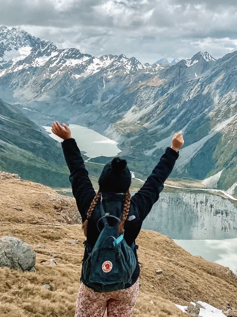
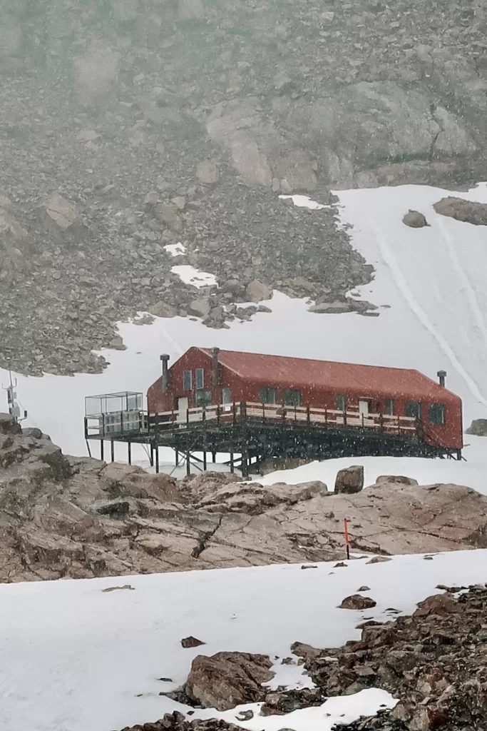
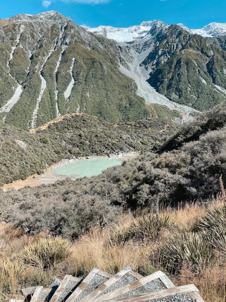
Mueller Hut Route
- Distance: 10.4 km / 6.5 mi
- Duration: 6-8 hours
- Difficulty: Hard
- Features: Stairs, boulder scrambling, views of alpine lakes and glaciers
If you’re not a fan of skipping leg day, the Mueller Hut Route could be the walk for you!
This killer tramp starts along the Sealy Tarns Track, also known as the “Stairway to Heaven” because of the 2,200 steps straight up to the lake. The views from here are already incredible — on a clear day, you can see Mueller Lake, the Hooker Valley, and Aoraki Mount Cook.
Once you reach the alpine lake, the track continues upwards with a bit of rocky bouldering and steep scree fields. Eventually, you’ll reach the iconic red Mueller Hut.
To stay at Mueller Hut overnight, you’ll need to make a booking online in advance.
⇉ Conquering the Mueller Hut Day Hike
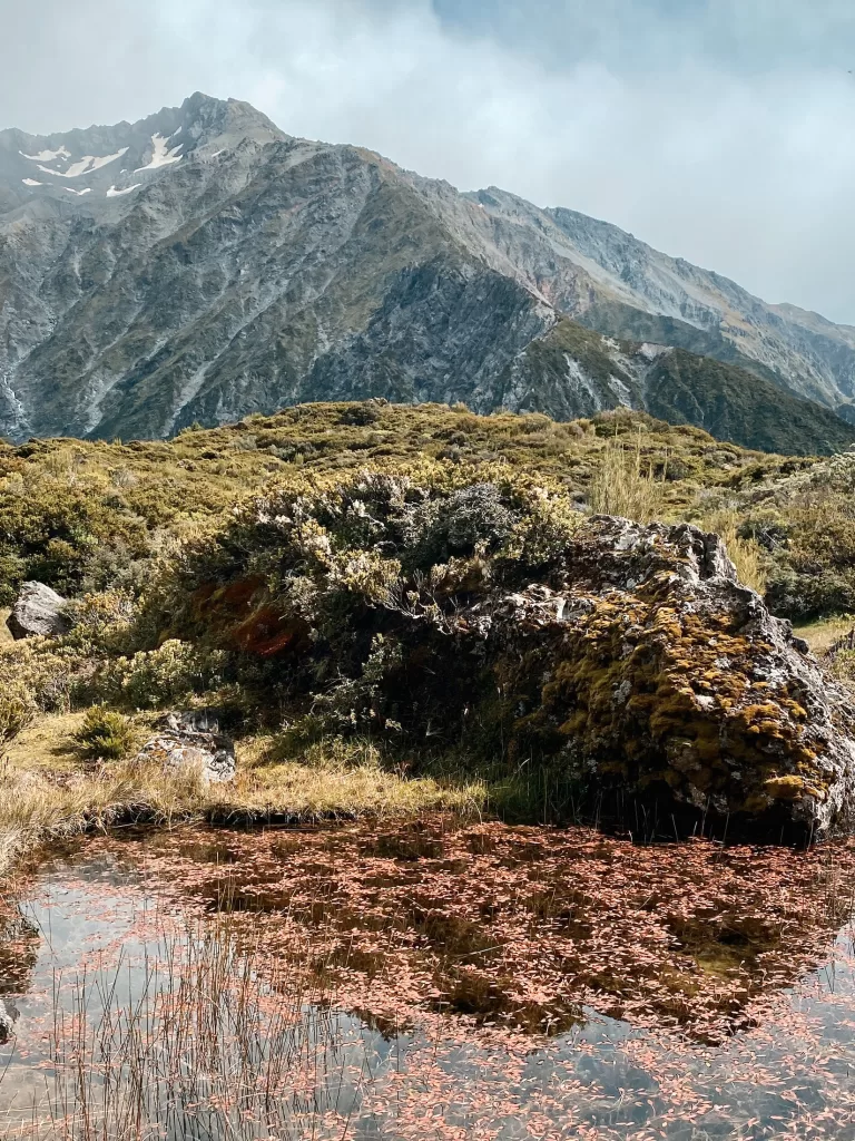
Red Tarns Track
- Distance: 4 km / 2.5 mi
- Duration: 2 hours
- Difficulty: Easy to moderate
- Features: Stairs, alpine lake with unique red pondweed
The Red Tarns Track is like a miniature version of the Mueller Hut Route — there are a lot of stairs, but by the time your legs start hurting, you’re at the top!
Starting from Mount Cook Village, the track ascends from the valley floor to the Red Tarns viewpoint, giving you a great look at the valley and surrounding mountains. The alpine tarn at the top is really cool too because it features a unique pondweed that turns it red!
⇉ Hiking the Red Tarns Track: Steep Stairs & A Glacial Lake
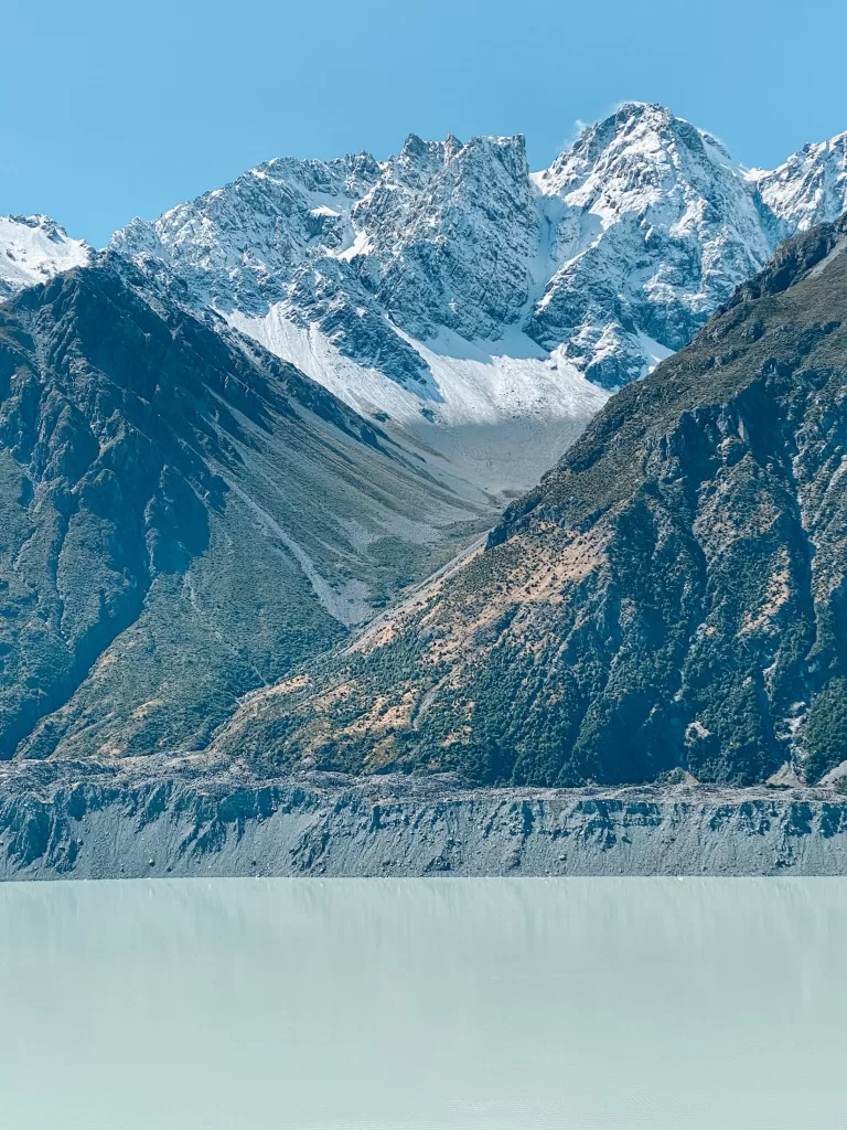
Blue Lakes & Tasman Glacier
These two short hikes start at the same trailhead and can easily be combined into a fun half-day walk. They both feature stunning alpine lakes, glaciers, and rocky fields.
Blue Lakes and Tasman Glacier View Track
- Distance: 2.6 km / 1.6 mi
- Duration: 40 minutes
- Difficulty: Easy
Tasman Lake Track
- Distance: 2.5 km / 1.5 mi
- Duration: 50 minutes – 1 hour
- Difficulty: Easy
The Blue Lakes and Tasman Glacier walks offer unparalleled views of Tasman Glacier, the longest glacier in New Zealand. On a clear day, the milky blue water of the alpine lakes is a striking contrast to the deep blue sky and the icy white icebergs that bob on the surface.
⇉ Blue Lakes and Tasman Glacier: Easy Hikes with Unparalleled Views
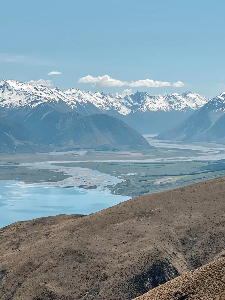
Best day hikes in South Canterbury & the Mackenzie Region
Greta Track
- Distance: 17.9 km / 11.2 mi
- Duration: 5-7 hours
- Difficulty: Moderate
- Features: Tussock-covered switchbacks, rocky valley, views of Lake Ohau and the Southern Alps
In my opinion, the Greta Track is one of the most underrated day hikes on New Zealand’s South Island.
This long loop features a steep climb up the side of Ben Ohau, a few shallow river crossings, and a sheltered walk back through the valley. You’ll enjoy unparalleled views over Lake Ohau and the Southern Alps mountain range.
Besides hiking, the Greta Track is also used for mountain biking and horseback riding.
⇉ Hiking the Greta Track for Stunning Views Over Lake Ohau
Pukaki Kettle Hole Track
- Distance: 4 km / 2.5 mi
- Duration: 45 minutes
- Difficulty: Easy
- Features: Farmland with sheep, views of Lake Pukaki and Aoraki Mount Cook
The Pukaki Kettle Hole Track is a wonderful short walk with stunning views over Lake Pukaki.
You’ll encounter roaming sheep, golden tussocks, and a small alpine lake. On a clear day, the views of Aoraki Mount Cook are out of this world. The Kettle Hole Track is also a great place to come see the sunrise or sunset!
The entire track is uncovered, so make sure to wear a hat and bring extra sunscreen.
⇉ Hiking the Pukaki Kettle Hole Track
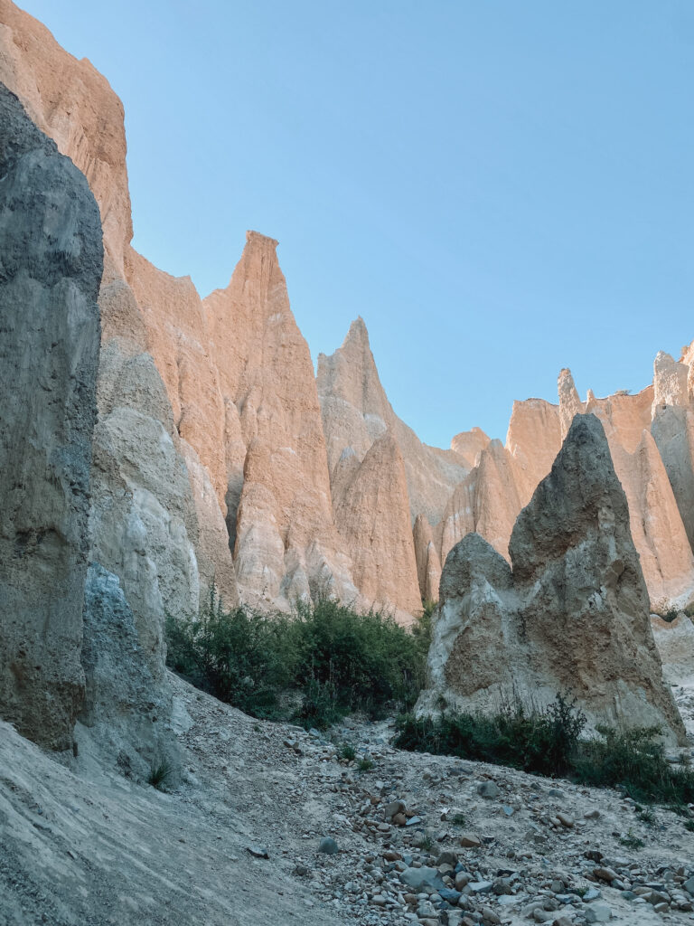
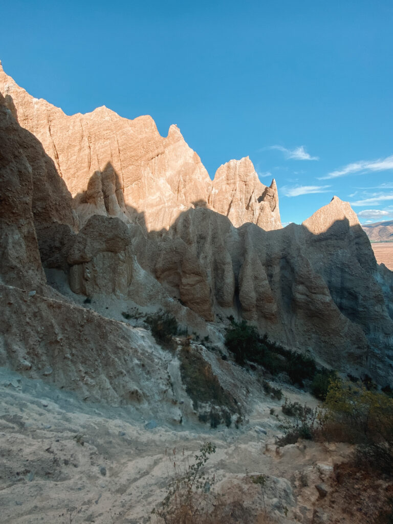
Omarama Clay Cliffs
- Distance: 1.3 km / 0.8 mi
- Duration: 30 minutes
- Difficulty: Easy
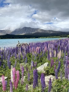
- Features: Unique rocky pinnacles, lupins (late November through late December)
The Omarama Clay Cliffs are less of a true walk and more of an experience.
The otherworldly rocky pinnacles stick straight out into the sky and are visible from the main road. Once you get closer to the formations, you start to appreciate the sheer magnitude of rock above you.
There is a $5 fee to access the Clay Cliffs that is payable at the start of the road (cash only).
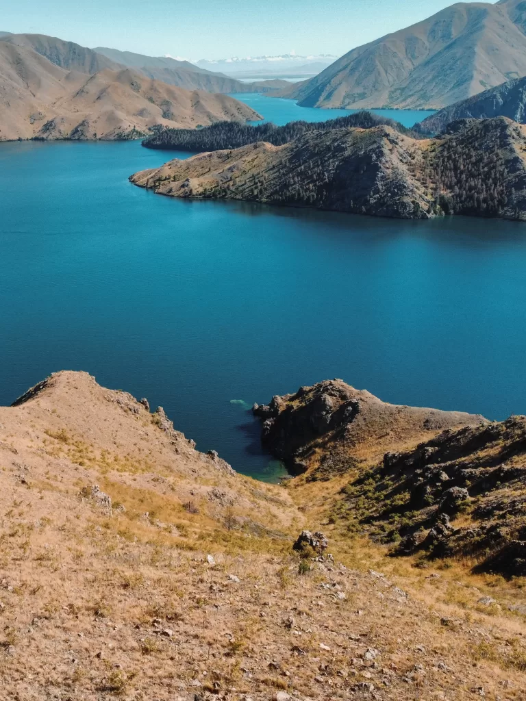
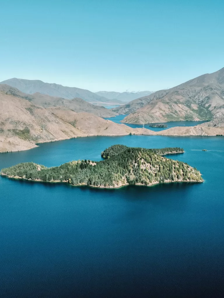
Lake Benmore Peninsula Track
- Distance: 4.7 km / 2.9 mi
- Duration: 1 hour 30 minutes
- Difficulty: Easy
- Features: Pine forest, views of Lake Benmore and the Benmore Dam
The Lake Benmore Peninsula Track near Otematata is a truly beautiful walk along the shores of Lake Benmore.
Looping around the peninsula, the track traverses through pine forest before opening out into rolling meadows filled with wildflowers. The views of the Benmore Dam and lake are impressive and reach out far into the distance.
⇉ Hiking the Lake Benmore Peninsula Track
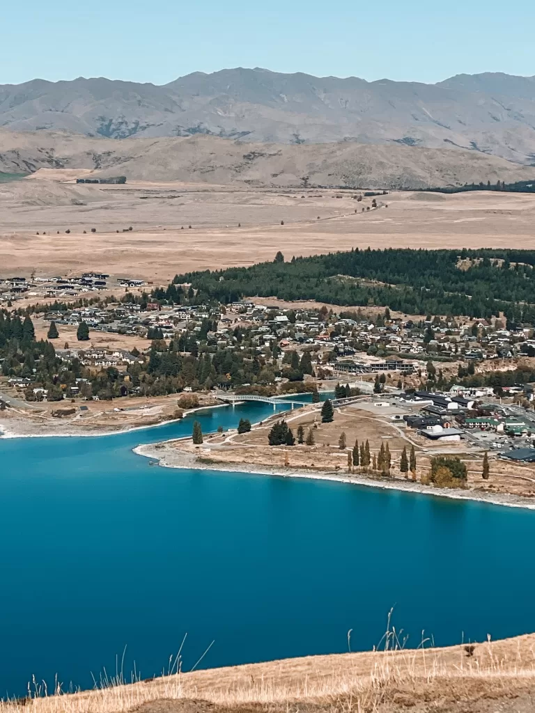
Mt John Summit Circuit Track
- Distance: 6.1 km / 3.8 mi
- Duration: 1.5-2 hours
- Difficulty: Moderate
- Features: Larch forest, astronomical observatory and cafe, views of Lake Tekapo and Lake Alexandrina
One of the best things to do in the area, the Mt John Summit Circuit Track offers some of the best views of Lake Tekapo and Lake Alexandrina.
Starting in a larch forest, the track climbs steadily up above the tree line. From there on, it’s an exposed walk uphill to the Mount John summit. At the top, you’ll find an astronomical observatory and cafe.
If you’d like, you can also drive up to the observatory instead of walking. There is an $8 road access fee (payable by cash or EFTPOS).
⇉ Hiking Mt John Summit Circuit Track Tekapo
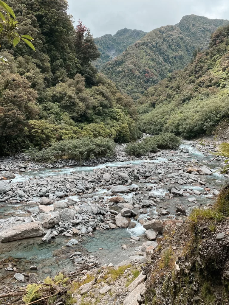
Best day hikes on the West Coast
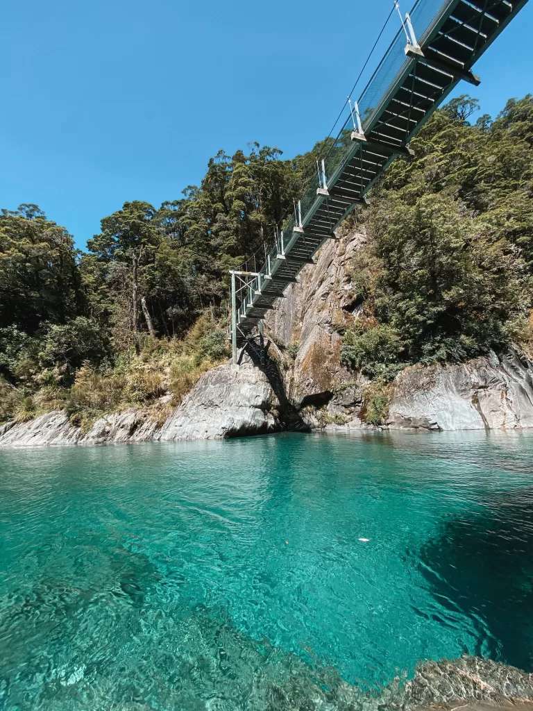
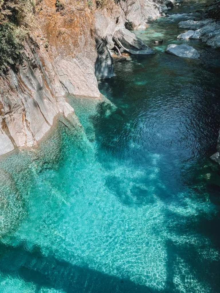
Blue Pools Track
- Distance: 3 km / 1.9 mi
- Duration: 1 hour
- Difficulty: Easy
- Features: Beech and podocarp forest, swing bridges, bright turquoise water
Located within Mt Aspiring National Park, the Blue Pools Track is an easy meandering walk to reach stunning, bright blue colored water.
You’ll cross mature native forest and a few swing bridges before making it to the glacial Blue Pools. On a warm day, make sure to bring your swimsuit and a towel to take a dip in the frigid, icy water!
This track can get very busy around midday, so I’d recommend going earlier or later in the day to avoid most of the crowds.
⇉ West Coast Road Trip Day 7: Haast Waterfalls & Blue Pools
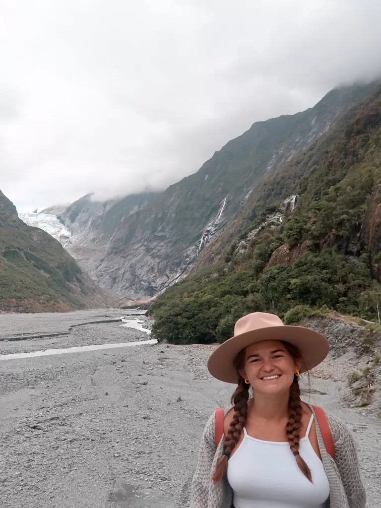
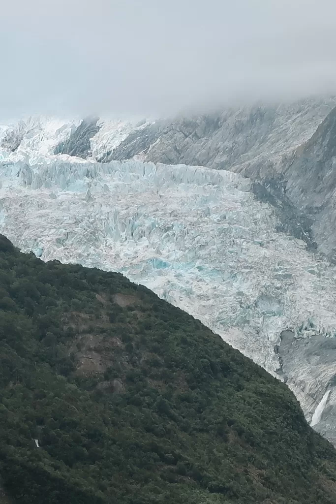
Franz Josef Glacier Walk
- Distance: 1.7 km / 1.1 mi
- Duration: 30 minutes
- Difficulty: Easy
- Features: Rainforest bush walk, glaciers
One of the most popular things to do in Franz Josef, the Franz Josef Glacier Walk takes you as close as you can get to the glacier without hiring a guide.
Unfortunately, because of climate change, the glacier itself has receded down the valley and is relatively far away from the viewpoint. I’d still recommend doing this walk, though, because the informational signs show you where the glacier used to end just over 100 years ago. It’s a stark look at how human actions have impacted the environment around us!
Alex Knob Track
- Distance: 17.2 km / 10.7 mi
- Duration: 8 hours
- Difficulty: Hard
- Features: Lowland forest, alpine meadows, glaciers
This challenging out-and-back track in Westland Tai Poutini National Park offers another view of Franz Josef Glacier from above.
Changing terrain from lowland forest to alpine meadows, the Alex Knob Track starts with a steep incline and gradually turns into a gentle grade up to the summit. You’ll get fabulous views of glaciers, mountains, and seascapes in every direction.
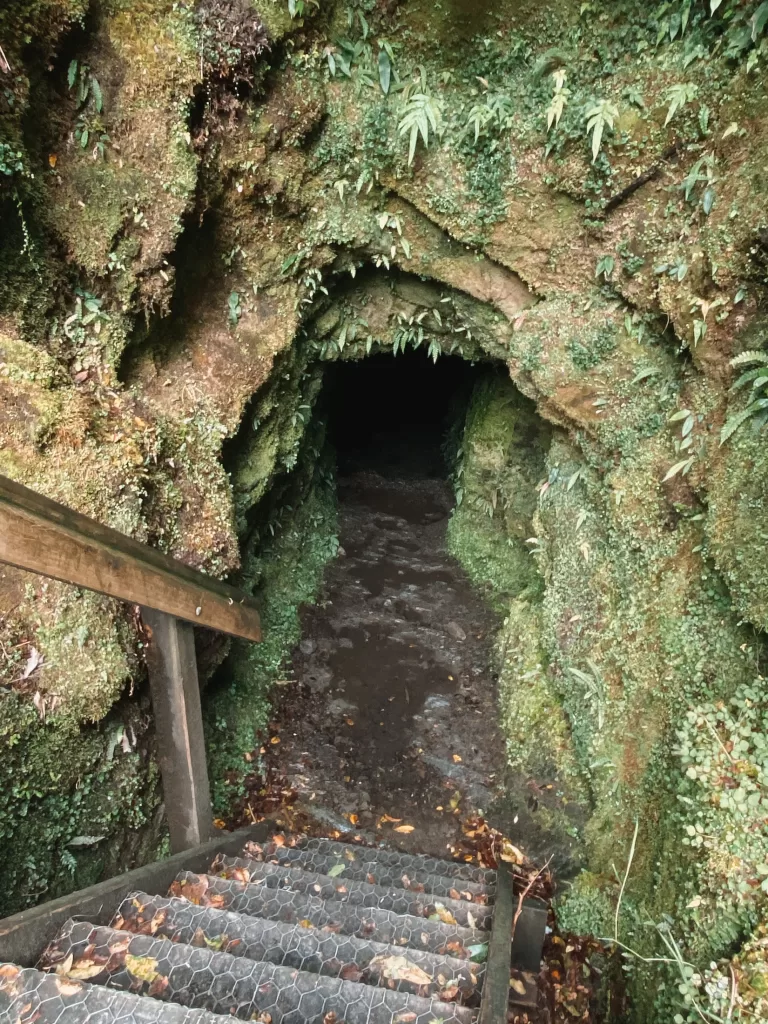
Tatare Tunnels Walk
- Distance: 3.6 km / 2.2 mi
- Duration: 1 hour 20 minutes
- Difficulty: Easy
- Features: Historical mining tunnel, views of Tatare Gorge
This is a super unique and interesting walk. Although it requires a bit of preparation, it’s definitely worth the extra effort!
The Tatare Tunnels Walk follows an old 4WD road along the Tatare Gorge before climbing to an old water tunnel. To make it through the tunnel, you’ll need waterproof shoes, a rain coat, and a head torch.
You’ll follow the pitch black tunnel through shin-deep water until you reach the other side (it sounds more terrifying than it actually is). This is a fun walk, especially for those with kids!
⇉ West Coast Road Trip Day 5: Tatare Tunnels & Franz Josef
Best day hikes in North Canterbury (Christchurch & Arthur’s Pass)
Avalanche Peak Route
- Distance: 7.1 km / 4.4 mi
- Duration: 6-8 hours
- Difficulty: Hard
- Features: Rocky scree, views of Canterbury Plains and Southern Alps
Avalanche Peak definitely packs a punch — it’s one of the most challenging and rewarding hikes I’ve ever done!
With over 1,100 m (3,608 ft) of elevation gain over a relatively short distance, the way up to the summit is very steep. The first half of the track climbs up through a mountain beech forest. After passing the tree line, the views down the Bealey Valley are already incredible — but you’re not there yet!
The second half of the track is fully exposed and very rocky. There are steep drop-offs, especially once you get higher up towards the summit.
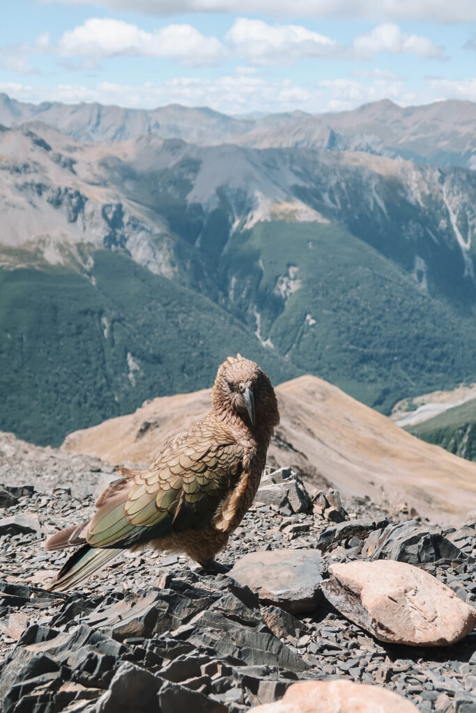
After your strenuous climb to the top, you’ll be rewarded with 360° views of the Southern Alps and Arthur’s Pass. If you’re lucky, a cheeky Kea (alpine parrot) will let you snap a few photos.
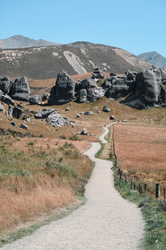
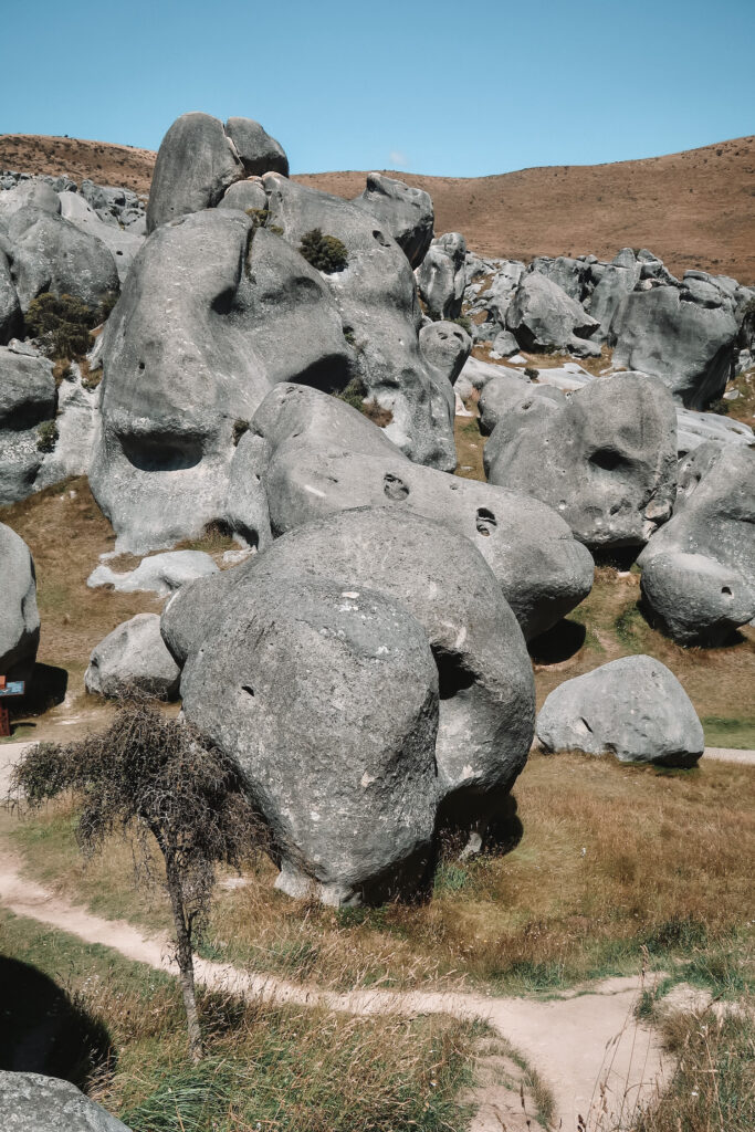
Castle Hill (Kura Tawhiti Access Track)
- Distance: 2.8 km / 1.7 mi
- Duration: 40 minutes – 1 hour
- Difficulty: Easy
- Features: Massive limestone rock formations, bouldering
Castle Hill Conservation Area is a unique site with large and funky rock formations. This track and the area around it are also of special significance to Ngai Tahu, the Maori iwi in the region.
One of the best things about the Kura Tawhiti Access Track is that you’re able to explore the boulders at your leisure. The trail has many places where you can wander off and get lost amongst the rocks. Many people also come here to try their hand at bouldering or climbing.
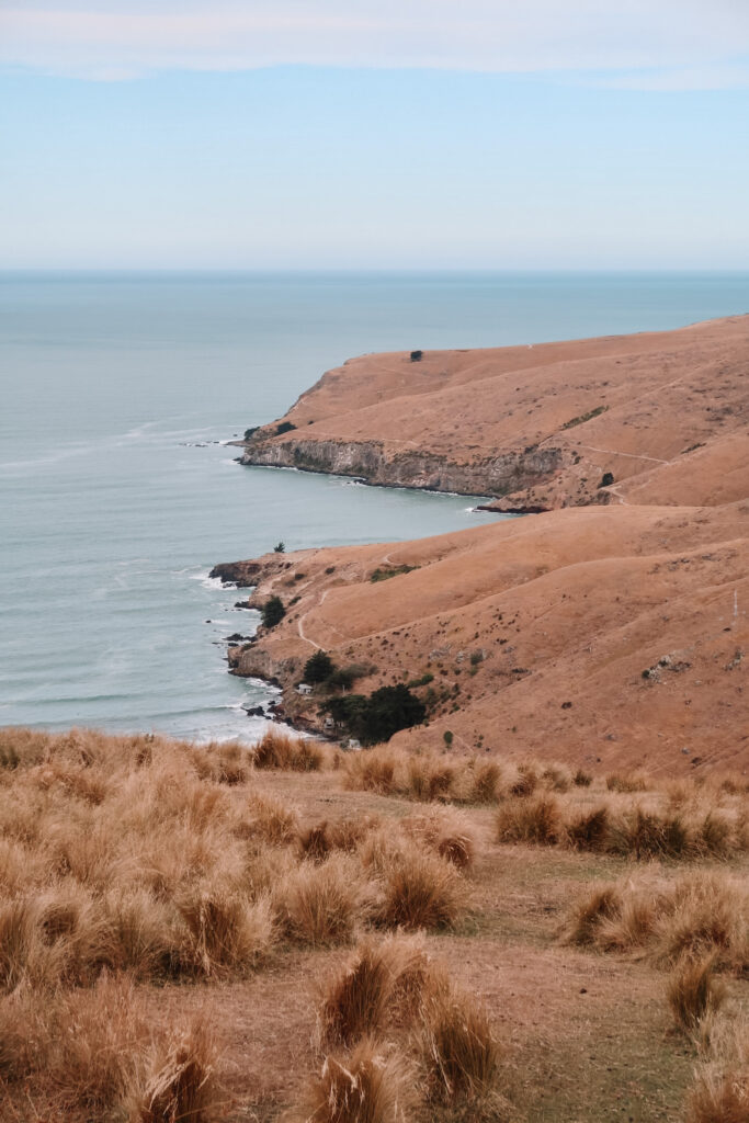
Godley Head Loop Track
- Distance: 9.3 km / 5.8 mi
- Duration: 3 hours
- Difficulty: Easy
- Features: Coastal views, historical WWII remains, seabirds and marine life
Christchurch’s Godley Head Loop Track offers amazing views of Lyttelton Harbour, the Banks Peninsula, and the South Island’s eastern coast.
Starting and ending at Taylors Mistake, a sheltered beach in the Sumner neighborhood, the track climbs up to the headland and around the peninsula. You can spot sheep, WWII remains, and coastal birdlife along the way.
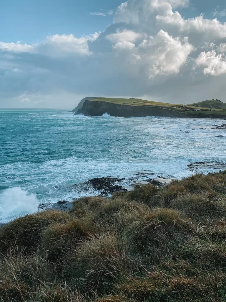
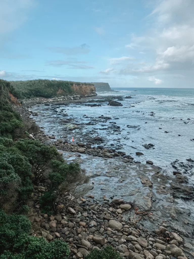
Best day hikes in Coastal Otago (Dunedin & the Catlins)
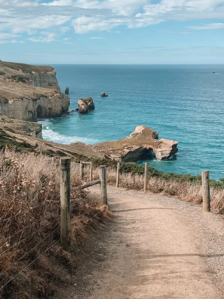
Tunnel Beach
- Distance: 2 km / 1.2 mi
- Duration: 1 hour
- Difficulty: Easy
- Features: Coastal views, rock formations, fur seals
The Tunnel Beach Track is a short but sweet walk along Dunedin’s rocky coastline. It passes through an excavated tunnel and leads to a small and secluded beach with massive boulders. The views of the natural archway and rock formations along the way are spectacular.
Sandfly Bay Track & Sandymount Track
The Sandfly Bay and Sandymount tracks are right next to each other, meaning they can be combined into an awesome morning or afternoon of hiking.
Sandfly Bay Track:
- Distance: 560 m / 0.4 mi
- Duration: 30 minutes
- Difficulty: Easy
Sandymount Track:
- Distance: 2.5 km / 1.6 mi
- Duration: 1 hour
- Difficulty: Easy
Both walks feature sand dunes and epic coastal views. The Sandfly Bay Track also offers the chance of seeing wildlife, like fur seals, sea lions, and penguins! Because of erosion in the sand, the the tracks along the beach are often difficult to follow — keep to the orange markers for the best experience.
Catlins short walks
The Catlins region is one of the most magical places on the South Island, but you won’t find any long or strenuous hikes here. Instead, there are numerous short and sweet walks that can be combined into a full day’s worth of adventures.
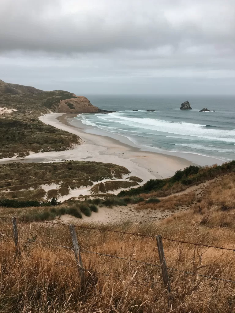
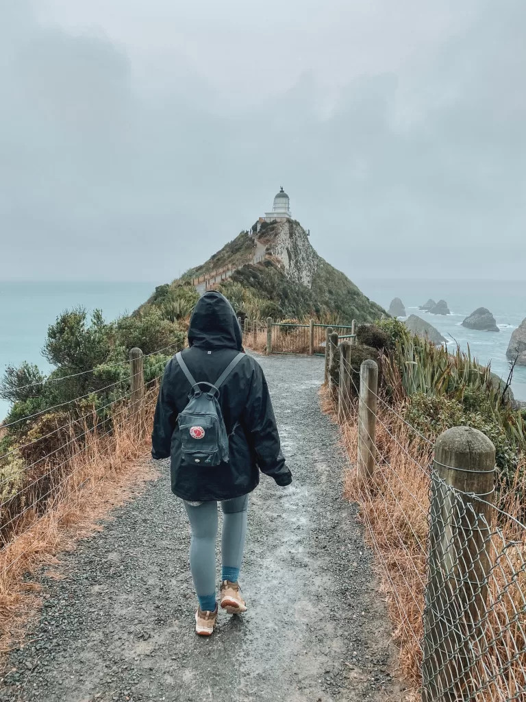
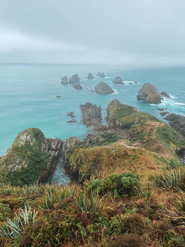
Nugget Point
- Distance: 1.8 km / 1.1 mi
- Duration: 20-30 minutes
- Features: Lighthouse, nugget-shaped rock formations
This easy path heads up to Tokata Lighthouse, giving you a panoramic view of the Catlins coast. The rocks below (called “nuggets” because of their shape) stick out majestically from the sea. Take a quick side trip out to Roaring Bay afterwards to try spotting some yellow-eyed penguins!
⇉ Nugget Point: All About the Coolest Lighthouse in the Catlins
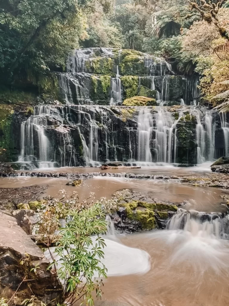
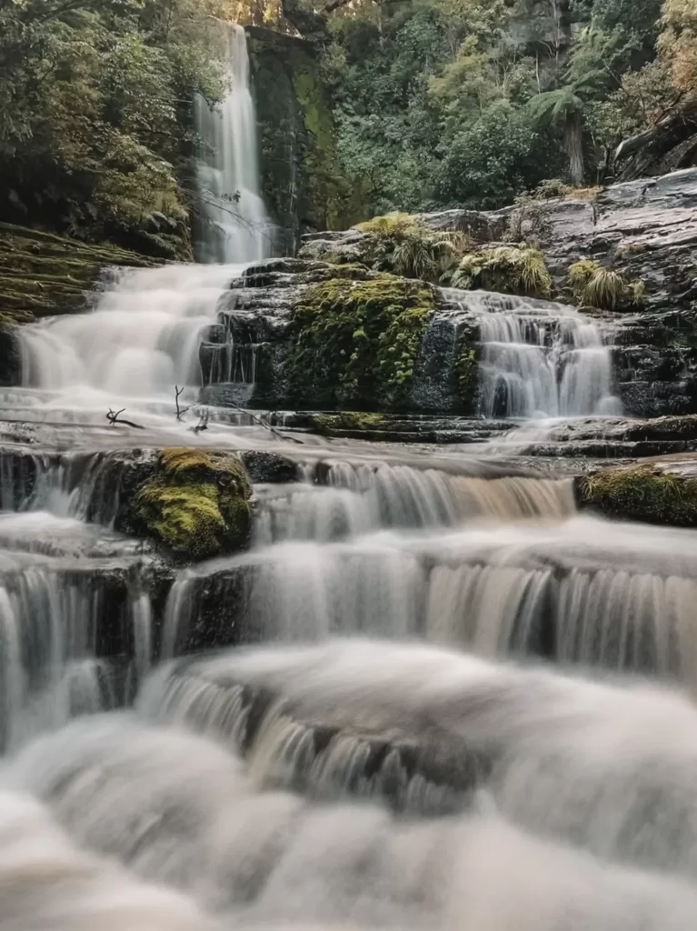
Purakaunui Falls
- Distance: 0.6 km / 0.4 mi
- Duration: 20 minutes
- Features: Lush rainforest, three-tiered waterfall
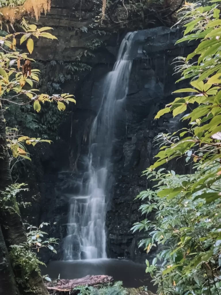
Purakaunui Falls is one of the Catlins’ most-photographed waterfalls, and for good reason! After an easy walk through mature beech and podocarp forests, the track ends at an impressive three-tiered waterfall.
Matai Falls & Horseshoe Falls
- Distance: 1.2 km / 0.8 mi
- Duration: 35 minutes
- Features: Lush rainforest, historic rail trail, two waterfalls
One single trail, two stunning waterfalls! The Matai Falls and Horseshoe Falls walk follows a podocarp forest and an old rail line that used to connect two small towns.
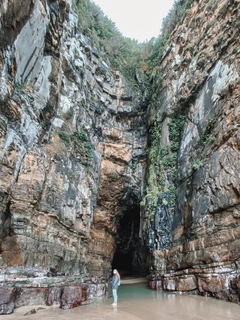
Cathedral Caves
- Distance: 2.6 km / 1.6 mi
- Duration: 1 hour
- Features: Limestone sea caves, beach
The imposing Cathedral Caves were named for their resemblance to European cathedrals (they’re over 30 m / 98 ft high inside!). You’ll need to plan your visit in advance because the caves are only accessible 1 hour each side of low tide. Access to the caves costs $10 per adult.
⇉ Cathedral Caves: A Catlins, New Zealand Must-See
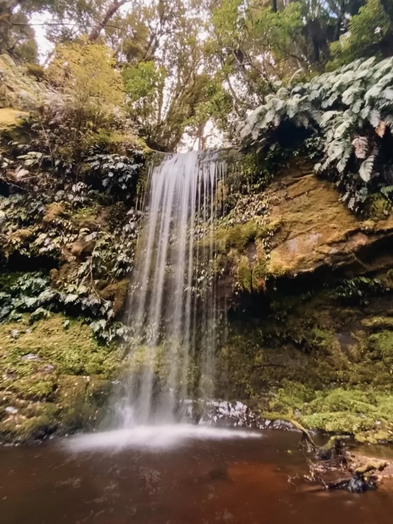
McLean Falls
- Distance: 2.1 km / 1.3 mi
- Duration: 40 minutes
- Features: Lush rainforest, terraced waterfall
This gentle walk through lush native bush leads to a dramatic, tiered waterfall. The waterfall’s terraces are easily accessible and make a great spot for a quick dip!
Koropuku Falls
- Distance: 0.6 km / 0.4 mi
- Duration: 40 minutes
- Features: Lush rainforest, enchanting waterfall
Because it’s not an official DOC track, the short hike to Koropuku Falls is an awesome off-the-beaten-track adventure. Expect to wander through magical rainforests and see plenty of native vegetation and birdlife.
Curio Bay
- Distance: 1.9 km / 1.2 mi
- Duration: 25 minutes
- Features: Petrified forest, dramatic coastal views, yellow-eyed penguins
The rugged and wild coastline of Curio Bay offers a chance to see rare wildlife and ancient fossilized trees. It’s a good idea to plan your visit around low tide because that is the best time to appreciate the petrified forest from the viewing platforms.
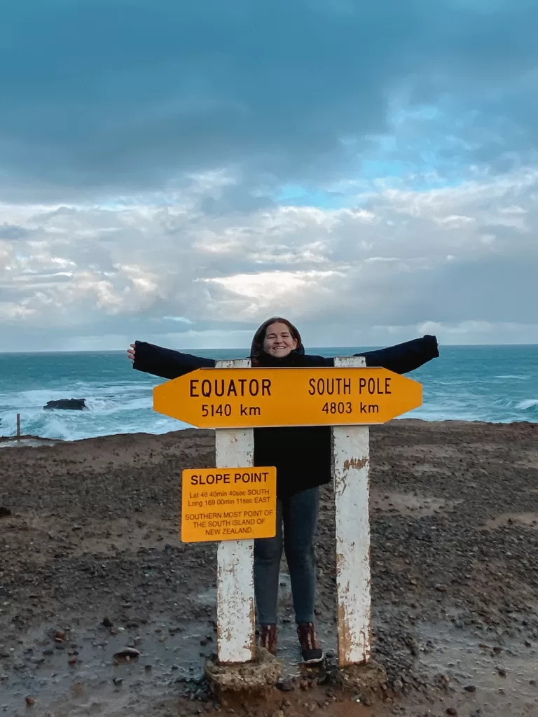
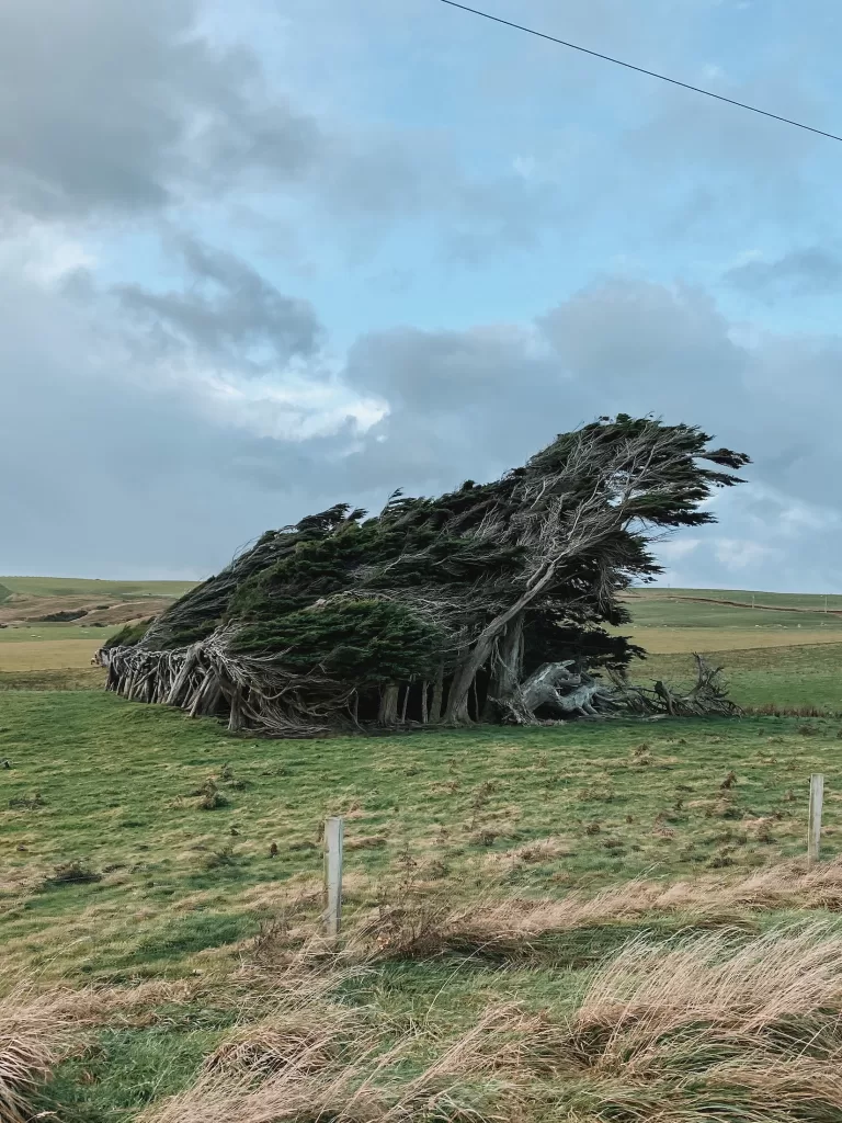
Slope Point
- Distance: 1.6 km / 1 mi
- Duration: 20 minutes
- Features: Windswept trees, coastal headland, southernmost point of the South Island
This short walk takes you through farmland to the southernmost point of New Zealand’s South Island. Expect to encounter a lot of wind, crashing waves, and extremely windswept trees! The Slope Point Walk is closed for lambing between September and November.
South Island New Zealand day hikes FAQ
What’s the best hike in New Zealand?
The answer to this question will be completely subjective based on what you value! Do you like easy hikes with incredible views? Or would you prefer a tough hike that gives you a sense of accomplishment at the end? Are you more into forests, mountains, or coastal settings?
The best hikes that I’ve personally done on the South Island are Avalanche Peak, Hooker Valley Track, Greta Track, and Rob Roy Glacier Track. I love all of these walks for different reasons, but they all fall under my all-time favorites!
What are the best day hikes on the North Island?
Tongariro Alpine Crossing
Maybe one of the most iconic hikes in the country, the Tongariro Crossing is a 19.4 km (12 mi) trek across dramatic volcanic landscapes. The main draw of this walk is the Emerald Lakes, a series of bright green pools surrounded by steam vents and geothermal activity.
Mount Maunganui Track
This 6.4 km (4 mi), moderately challenging track takes you to the summit of Mt Maunganui, an extinct volcano and sacred Maori site. From the top, you’ll get glorious views of the Bay of Plenty and the towns of Tauranga and the Mount.
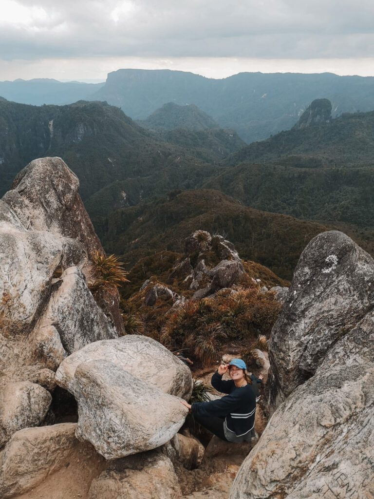
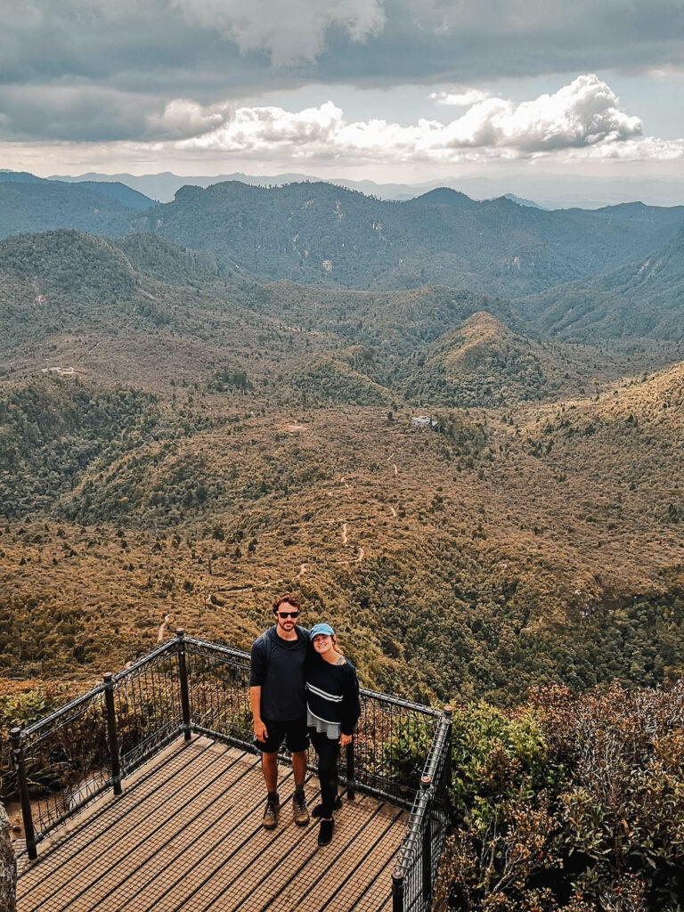
Kauaeranga Kauri Trail (Pinnacles Walk)
The Pinnacles Walk is a 14.2 km (8.8 mi), moderately challenging out-and-back track in the Coromandel Peninsula. Along the way, you’ll see amazing panoramic vistas and unique rocky pinnacles. If you want to make this an overnight hike, you can stay in the Pinnacles Hut, the largest DOC hut in the country.
What are the best multi-day hikes on New Zealand’s South Island?
If you’re after a longer multi-day hike, try one of these Great Walks. New Zealand’s Great Walks are some of the most popular overnight tramps in the country because they offer the most breathtaking scenery and unique backcountry experiences.
Milford Track
The Milford Track is a 4-day, 53.5 km (33 mi) one-way walk in Fiordland National Park. Crossing along ancient rainforests, glacier-carved valleys, and gushing waterfalls, the Milford Track is considered one of New Zealand’s all-time best walks.
Routeburn Track
Spanning 33 km (20.5) and taking 2 to 4 days, the Routeburn Track stretches from Fiordland National Park to Glenorchy. The track winds through alpine meadows and valleys, giving you incredible views of the surrounding mountain ranges and rugged scenery.
Kepler Track
The Kepler Track is a 60 km (37 mi) loop south of Te Anau. Taking anywhere between 3 and 4 days, this Great Walk features tussock-covered ridge lines, alpine vistas, and beech forests around the shorelines of Lake Te Anau and Lake Manapouri.
Abel Tasman Coast Track
Located in the South Island’s northern Nelson Tasman region, the 60 km (37 mi) Abel Tasman Coast Track takes between 3 and 5 days to complete. This unique track features golden sandy beaches, lush coastal bush, and native wildlife like fur seals.
You’ll also love:
- Solo Travel Activities: 14 Ways to Have More Fun On Your Own
- The Truth About Peru’s Rainbow Mountain Hike
- 8 Common Travel Myths That Need to Be Debunked
Thanks for reading this guide to the best day hikes on the South Island of New Zealand! Have you done any, and if so, which one was your favorite? Let me know below!
xoxo Niki