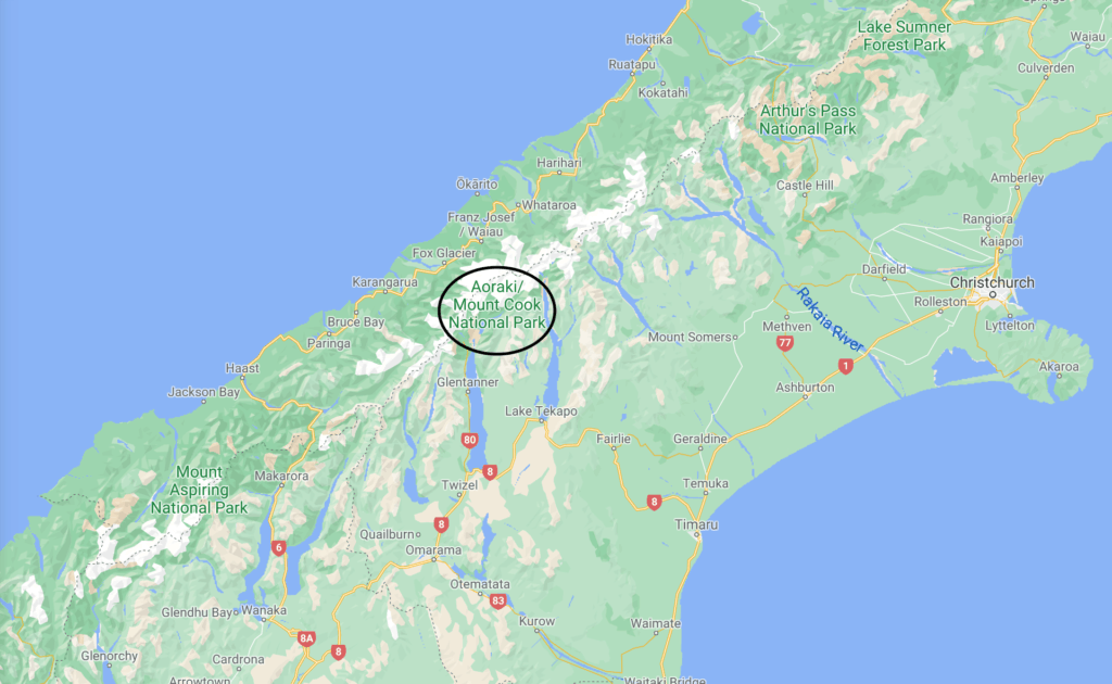
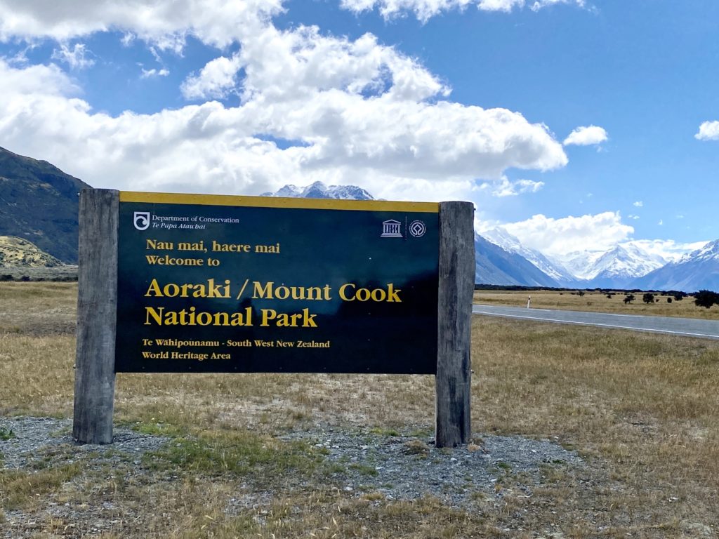
Aoraki/Mt Cook National Park is located in the heart of New Zealand’s Southern Alps mountain range. Mt Cook is New Zealand’s tallest mountain at 3,724 m (12,218 ft). Known for its scenic hikes and intense alpine conditions, Aoraki/Mt Cook National Park is a must-visit when traveling throughout New Zealand. Read on for a complete guide to everything you’ll need to know before visiting, including accommodation, best hikes, and more!
- Where is Mt Cook National Park?
- How to get to Mt Cook National Park
- The road to Mt Cook National Park
- How to take great pictures on the road to Mt Cook
- Aoraki/Mt Cook Village
- Where to stay in Mt Cook National Park
- Why is it called Aoraki/Mt Cook?
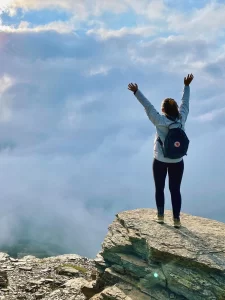
- Aoraki/Mt Cook National Park hikes
- Other activities around Mt Cook National Park
Where is Mt Cook National Park?
Mt Cook National Park sits on the northern tip of Lake Pukaki, right in the heart of the Southern Alps mountain range. Aoraki/Mt Cook Village is located 55 km (34 mi) down the road after turning off of the Christchurch-Queenstown highway.
⇉ Official DOC website with more information
How to get to Mt Cook National Park
Driving
If you’re taking your own car, you’ll drive north along SH 80 to get to Mt Cook. The road follows the length of Lake Pukaki and can occasionally be closed in the winter due to snow. Make sure to fill up your gas tank in either Twizel or Tekapo before turning off towards Mt Cook as it gets pretty expensive the closer you get to the park.
Driving times from:
- Twizel: 45 minutes
- Queenstown: 3 hours
- Christchurch: 4 hours
By bus
It’s also possible to hitch a ride on a private bus from Queenstown, Wanaka, or Christchurch. These buses usually operate as day tours, but some offer multi-day tours as well. They’ll drop you off at Mount Cook YHA, Aoraki Alpine Lodge, and the Hermitage Hotel.
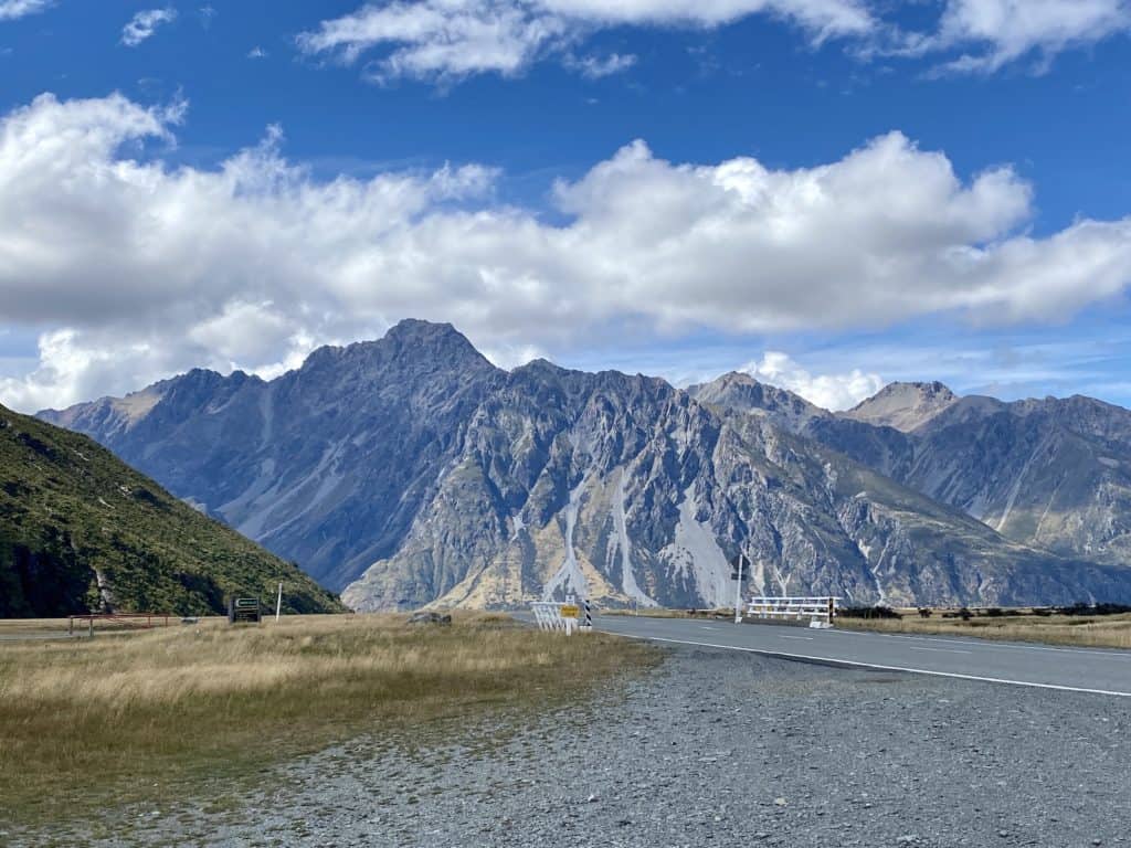
The road to Mt Cook National Park
The road to Mt Cook is considered one of the most scenic roads in all of New Zealand. Here are a few of the iconic spots you’ll see along the way.
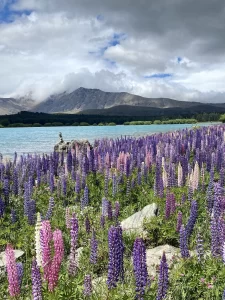
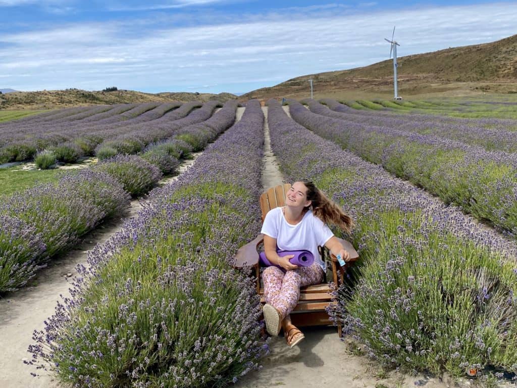
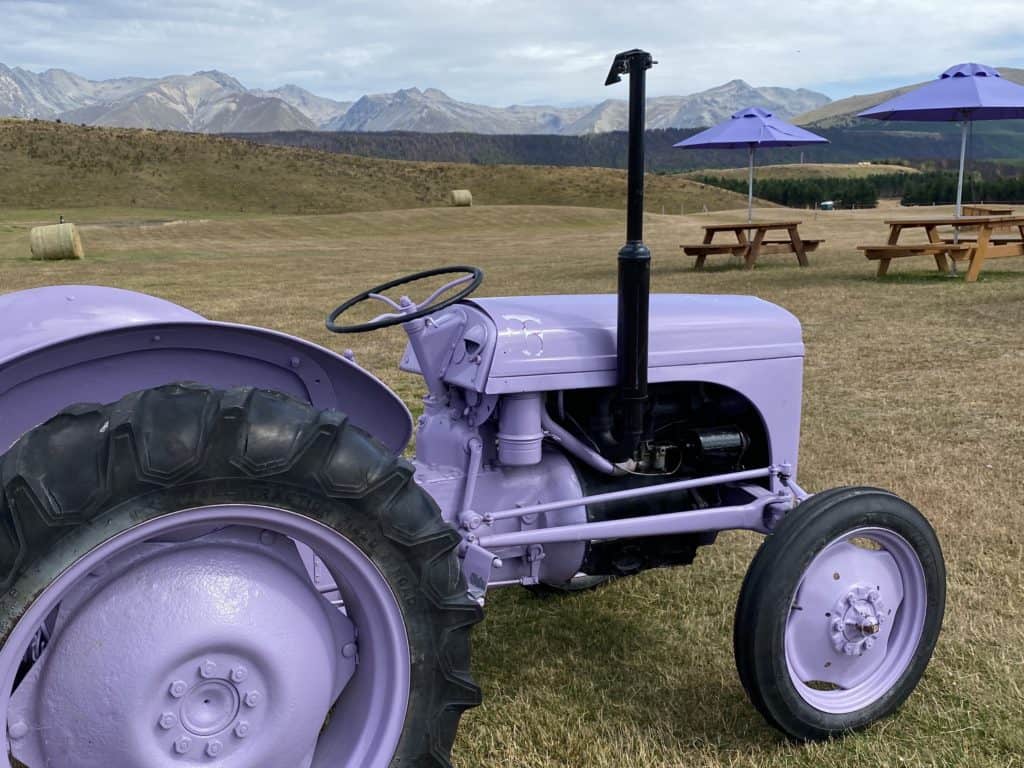
Alpine Lavender
This is a super fun place to stop along the way in the summer. You’ll see a massive field of purple on your left when the lavender is in bloom. You can pay a few dollars to walk through the field and take pictures with their fun purple props. They also sell heaps of different lavender-scented and flavored products, including lavender ice cream (yum)!
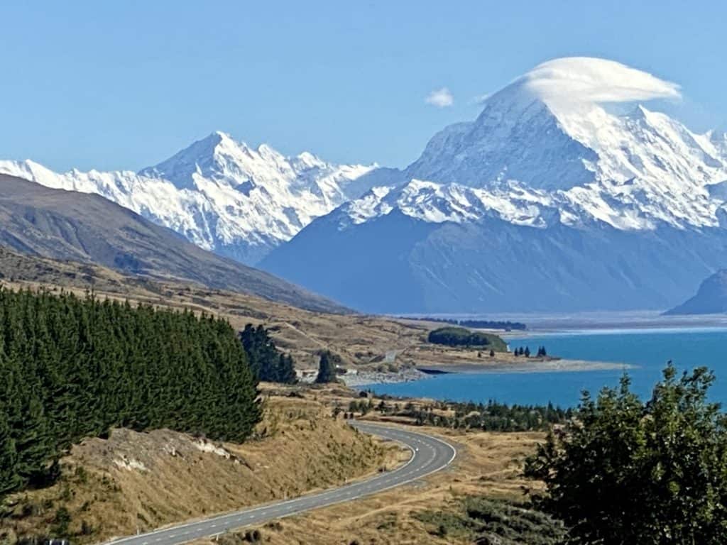
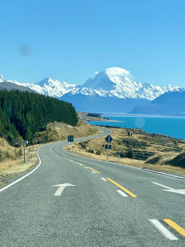
Peter’s Lookout
If you’ve ever seen the iconic shot of a winding road leading to Mt Cook, this is probably where it was taken. This is one of the nicest spots to pull over for pictures along the way to Mt Cook National Park — on a nice day, the view of the mountains and Lake Pukaki is very majestic. Peter’s Lookout has a fairly large parking lot, public toilets, and a nice path you can walk that leads down to the water.
Glentanner Station
Glentanner Station is a high country sheep farm slash airport on the way to Mt Cook National Park. They offer tons of different activities and tours, including heli hikes, scenic plane rides, and glacier trips around Mt Cook. You’ll also find accommodation here in the form of motel-style units, hostel rooms, and campsites.
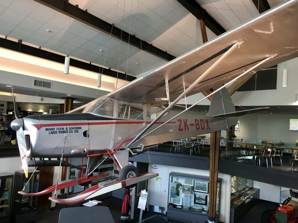
Aoraki/Mt Cook Airport
This is where you’ll stop if you’ve booked through Mt Cook Ski Planes and Helicopters. Like Glentanner Station, Mt Cook Airport offers scenic plane and helicopter tours over the park. You can also go skydiving here!
How to take great pictures on the road to Mt Cook
You’ll definitely want to stop for pictures along the way. Here are some tips to consider.
- Safety first! If you’re going out onto the road to take pictures, always make sure that there are no cars anywhere near you. It’s best to have somebody else looking out for you when you take your pictures.
- There are tons of places to safely pull over for pictures — take advantage of them! In addition to official scenic lookouts, multiple spots along the road have large enough shoulders to pull over onto.
- Play with perspective — try taking pictures from below or with different plants in the foreground.
- Take lots of pictures — it’s always better to have several options instead of finding out that the one picture you took is blurry after the fact.
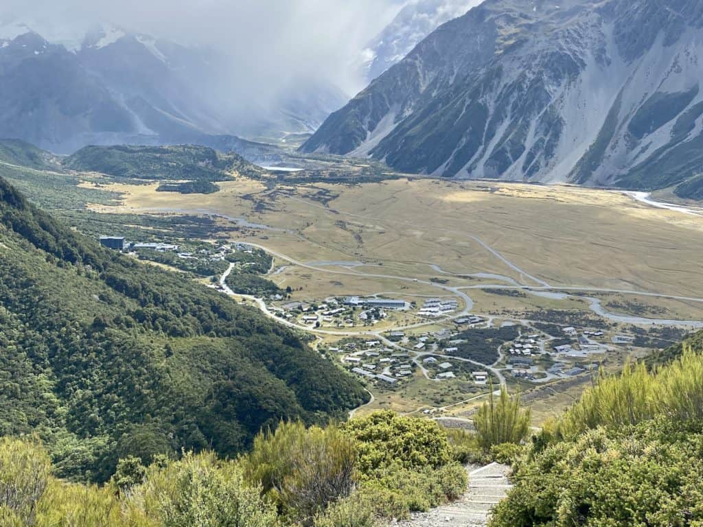
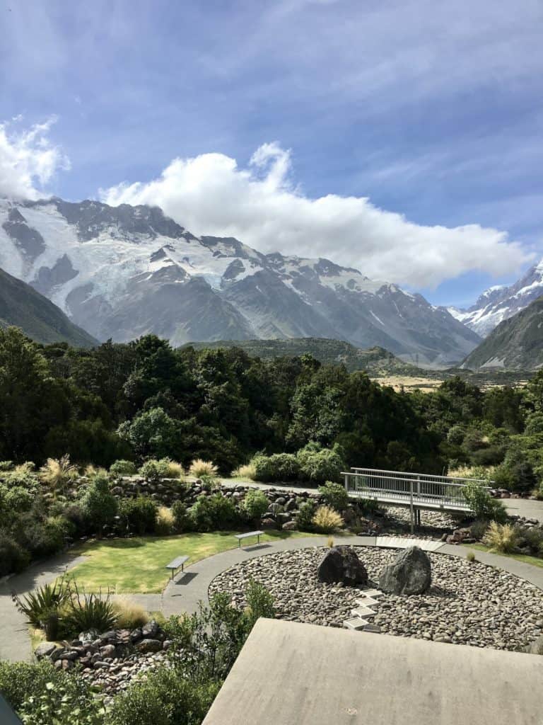
Aoraki/Mt Cook Village
Aoraki/Mt Cook Village is located 15 km (9.3 mi) south of the mountain’s summit. There are a few hotels, restaurants, and information/visitor centers. Here are some cool places to check out:
- DOC center: This is a good spot to visit before going on any hikes. You’ll find topographical maps, books, and a memorial to commemorate those who have died in the park.
- Old Mountaineer’s Cafe: This is the only business officially opened by Sir Edmund Hillary, the first person to successfully climb Mt Everest (and an Aoraki/Mt Cook icon).
- Hermitage Hotel: The Hermitage is a historic building in Mt Cook Village. In addition to being a hotel (obviously), you’ll find the Sir Edmund Hillary Museum, a planetarium, a 3D theatre, and a few cafes and bars.
Where to stay in Mt Cook National Park
In the park
- The Hermitage Hotel: Historic and luxurious, the largest hotel in the park
- Mt Cook Lodge: At the Hermitage Hotel, stylish new rooms
- Aoraki Alpine Lodge: Chalet vibes, great for couples
- Aoraki Court Motel: Motel units with mountain views
- YHA Mt Cook: Budget hostel accommodation, the best for backpackers
- White Horse Hill Campground: A DOC-operated campsite for tents and vehicles
Outside the park
- Glentanner Holiday Park: Powered and non-powered campsites just outside Aoraki/Mt Cook National Park
- Twizel (45 minutes away): This is the closest town with accommodation outside the park. Matuka Lodge is a great luxury option, while Mountain Chalet Motels are more affordable.
- Tekapo (1 hour away): The next-closest base to the park. Try Mantra Hotel or YHA Lake Tekapo.
Why is it called Aoraki/Mt Cook?
Aoraki (spelled Aorangi in te reo) is the Maori name for New Zealand’s tallest mountain. It means “Cloud Piercer,” which is a combination of the words ao (meaning world, daytime, cloud, etc.) and raki or rangi (meaning day, sky, or weather).
The English name Mount Cook was given in 1851 to honor Captain James Cook, who circumnavigated New Zealand’s islands in the late 1700s. In 1998, the mountain’s name was officially changed from Mt Cook to Aoraki/Mt Cook.
Aoraki/Mt Cook National Park hikes
There are three different trailheads where hikes begin in the park: Aoraki/Mt Cook Village, White Horse Hill Campground, and Tasman Glacier car park. I’ve organized the 11 official Aoraki/Mt Cook National Park hikes below based on which trailhead they originate from. If I’ve done that particular hike, I’ll include a link to a more in-depth blog post.
Aoraki/Mt Cook Village trailhead
This trailhead is in town at the same location as the Mt Cook Village Public Shelter (59 Bowen Drive). The shelter has public toilets, coin-operated showers, and outdoor barbecues. This is the easiest trailhead to get to if you’re staying in Aoraki/Mt Cook Village.
Governors Bush walk
- Difficulty: Easy
- Elevation gain: 100 m / 328 ft
- Length: 1.5 km / 0.9 mi return
- Time: 45 minutes
- Type of hike: Gentle walk through beech forest
Bowen Bush walk
- Difficulty: Very easy
- Elevation gain: None
- Length: 0.2 km / 0.1 mi return
- Time: 10 – 15 minutes
- Type of hike: Short walk with a few steps
Glencoe walk
- Difficulty: Easy
- Elevation gain: 54 m / 177 ft
- Length: 0.6 km / 0.4 mi return
- Time: 30 minutes
- Type of hike: Short walk to a viewpoint
Red Tarns track
- Difficulty: Intermediate
- Elevation gain: 300 m / 984 ft
- Length: 4 km / 2.5 mi return
- Time: 2 hours
- Type of hike: Lots of stairs, baby

White Horse Hill Campground
The White Horse Hill Campground and trailhead is about 2 km (1.2 mi) from Mt Cook Village. It’s connected via a walking track, making it easy to start these hikes if you’re visiting Mt Cook National Park without your own car.
Kea Point track
- Difficulty: Easy
- Elevation gain: None
- Length: 2.8 km / 1.7 mi return
- Time: 1 hour
- Type of hike: Exposed boardwalk
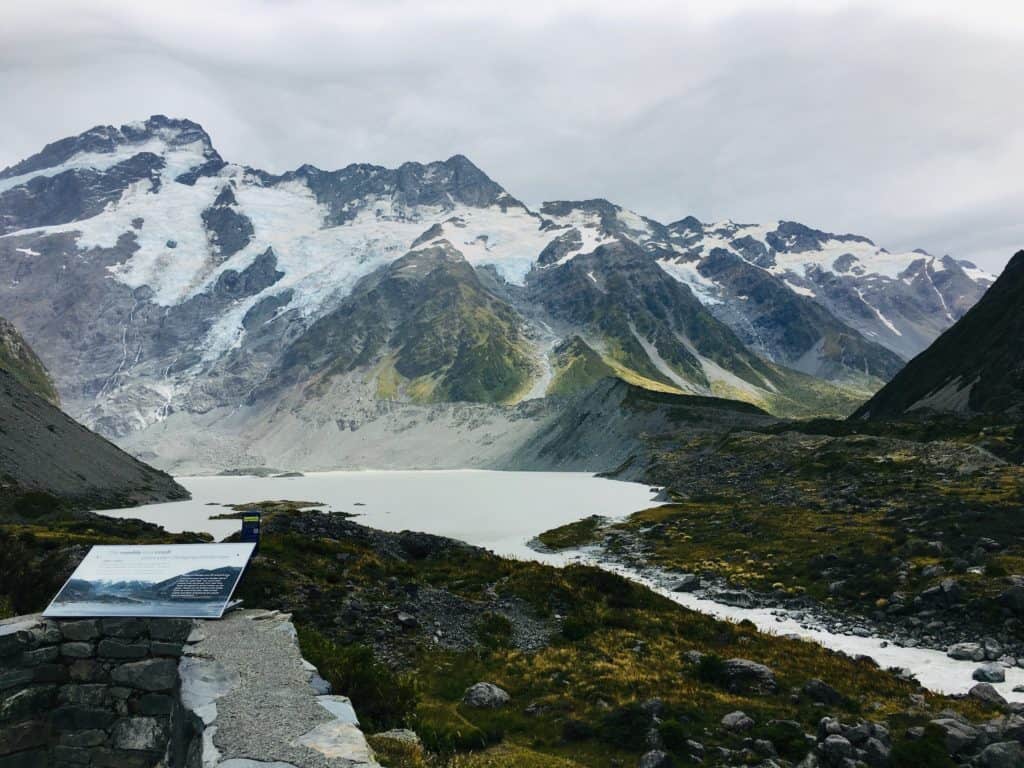
Hooker Valley track
- Difficulty: Easy
- Elevation gain: None
- Length: 10 km / 6.2 mi return
- Time: 3 hours
- Type of hike: Exposed boardwalk with several swing bridges
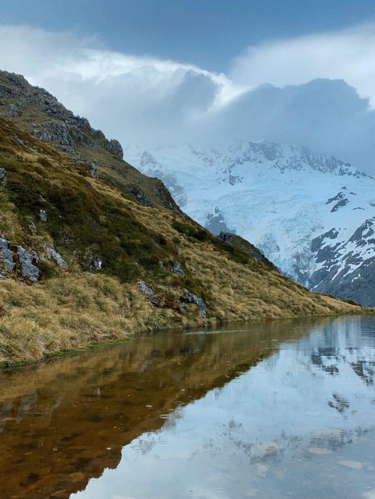
Sealy Tarns track
- Difficulty: Intermediate
- Elevation gain: 600 m / 1,969 ft
- Length: 5.8 km / 3.6 mi return
- Time: 3 – 4 hours
- Type of hike: 2,200 stairs (it’s leg day)
The Sealy Tarns track is also the first part of the Mueller Hut track. You can either go back down when you reach the tarn or continue up to the hut.
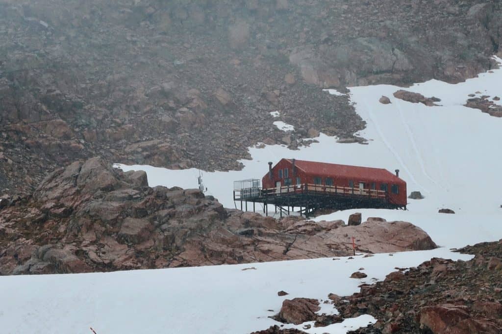
Mueller Hut track
- Difficulty: Hard
- Elevation gain: 995 m / 3,263 ft
- Length: 10.4 km / 6.5 mi return
- Time: 4 – 5 hours one way, 7 – 8 hours total
- Type of hike: Lots of stairs (see Sealy Tarns above), big boulders, scree
The Mueller Hut track is a continuation of the Sealy Tarns track. It can be done as a day hike or a 2-day tramp.
Tasman Glacier car park
This trailhead is about 7 km (4.3 mi) down Tasman Valley Rd. There is a public shelter with toilets and ample parking space. It would be difficult to make it to this trailhead from Aoraki/Mt Cook Village without your own vehicle.
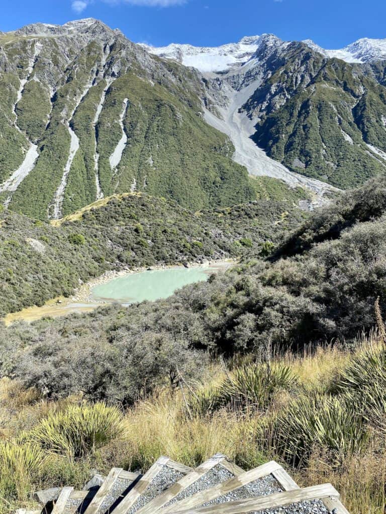
Blue Lakes and Tasman Glacier View track
- Difficulty: Easy
- Elevation gain: 68 m / 223 ft
- Length: 2.5 km / 1.5 mi return
- Time: 1 hour
- Type of hike: Some paved steps and rocks
⇉ Blue Lakes and Tasman Glacier
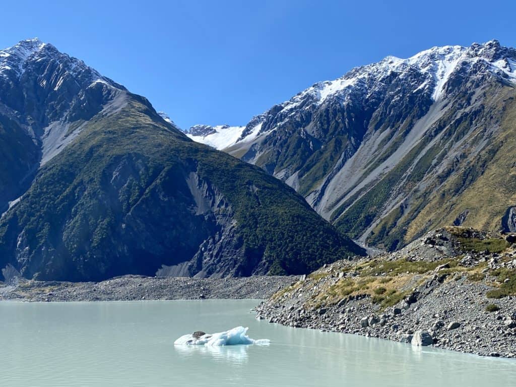
Tasman Lake track
- Difficulty: Easy
- Elevation gain: Mostly flat
- Length: 2.5 km / 1.5 mi return
- Time: 50 minutes – 1 hour
- Type of hike: Gravel path and rocks
⇉ Blue Lakes and Tasman Glacier
Ball Hut route
- Difficulty: Intermediate
- Elevation gain: 119 m / 390 ft
- Length: 9 km / 5.6 mi return
- Time: 3 – 4 hours one way, 7 – 8 hours return
- Type of hike: Easy 4WD track that turns rocky and unstable
Just like the Mueller Hut route, the Ball Hut route can be done as either a day hike or a 2-day tramp.
Other activities around Mt Cook National Park
Hiking isn’t the only thing that you can do at Mt Cook! Here are a few more popular activities:
- Cycling (Alps2Ocean trail)
- Jet boating in Tasman Lake
- Scenic helicopter or airplane flights (from Glentanner Station or Aoraki/Mt Cook Airport)
- Guided tours
- Stargazing (Aoraki Mackenzie International Dark Sky Reserve)
- Kayaking in Tasman Lake or Mueller Lake
Thanks for reading this guide to Aoraki/Mt Cook National Park! I’ll keep this post updated with relevant links as often as I can.
xoxo Niki