Blue Lakes and Tasman Glacier are two easy hikes with incredible views of the surrounding mountains, lakes, and glaciers. Because they are short and start at the same trailhead, they’re perfect to combine into a single day’s hike. Read on for everything you need to know before tackling the Blue Lakes and Tasman Glacier hikes!
General information
Blue Lakes and Tasman Glacier View track
- Difficulty: Easy
- Elevation gain: 68 m / 223 ft
- Length: 2.5 km / 1.5 mi loop
- Time: 1 hour
- Type of hike: Some stairs and rocks
Tasman Lake track
- Difficulty: Easy
- Elevation gain: Mostly flat
- Length: 2.5 km / 1.5 mi
- Time: 50 minutes – 1 hour
- Type of hike: Gravel path and rocks
Click here to check out the official DOC website for both tracks.
How to get to Blue Lakes and Tasman Glacier
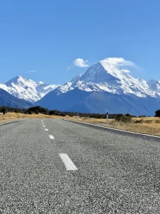
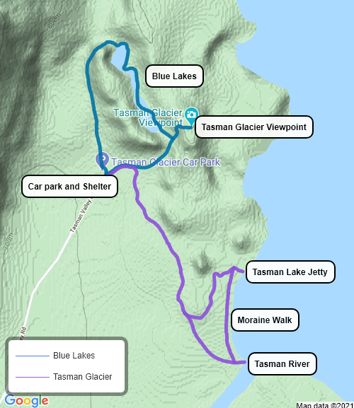
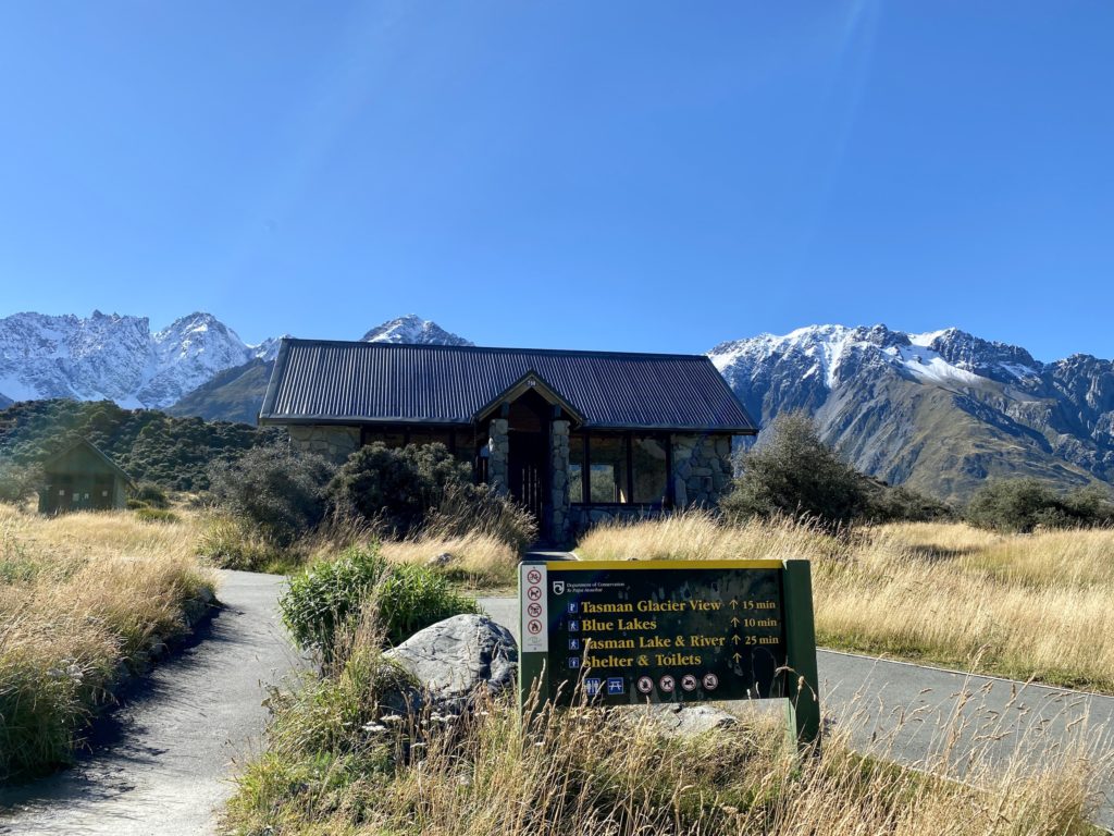
Both hikes originate at the Tasman Glacier Car Park, which is easily found on Google Maps. Beside the lot, you’ll find the Blue Lakes Shelter. There are toilets and a nice spot to relax and have some food. (If you’re looking for a longer hike, the Ball Hut Route also originates at the Tasman Glacier Car Park.)
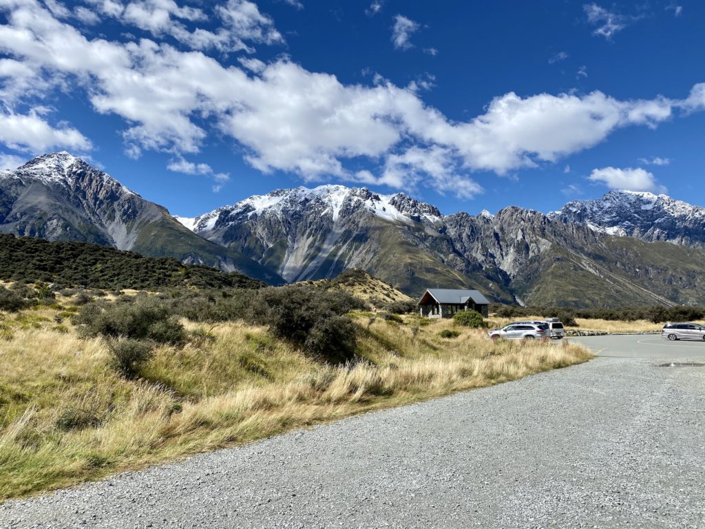
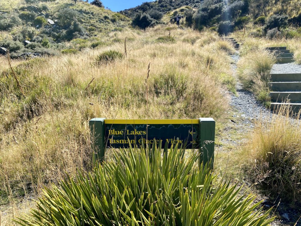
Both tracks follow the same path for about 150 m (492 ft). At the fork, turn left for the Blue Lakes track and right for the Tasman Glacier track.
Hike #1: Blue Lakes
The Blue Lakes track is actually comprised of two separate trails: the Tasman Glacier View and the Blue Lakes. You’ll need to double back a bit from the glacier viewpoint before starting on the Blue Lakes loop.
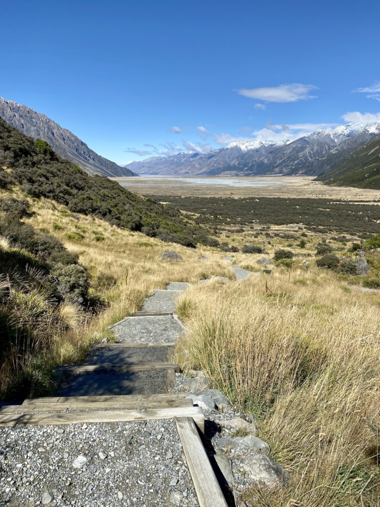
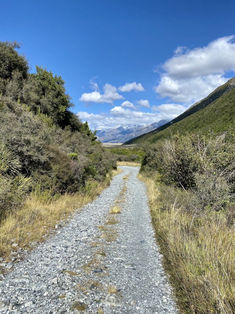
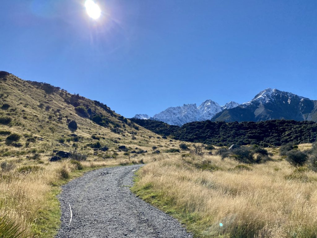
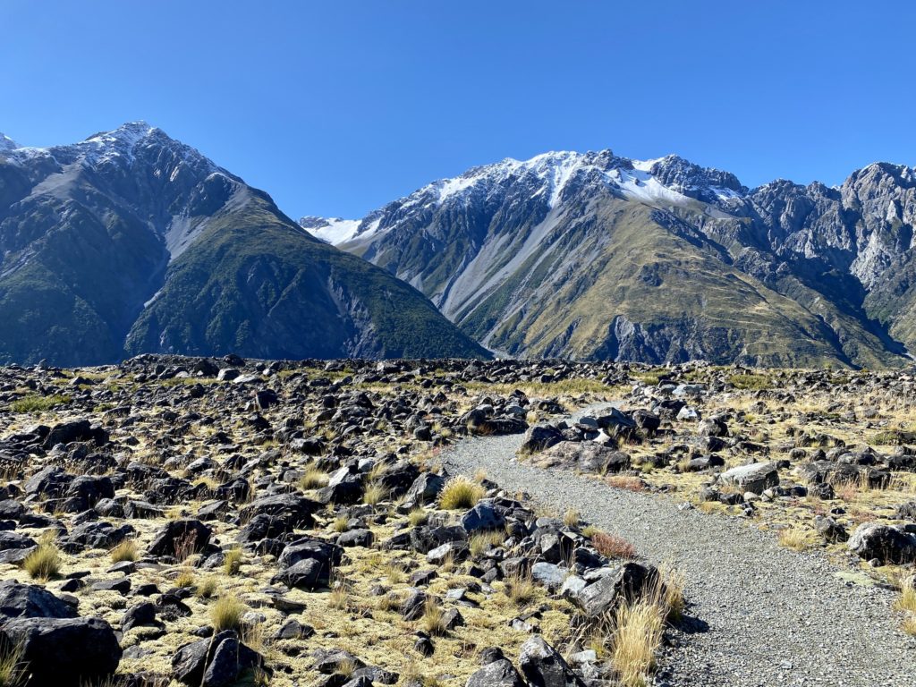
The track begins with a gentle gravel path. From the very beginning, the views are incredible — since the track begins in a valley, you can see mountains all around you.
After a few minutes of walking, you’ll reach another fork in the road. Start by going right towards the Tasman Glacier View.
Tasman Glacier View
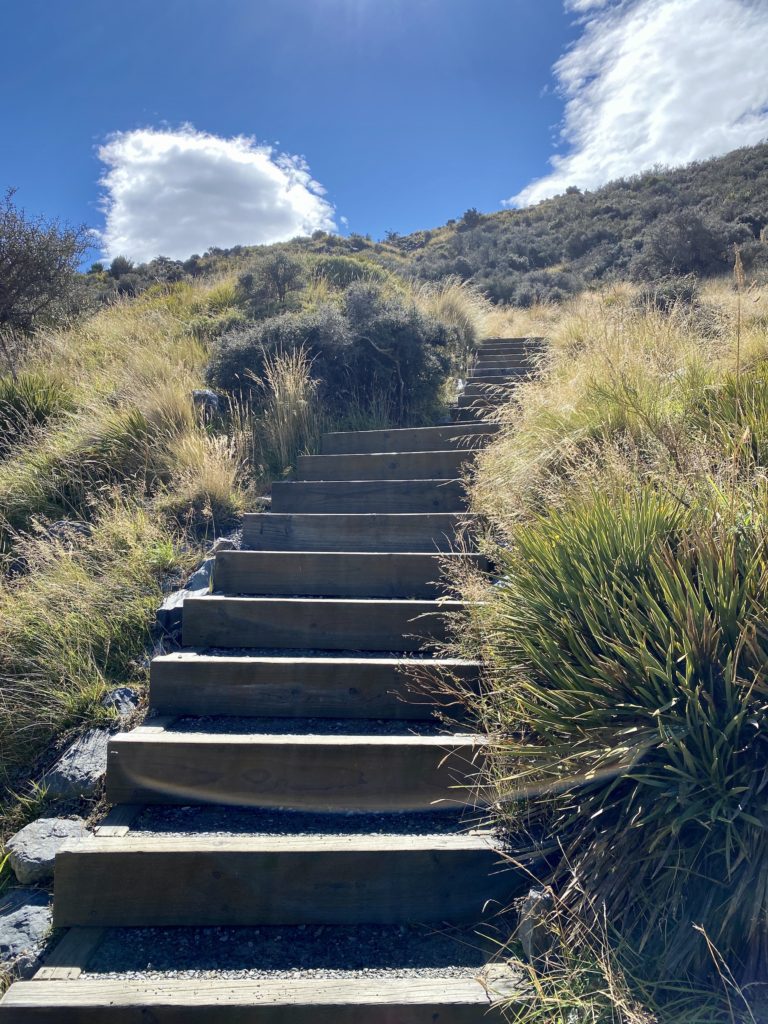
There are a few stairs to climb at this point! While they are pretty steep at times, I didn’t feel like it was too strenuous. It’s not a long way to the top and there are a few spots along the way with informational signs and places to rest.
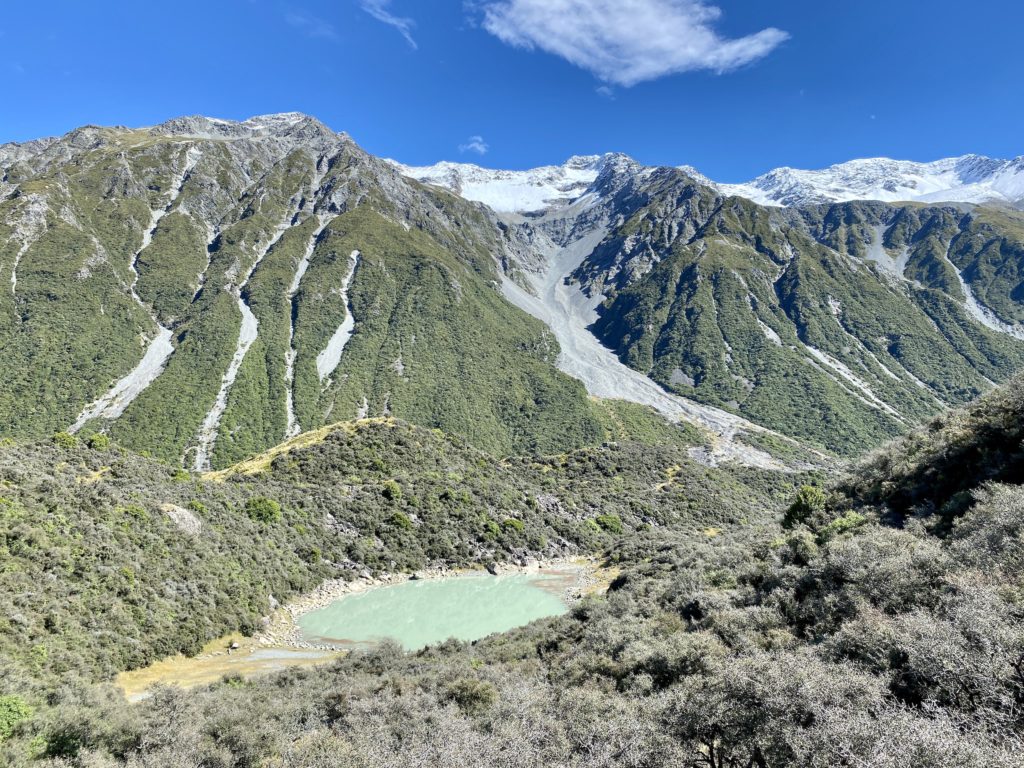
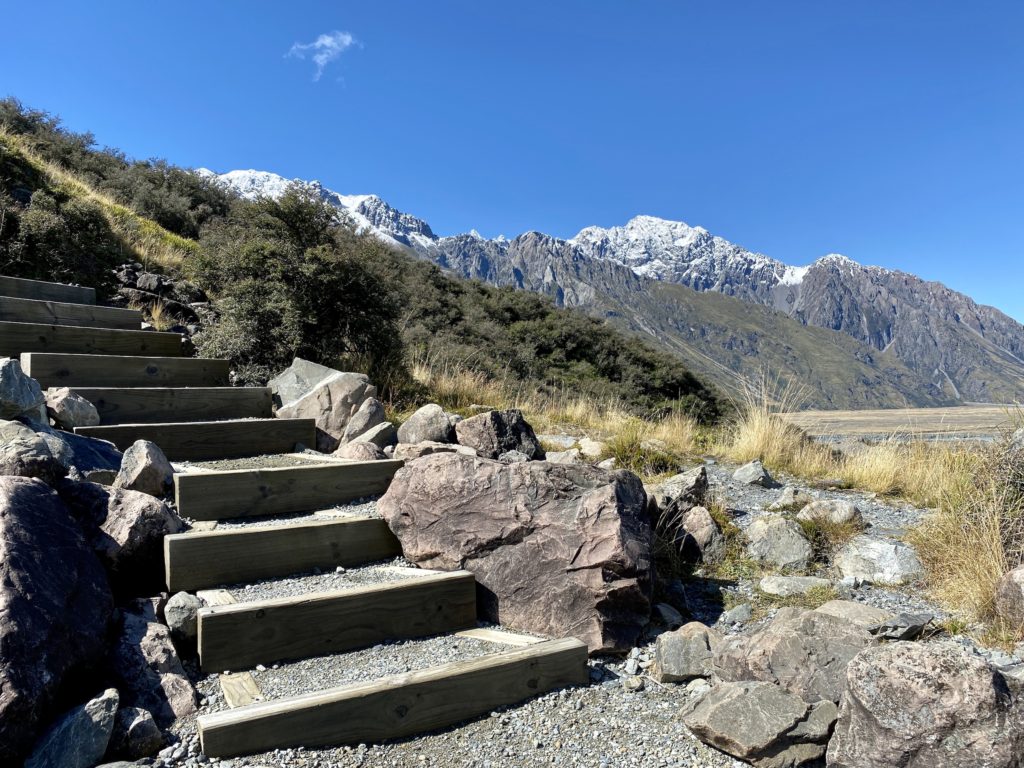
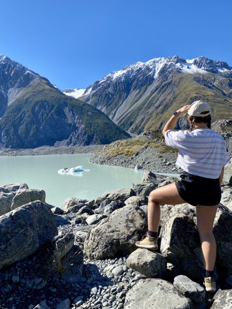
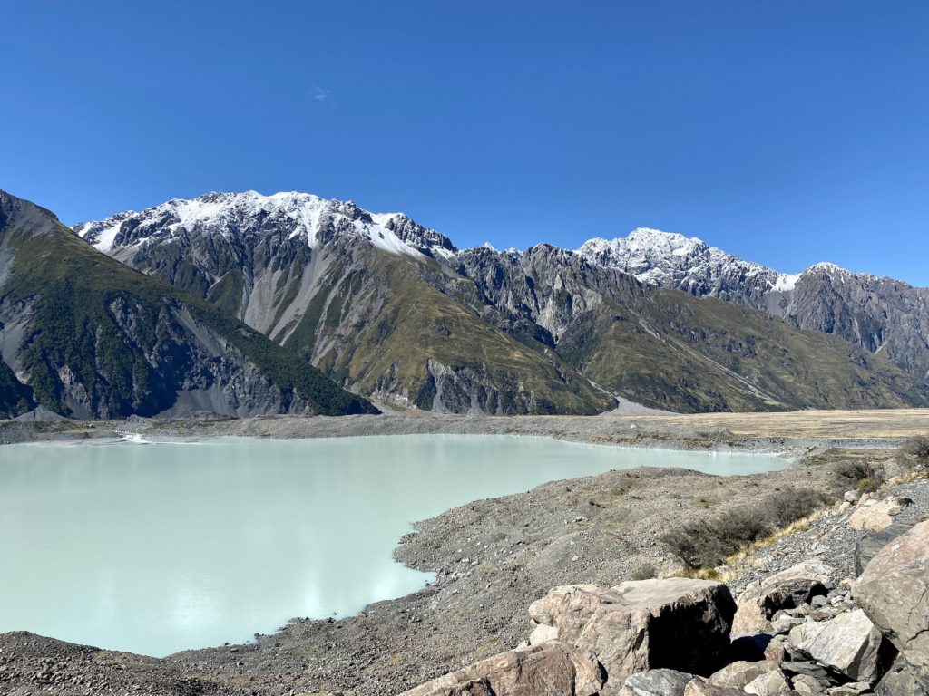
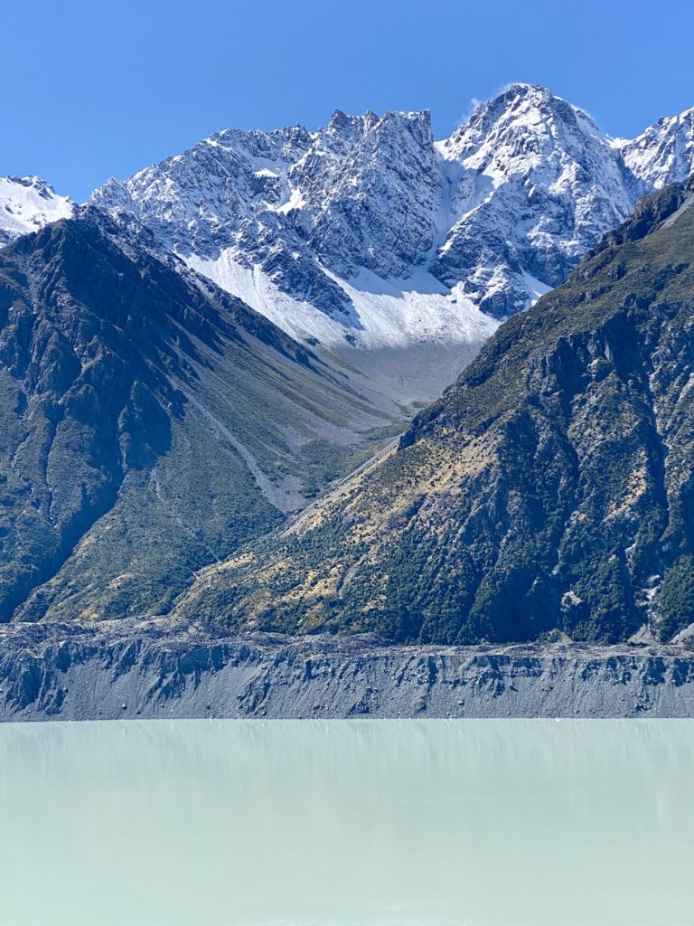
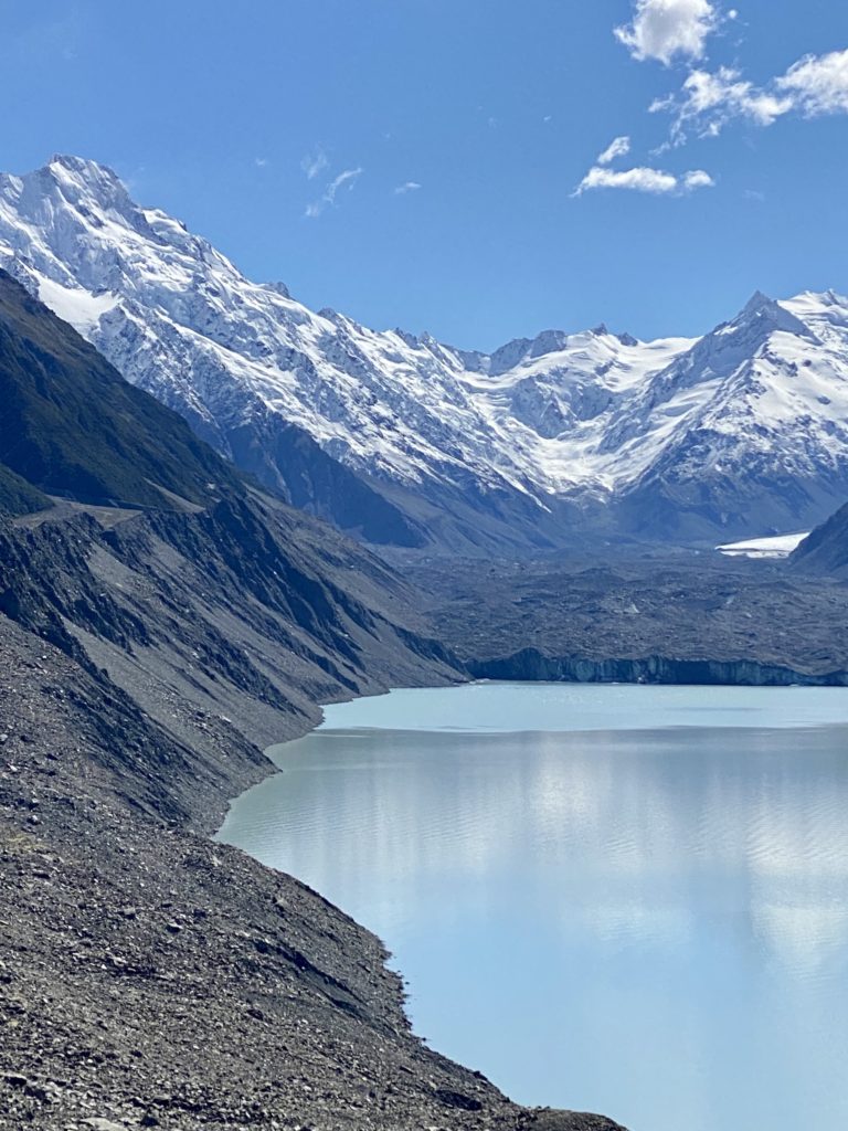
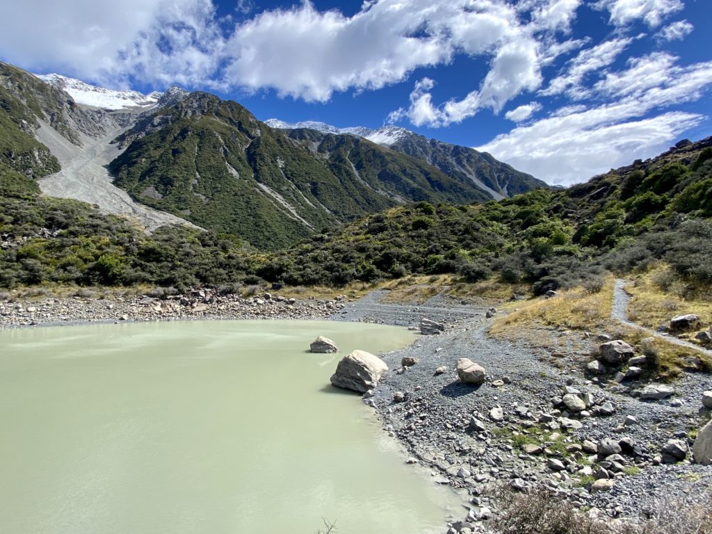
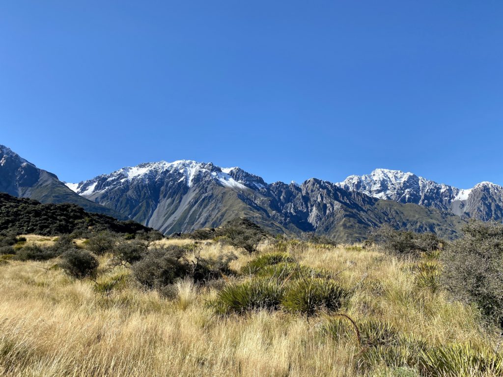
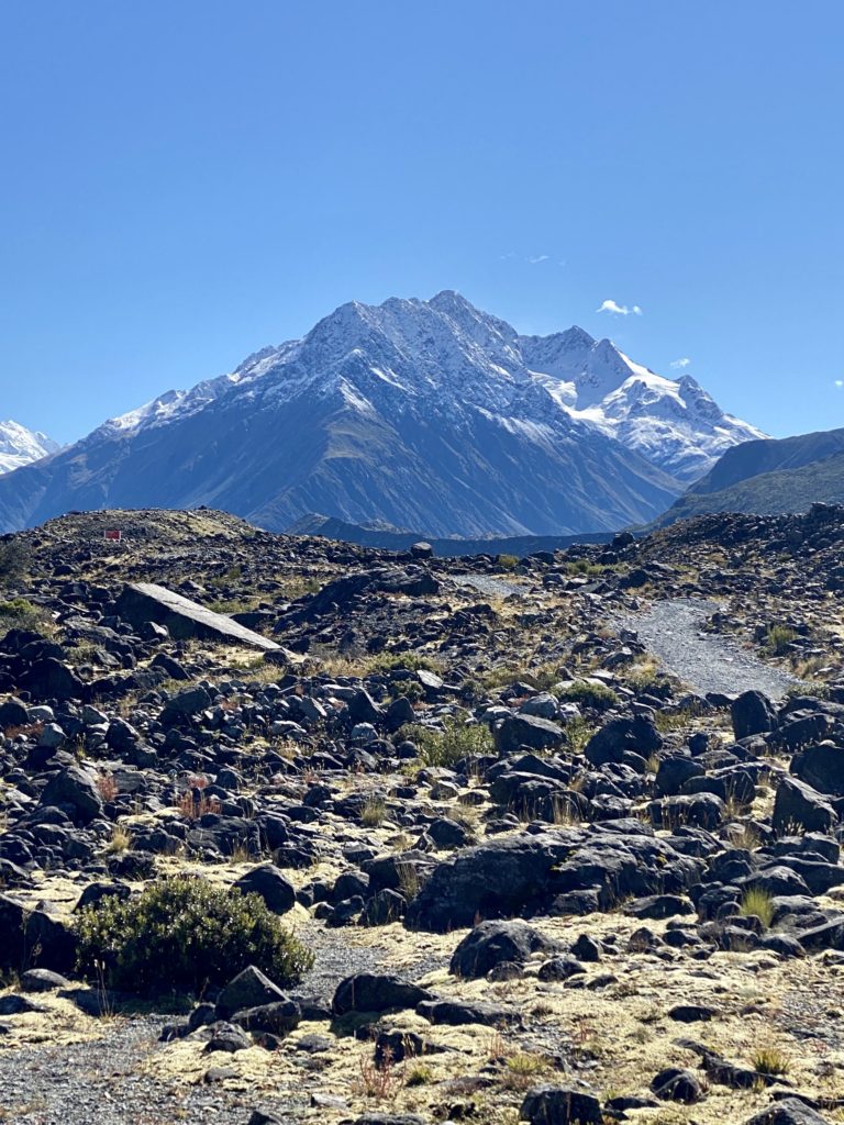
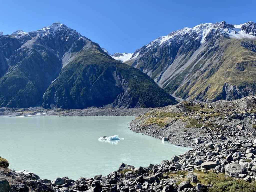
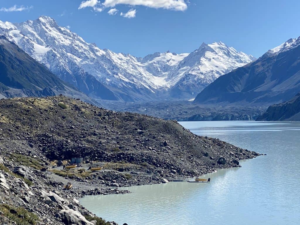
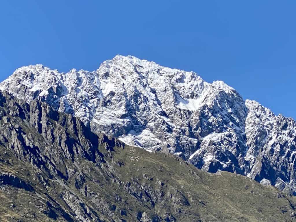
The views from the top are phenomenal. Aoraki/Mt Cook, Mt Johnson, and The Nun’s Veil are out in full view. You can also see a big section of Tasman Lake and the accompanying Tasman Glacier in the distance.
Because of climate change, the glacier’s current rate of retreat is 480-820 m (1378-2690 ft) per year. By 2027, it is estimated that the glacier’s length will be 20 km (12 mi) — a mere shadow of its former self.
Once you’ve enjoyed the view from the top, head back down the stairs until you reach the fork and follow the path for the Blue Lakes.
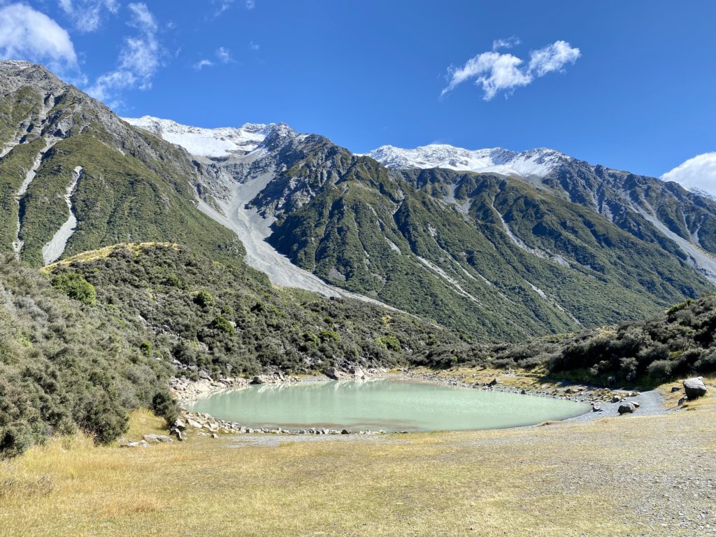
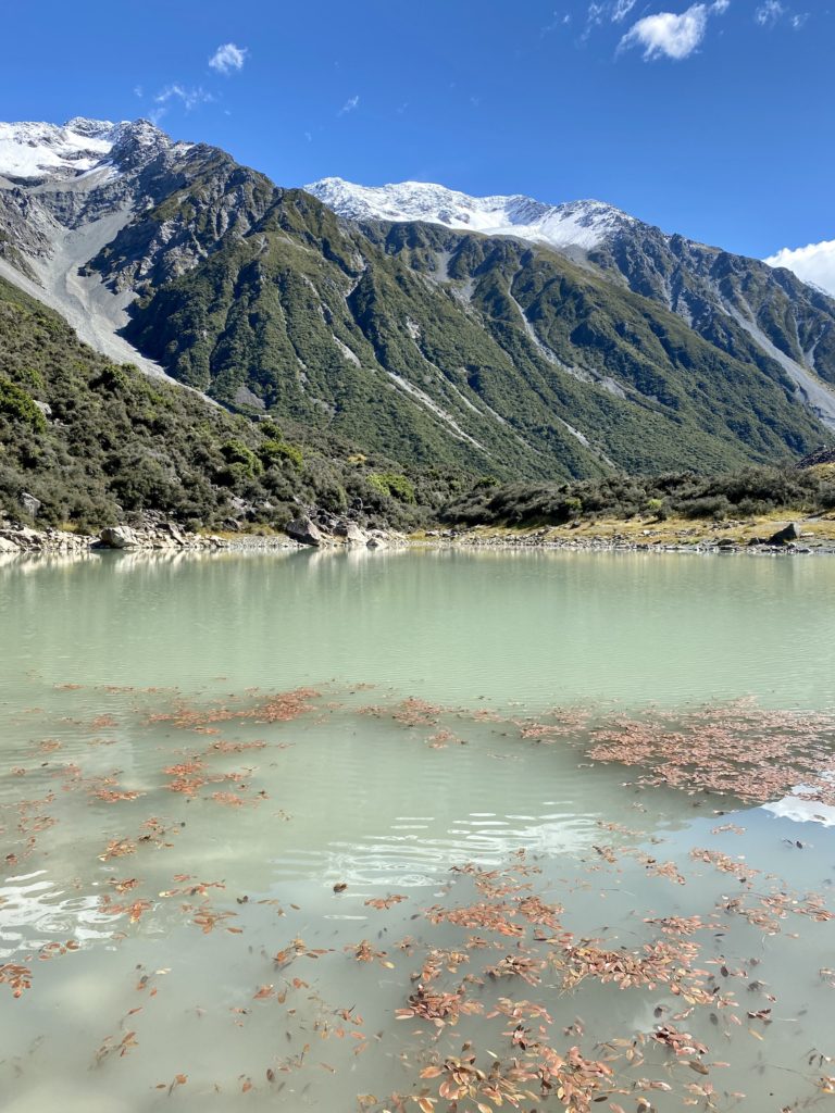
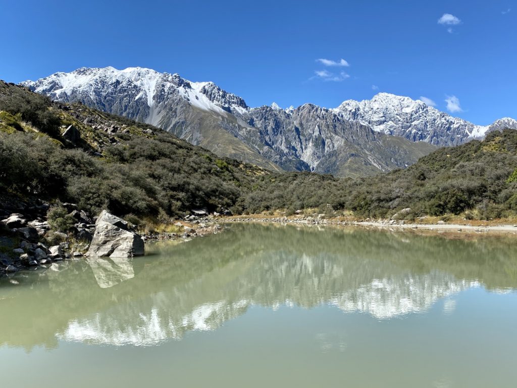
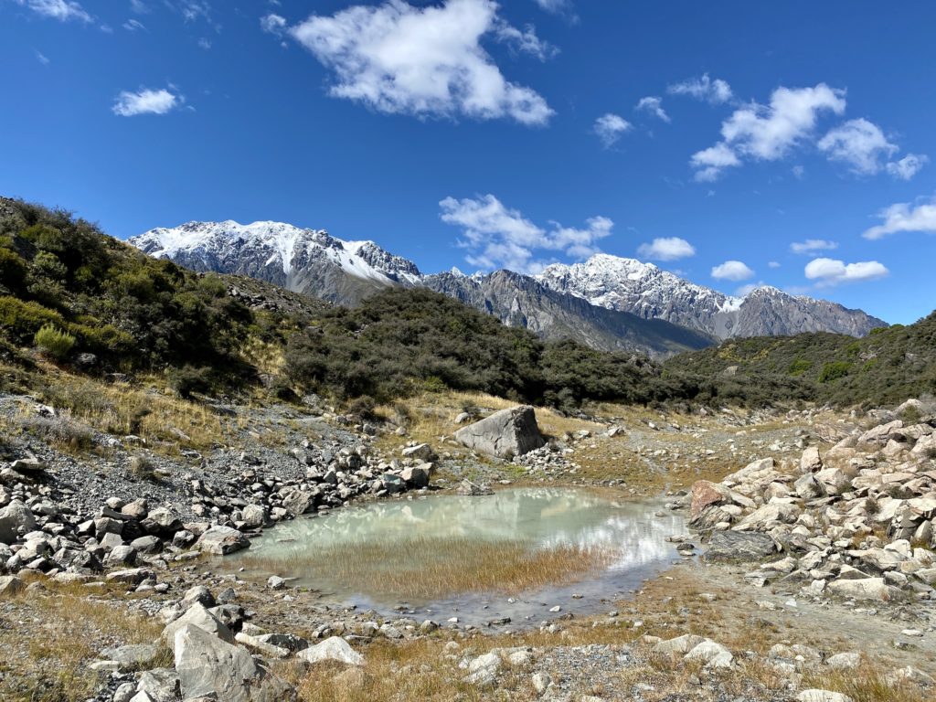
Blue Lakes
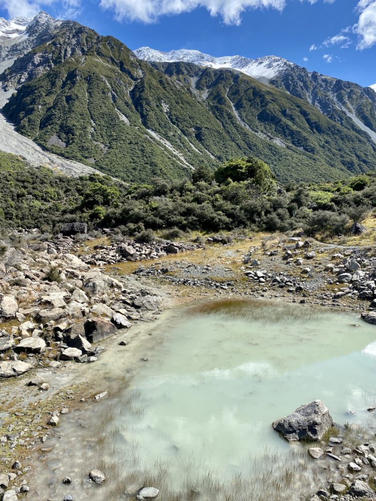
This section of the track takes you closer to the Blue Lakes (that are actually green because of rainwater) that you saw from the viewpoint. A short 2-minute walk brings you to the first of the lakes. There are 5 lakes total, although a few of them have dried up into little puddles. The track goes around all of the lakes before looping around and following the Ball Hut Route track back to the car park.
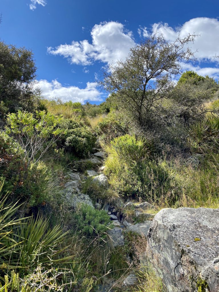
Most sections of this track are unfortunately pretty overgrown. Scratchy matagouri plants line the tracks and have grown over it in places, making the path extremely narrow. At a few points, I wasn’t actually sure where the track was. I’d recommend using some sort of navigation app to help you find your way if you’re going to do this section of the track (I love the AllTrails app). Otherwise, you can turn around and follow your steps back the way you came.
Hike #2: Tasman Glacier
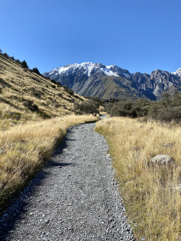
From the car park, walk a few minutes down the same track you walked earlier. This time, take a right to go towards the Tasman Lake track. You’ll walk down a flat and rocky path for about 20 minutes. I really enjoyed the panoramic views of the mountains here — it never gets old.
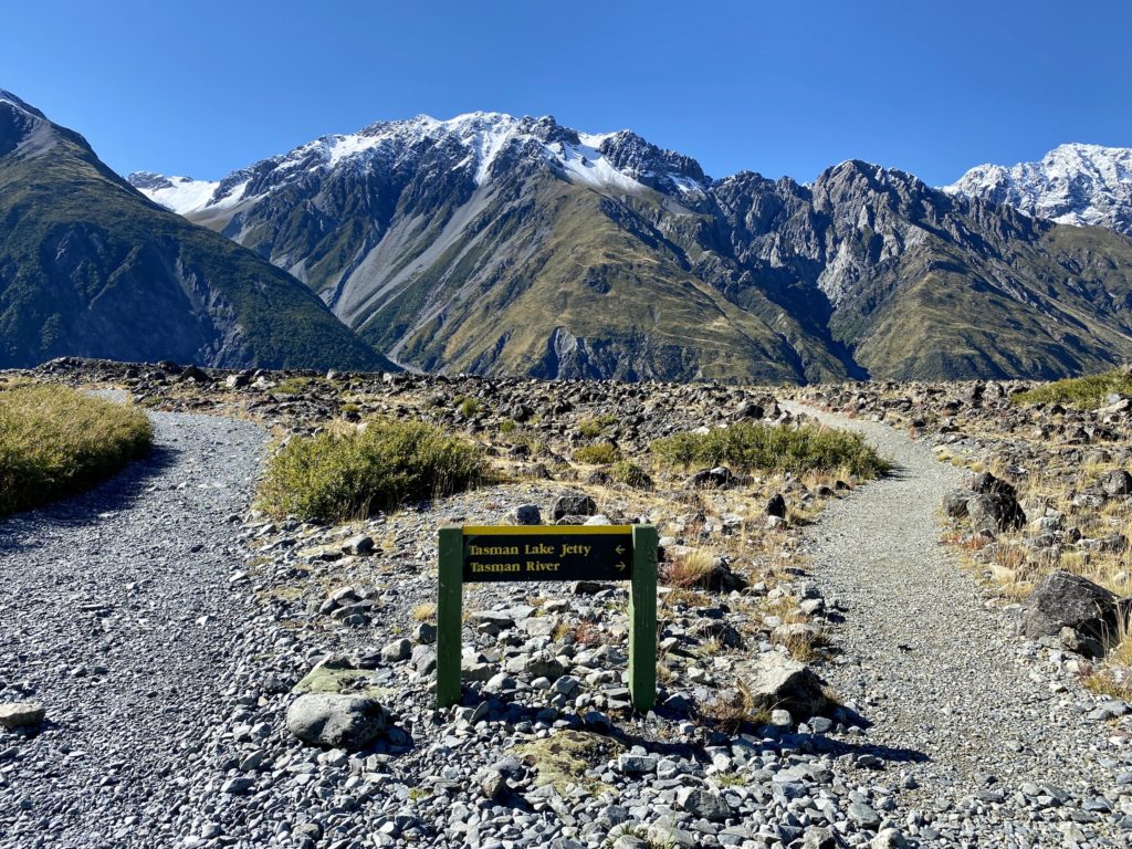
When you reach the fork in the path, you have the choice of going to the Tasman Lake Jetty or the Tasman River first. I chose to see the river, but it doesn’t really matter. There is a very cool path you can take to turn these two points into a loop so you don’t have to backtrack.
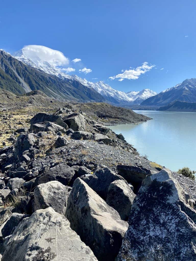
The path down to the Tasman River was (again) flat and rocky. There are massive boulders everywhere, which would make great places to pose for a picture if you’re interested.

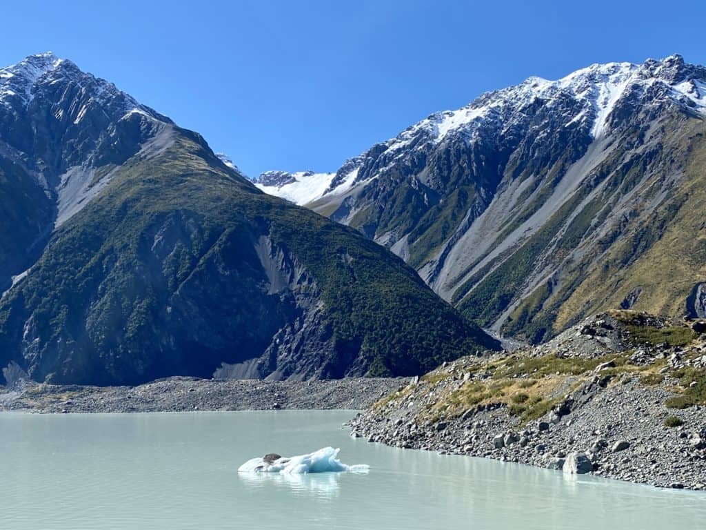
Once you reach the end of this trail, you’re met with the other end of Tasman Lake. You can make it all the way to the edge of the water by bouldering down the large rocks.
To take a very fun shortcut to the jetty, climb up the large rocky wall (otherwise known as a moraine). This moraine runs parallel to the edge of the lake and will take you all the way to the jetty without having to backtrack. It is pretty narrow and high up, so make sure you take extra care to not slip over the edge.
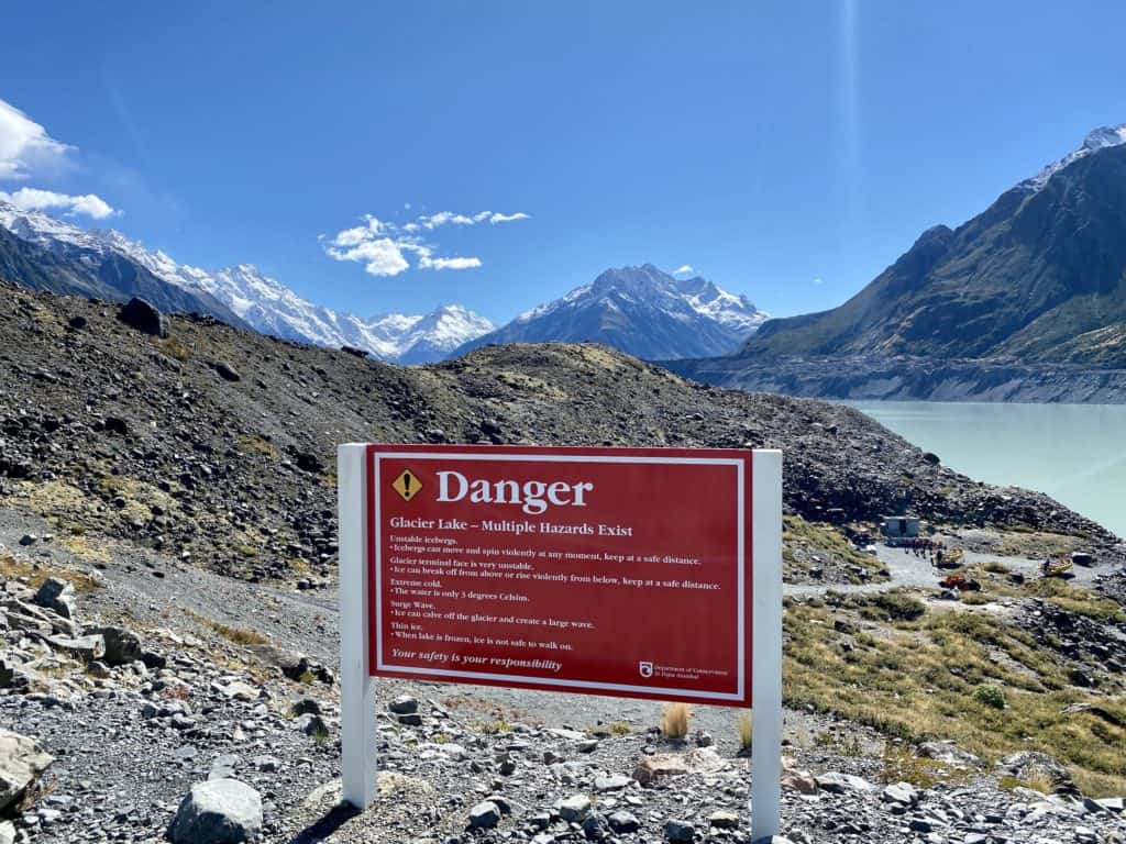
The jetty is where the Tasman Lake Glacier Boat Rides depart from. You can walk all the way down to the water here, too. Once you’re done admiring nature, follow the trail back down the way you came to the car park.
Final thoughts on Blue Lakes and Tasman Glacier
These two hikes exceeded my expectations! I think that they would be wonderful to do if you want to experience Mt Cook National Park but don’t have tons of time. They’re easy, quick, and can even be split up if you only want to do one or the other.
My one qualm would be the fact that the Blue Lakes section is overgrown. I can imagine that someone could feel a bit uneasy walking that section if they weren’t a confident hiker. Although it would be hard to get lost, I’d still recommend tackling that section only if you feel comfortable.
Other hikes at Mt Cook National Park
Mt Cook National Park is filled to the brim with amazing hikes. Here are a few of my top picks, based on difficulty:
- Easy: Hooker Valley track
- Intermediate: Red Tarns
- Hard: Mueller Hut
Thanks for reading this guide to the Blue Lakes and Tasman Glacier hikes! I hope you found it informative.
xoxo Niki
Pin this post to save it for later!