The Benmore Peninsula Track outside of Otematata, New Zealand is one of the most wonderfully underrated things to do in the Waitaki Valley. The views are out of this world, with rolling hills, fresh cedar trees, and bright blue water all around you. While it isn’t completely flat, the walk itself feels more refreshing than strenuous. Read on for all the information you’ll need before hitting the track!
General information
- Difficulty: Easy
- Elevation: 556 m / 1826 ft
- Elevation gain: 262 m / 861 ft
- Length: 4.7 km / 2.9 mi return
- Time: 1.5 hours total
- Type of track: Loop
The Benmore Peninsula Track can be used for both hiking and cycling. Many cyclers will make a detour to the Benmore Peninsula Track since it is just off of Section 5 of the Alps 2 Ocean trail (Omarama to Otematata).
How to get to the Benmore Peninsula Track
This hike is located outside the town of Otematata. From town, follow Loch Laird Road towards the Benmore Dam. You’ll find a small parking lot along with the start of the track just up the hill.
Driving times from:
- Twizel: 40 minutes
- Aoraki/Mt Cook National Park: 1 hour 20 minutes
- Wanaka: 1 hour 40 minutes
- Dunedin: 2 hours 30 minutes
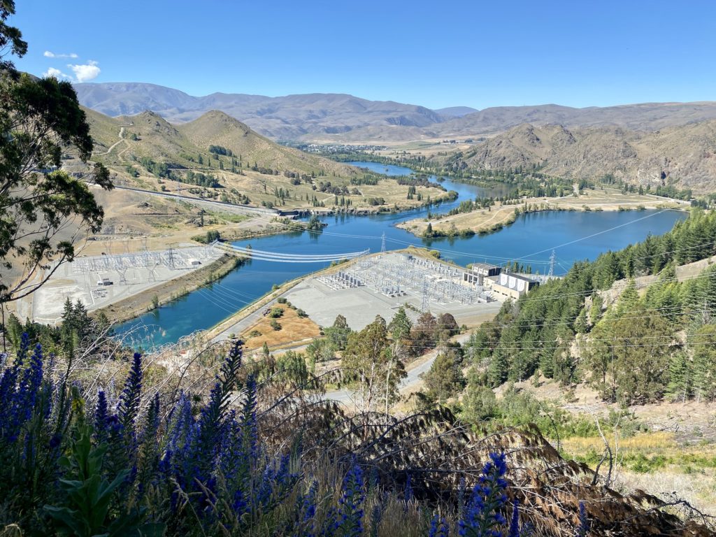
Benmore Dam history
The Benmore Dam is part of the Waitaki power scheme, a group of power stations in the area that generates mass amounts of hydroelectricity. Lake Benmore was created in the 1960s to help power the dam. The lake is New Zealand’s largest man-made lake and can hold over 1.5 times as much water as Wellington Harbour!
Back in the day, the entire town of Otematata was created to house the workers during the dam’s construction. Once it was up and running, most of the houses were dismantled and transported to Twizel, the next dam construction site. Now, the town has a permanent population of about 200 people and has become a popular tourist destination in the summer.
Benmore Peninsula Track
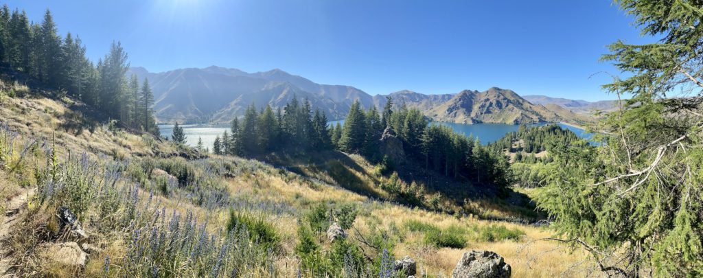
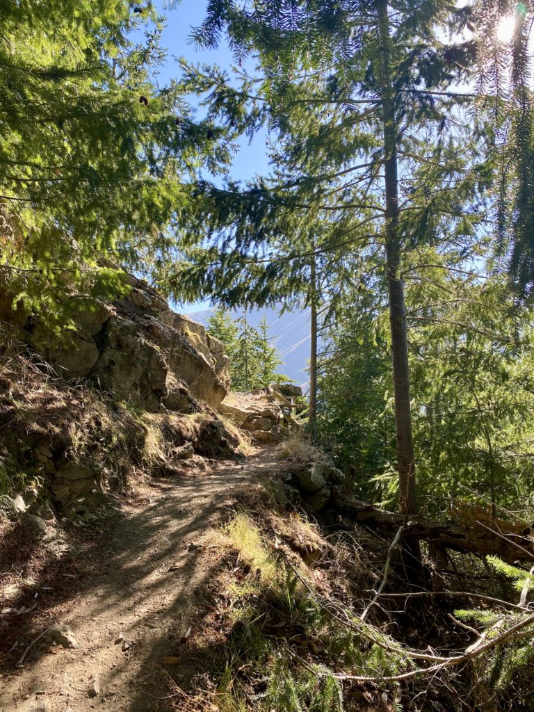
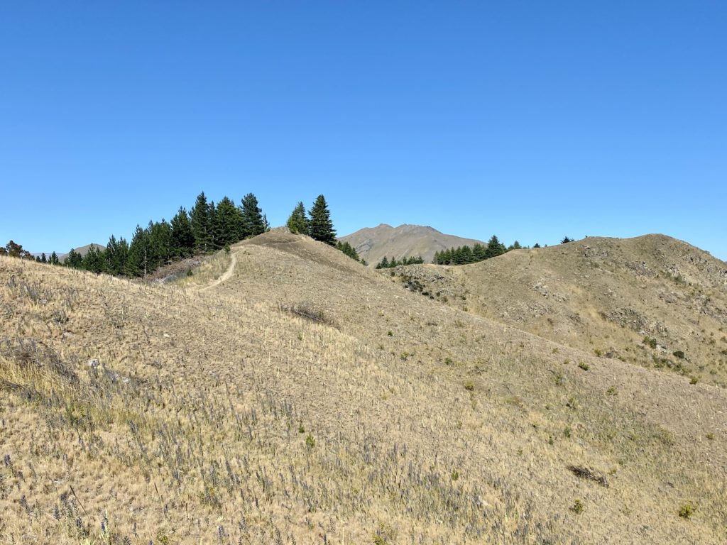
The first part of the track starts off through a lovely shaded pine forest. Early on, you’ll reach a fork in the road. Since it’s a loop track, you can walk in either direction. I decided to head down the right side trail (counter-clockwise) because it looked less steep (lol).
Despite the fact that this should be an easy-to-follow loop track, I did find that there was a lack of signposting to guide you in the right direction. It seems like there are several separate trails that are a part of the circuit and all end up in the same place. Even now, I’m not actually sure if I took the proper trail (although in the grand scheme of things, it doesn’t actually matter).
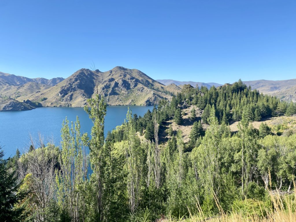
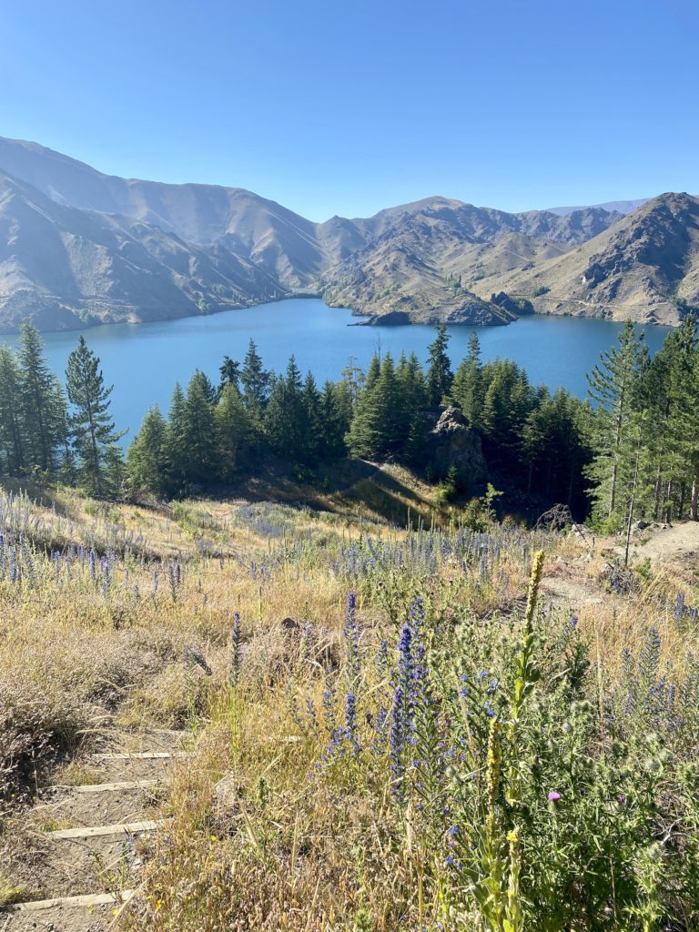
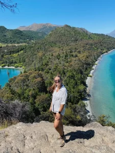
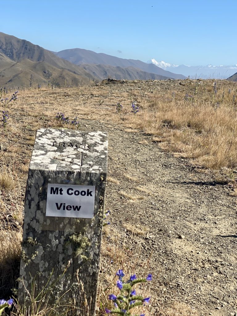
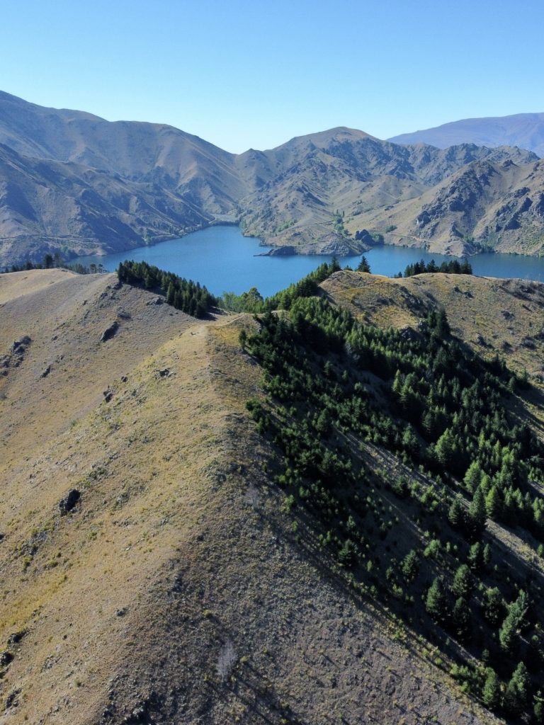
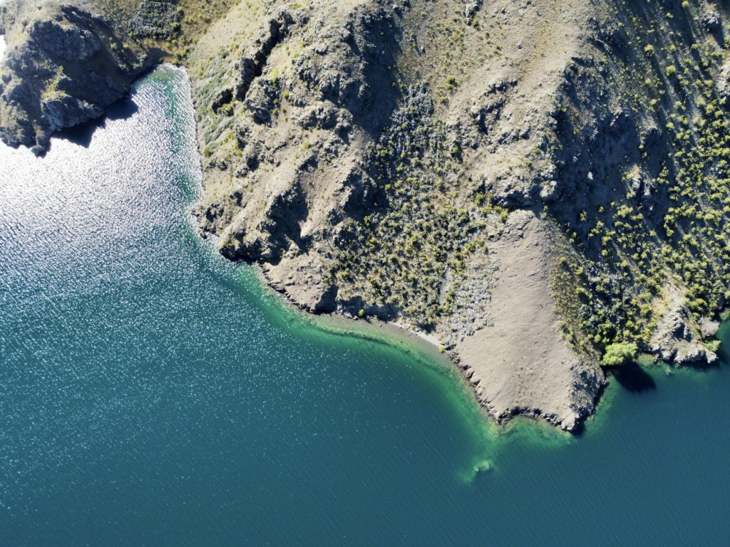
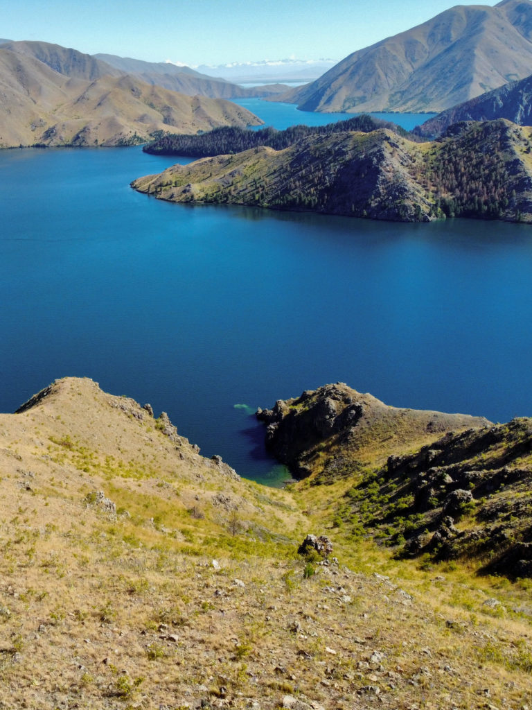
Once you get above the treeline, the views become spectacular. You get a panoramic view of Lake Benmore’s bright blue water, along with the rolling hills of the Waitaki Valley. On a clear day, there’s also a straight-on view of Aoraki/Mt Cook in the distance.
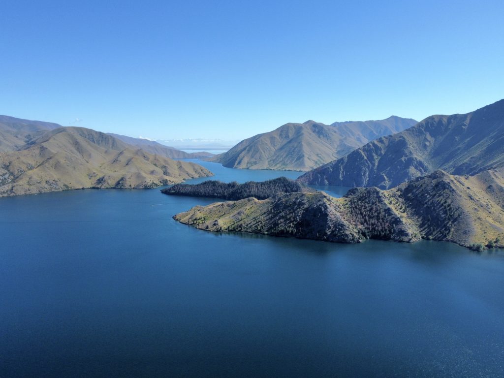
After reaching the top of the hill, you’ll follow the exposed ridgeline down to the Islands Viewpoint. In my opinion, this part of the track was the coolest because you are surrounded on both sides by water and forest.
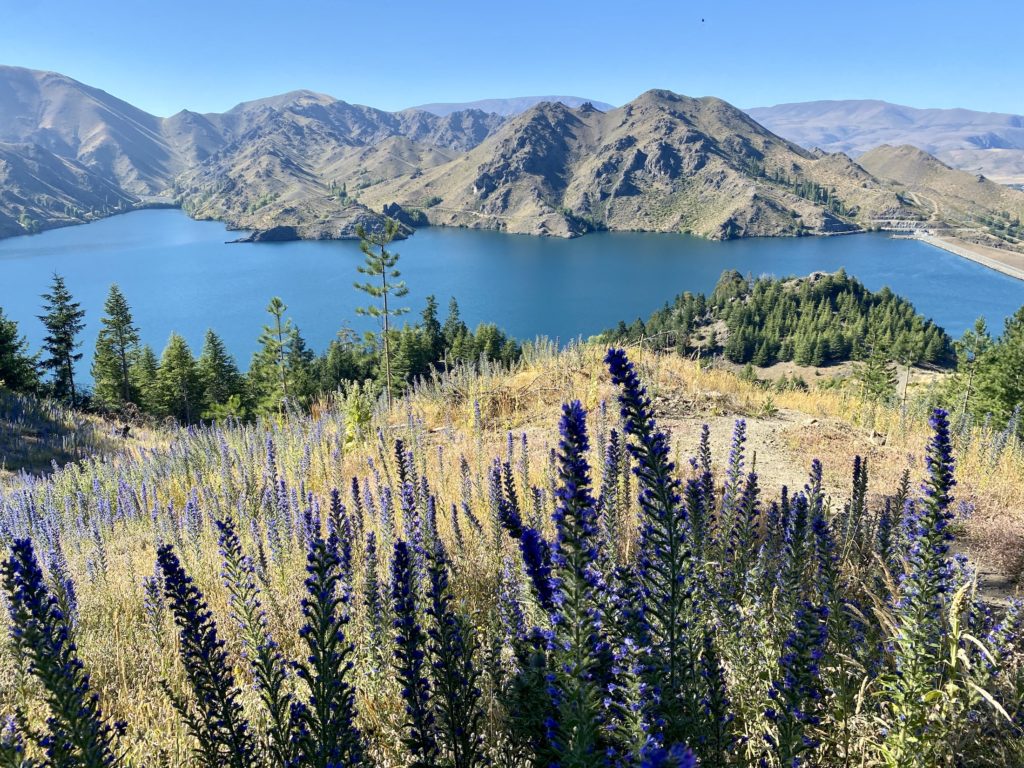
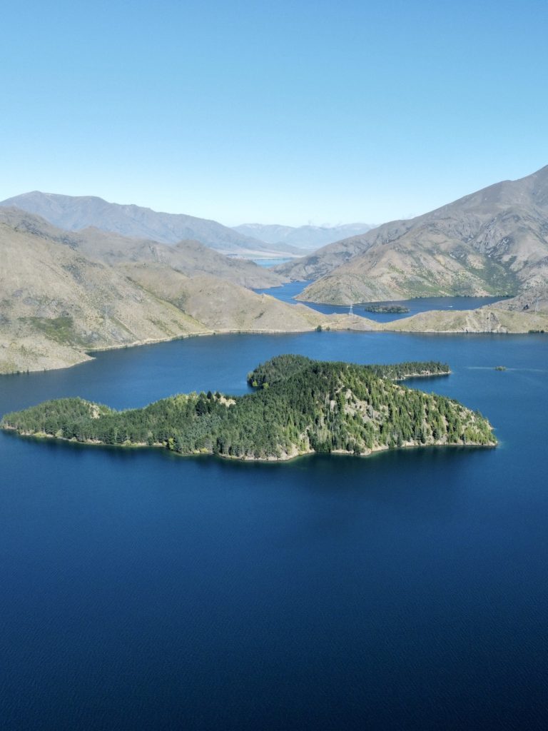
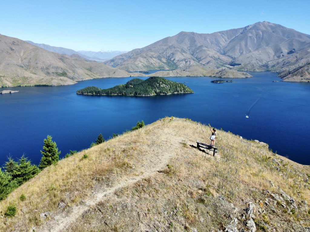
The Islands Viewpoint is just a quick jaunt up from the main track. Here, you’ll find the ultimate view over Lake Benmore and its many arms. The view in every direction is unique and incredible in its own way.
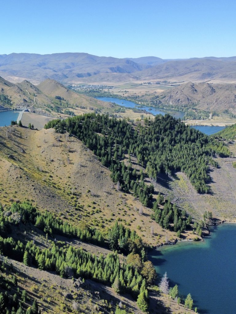
After soaking in the view, head back down the trail to close the loop. This part of the track becomes more shaded once you get back below the trees, but you’ll still get good views of the dam on your way down.
Other activities in the area
- Fishing: Lake Benmore has brown trout, rainbow trout, and sockeye salmon
- Cycling: Alps 2 Ocean trail from Omarama to Otematata
- Boating: There are many coves and beaches around Lakes Benmore and Aviemore
- Clay Cliffs: Natural rock formations in nearby Omarama
Thanks for reading this Lake Benmore Peninsula Track hike guide! You can find more of my New Zealand hiking posts here.
xoxo Niki